- Desert Shores, California
-
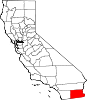
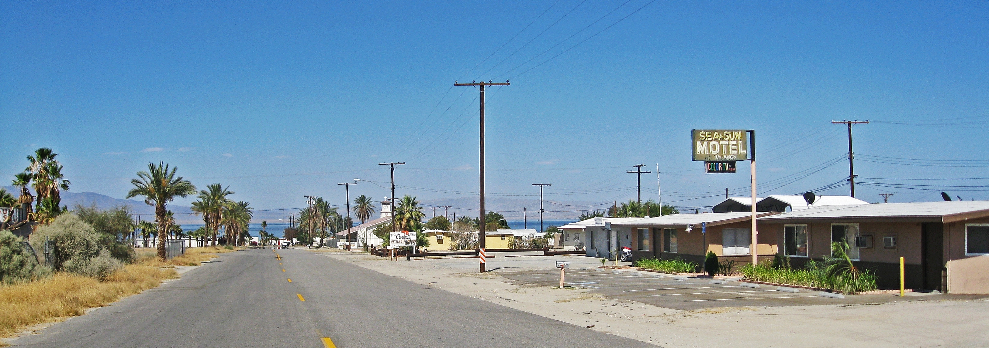
Desert Shores — census-designated place — Desert Shores, CA, looking east toward the Salton Sea Location in Imperial County and the state of California
Coordinates: 33°24′15″N 116°02′23″W / 33.40417°N 116.03972°WCoordinates: 33°24′15″N 116°02′23″W / 33.40417°N 116.03972°W Country  United States
State  California
County Imperial Area[1] – Total 0.682 sq mi (1.765 km2) – Land 0.682 sq mi (1.765 km2) – Water 0 sq mi (0 km2) 0% Elevation −190 ft (−58 m) Population (2010) – Total 1,104 – Density 1,618.8/sq mi (625.5/km2) Time zone Pacific (PST) (UTC-8) – Summer (DST) PDT (UTC-7) ZIP code 92274 Area code(s) 760 FIPS code 06-19024 GNIS feature ID 1693254 U.S. Geological Survey Geographic Names Information System: Desert Shores, California Desert Shores (formerly, Fish Springs)[2] is a census-designated place (CDP) in Imperial County, California. It is located on Salton Sea 36 miles (58 km) west-northwest of Calipatria.[3] It is part of the El Centro, California Metropolitan Statistical Area. The population was 1,104 at the 2010 census, up from 792 at the 2000 census.
Contents
Geography
Desert Shores is located at 33°24′15″N 116°02′23″W / 33.40417°N 116.03972°W.[2] According to the United States Census Bureau, the CDP has a total area of 0.7 square miles (1.8 km2), all of it land.
Demographics
2010
The 2010 United States Census[4] reported that Desert Shores had a population of 1,104. The population density was 1,619.9 people per square mile (625.5/km²). The racial makeup of Desert Shores was 709 (64.2%) White, 8 (0.7%) African American, 26 (2.4%) Native American, 4 (0.4%) Asian, 1 (0.1%) Pacific Islander, 307 (27.8%) from other races, and 49 (4.4%) from two or more races. Hispanic or Latino of any race were 848 persons (76.8%).
The Census reported that 1,104 people (100% of the population) lived in households, 0 (0%) lived in non-institutionalized group quarters, and 0 (0%) were institutionalized.
There were 344 households, out of which 167 (48.5%) had children under the age of 18 living in them, 181 (52.6%) were opposite-sex married couples living together, 37 (10.8%) had a female householder with no husband present, 27 (7.8%) had a male householder with no wife present. There were 29 (8.4%) unmarried opposite-sex partnerships, and 1 (0.3%) same-sex married couples or partnerships. 80 households (23.3%) were made up of individuals and 42 (12.2%) had someone living alone who was 65 years of age or older. The average household size was 3.21. There were 245 families (71.2% of all households); the average family size was 3.84.
The population was spread out with 352 people (31.9%) under the age of 18, 124 people (11.2%) aged 18 to 24, 263 people (23.8%) aged 25 to 44, 218 people (19.7%) aged 45 to 64, and 147 people (13.3%) who were 65 years of age or older. The median age was 29.9 years. For every 100 females there were 108.7 males. For every 100 females age 18 and over, there were 98.4 males.
There were 421 housing units at an average density of 617.7 per square mile (238.5/km²), of which 225 (65.4%) were owner-occupied, and 119 (34.6%) were occupied by renters. The homeowner vacancy rate was 4.2%; the rental vacancy rate was 2.4%. 704 people (63.8% of the population) lived in owner-occupied housing units and 400 people (36.2%) lived in rental housing units.
2000
As of the census[5] of 2000, there were 792 people, 279 households, and 181 families residing in the CDP. The population density was 1,208.4 people per square mile (463.3/km²). There were 406 housing units at an average density of 619.5 per square mile (237.5/km²). The racial makeup of the CDP was 73.5% White, 1.4% Black or African American, 0.9% Native American, 0.3% Asian, 21.1% from other races, and 2.9% from two or more races. 60.9% of the population were Hispanic or Latino of any race.
There were 279 households out of which 28.3% had children under the age of 18 living with them, 50.5% were married couples living together, 5.4% had a female householder with no husband present, and 35.1% were non-families. 29.0% of all households were made up of individuals and 18.3% had someone living alone who was 65 years of age or older. The average household size was 2.8 and the average family size was 3.6.
In the CDP the population was spread out with 26.9% under the age of 18, 8.5% from 18 to 24, 25.4% from 25 to 44, 18.8% from 45 to 64, and 20.5% who were 65 years of age or older. The median age was 37 years. For every 100 females there were 128.2 males. For every 100 females age 18 and over, there were 125.3 males.
The median income for a household in the CDP was $24,712, and the median income for a family was $29,550. Males had a median income of $26,176 versus $19,375 for females. The per capita income for the CDP was $8,352. About 12.0% of families and 7.9% of the population were below the poverty line, including none of those under age 18 and 14.9% of those age 65 or over.
Government
Local
Desert Shores and its neighboring community of Salton City are governed by the Salton Community Services District (SCSD) which is a special district per California Government Code. The legislative body of the SCSD is a five member Board of Directors who are elected by the registered voters in the district every two years.
The SCSD has seven services that it is authorized to provide: 1. Collect, treat, or dispose of sewage. 2. Collect, transfer, and dispose of solid waste. 3. Provide fire protection. 4. Acquire, construct recreational facilities. 5. Organize, promote community recreation. 6. Acquire, construct, and improve street lighting and landscaping. 7. Provide emergency medical services.
Aside from acting as the architectural committee for architectural compliance with the Covenants, Conditions, and Restrictions (CC&R’s) of the 80 plus tracts within the district the SCSD has no land use authority under existing law, that responsibility falls on the County of Imperial Board of Supervisors.
State and federal
In the state legislature Desert Shores is located in the 40th Senate District, represented by Democrat Denise Moreno Ducheny, and in the 80th Assembly District, represented by Republican Bonnie Garcia. Federally, Desert Shores is located in California's 51st congressional district, which has a Cook PVI of D +7[6] and is represented by Democrat Bob Filner.
See also
- San Diego–Imperial, California
- El Centro Metropolitan Area
References
- ^ U.S. Census
- ^ a b U.S. Geological Survey Geographic Names Information System: Desert Shores, California
- ^ Durham, David L. (1998). California's Geographic Names: A Gazetteer of Historic and Modern Names of the State. Quill Driver Books. p. 1413. ISBN 9781884995149.
- ^ All data are derived from the United States Census Bureau reports from the 2010 United States Census, and are accessible on-line here. The data on unmarried partnerships and same-sex married couples are from the Census report DEC_10_SF1_PCT15. All other housing and population data are from Census report DEC_10_DP_DPDP1. Both reports are viewable online or downloadable in a zip file containing a comma-delimited data file. The area data, from which densities are calculated, are available on-line here. Percentage totals may not add to 100% due to rounding. The Census Bureau defines families as a household containing one or more people related to the householder by birth, opposite-sex marriage, or adoption. People living in group quarters are tabulated by the Census Bureau as neither owners nor renters. For further details, see the text files accompanying the data files containing the Census reports mentioned above.
- ^ "American FactFinder". United States Census Bureau. http://factfinder.census.gov. Retrieved 2008-01-31.
- ^ "Will Gerrymandered Districts Stem the Wave of Voter Unrest?". Campaign Legal Center Blog. http://www.clcblog.org/blog_item-85.html. Retrieved 2007-10-20.
External links
- Salton Sea West is a non-commercial website with a large library of government documents pertaining to Desert Shores
Municipalities and communities of Imperial County, California Cities Brawley | Calexico | Calipatria | El Centro | Holtville | Imperial | Westmorland
CDPs Bombay Beach | Desert Shores | Heber | Niland | Ocotillo | Palo Verde | Salton City | Salton Sea Beach | Seeley | Winterhaven
Unincorporated
communitiesAcolita | Alamorio | Amos | Andrade | Anza | Araz Junction | Bard | Bertram | Bonds Corner | Boulder Park | Cactus | Citrus View | Clyde | Coolidge Springs | Coyote Wells | Curlew | Date City | Dixieland | Dunes | Edgar | Elmore Desert Ranch | Estelle | Felicity | Fondo | Frink | Fuller | Glamis | Gordons Well | Hovley | Imperial Gables | Iris | Kane Spring | Meloland | Mesquite | Moss | Mount Signal | Mundo | Munyon | Obregon | Ogilby | Orita | Paymaster Landing | Perrys Corner | Picacho | Plaster City | Pope | Rico | Rockwood | Ross Corner | Ruthven | Sandia | Slab City | Tortuga | Truckhaven | Verdant | Watermans Corner | Wiest | Wilsie | Wister
Indian
reservationsFort Yuma Indian Reservation | Torres-Martinez Indian Reservation
Ghost towns Araz | Barnes | Bernice | Bradtmoore | Butlers | Colorado | Concepcíon | Eastside | Gleason | Hazelwood | Highline | Indian Wells | Keystone | Laguna | Laparra | Lano | Mayflower | Mobile | No Mirage | Paringa | Picacho Basin | Potholes | Sackett's Wells | Sellew | Shamrock | Silsbee | Squeaky Springs
Categories:- Populated places in the Sonoran Desert
- Populated places in the Colorado Desert
- Census-designated places in Imperial County, California
- Populated places in California with Hispanic majority populations


Wikimedia Foundation. 2010.