- Westmorland, California
Infobox Settlement
official_name = Westmorland, California
settlement_type =City
imagesize =
image_caption =
image_
imagesize =
image_caption =
image_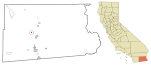
mapsize = 250x200px
map_caption = Location in Imperial County and the state ofCalifornia
mapsize1 =
map_caption1 =
subdivision_type = Country
subdivision_type1 = State
subdivision_type2 = County
subdivision_name =United States
subdivision_name1 =California
subdivision_name2 = Imperial
government_type =
leader_title =
leader_name =
established_date =
area_magnitude =
area_total_km2 = 1
area_total_sq_mi = 0.4
area_land_km2 = 1
area_land_sq_mi = 0.4
area_water_km2 = 0
area_water_sq_mi = 0
elevation_ft = -161
elevation_m = -49
population_as_of = 2000
population_footnotes =
population_total = 2131
population_metro =
population_density_km2 = 2131
population_density_sq_mi = 5327.5
timezone = Pacific (PST)
utc_offset = -8
latd = 33 |latm = 2 |lats = 17 |latNS = N
longd = 115 |longm = 37 |longs = 20 |longEW = W
timezone_DST = PDT
utc_offset_DST = -7
postal_code_type =ZIP code
postal_code = 92281
area_code = 760
blank_name = FIPS code
blank_info = 06-84606
blank1_name = GNIS feature ID
blank1_info = 1652812
footnotes =
website =Westmorland is a city in Imperial County,
California ,United States . The population was 2,131 at the 2000 census. It is part of the 'El Centro, California Metropolitan Statistical Area '. The city got its name from the phrase 'in the West is More Land'.Westmorland is on State Route 86 which is upgraded to a new six-lane highway to reduce its' infamous auto accident and fatality risk, while it connects with Brawley, El Centro and
Mexicali, Baja California ,Mexico .In the 1920s to the 1950s Westmorland was the site of illegal gaming establishments, many whorehouses and brothels, but these were later destroyed in an attempt to try to improve the town's image.
Westmorland has dealt with the image of high
poverty rates and prior to the 1990sNorth American Free Trade Agreement (NAFTA) economic boom, a nearly dead farm food shipping industry.Geography
Westmorland is located at coor dms|33|2|17|N|115|37|20|W|city (33.037923, -115.622292)GR|1.
According to the
United States Census Bureau , the city has a total area of 0.4square mile s (1.0km² ), all of it land.Westmorland is below sea level, sits behind a number of active
earthquake faults and experienced seismic activity in the past century (the 1907, 1916, 1925, 1940, 1948, 1965 and 1979 tremors). The 1987 Superstition Hills event caused serious damage in Westmorland and the Imperial valley.Demographics
As of the
census GR|2 of 2000, there were 2,131 people, 625 households, and 501 families residing in the city. Thepopulation density was 5,263.6 people per square mile (2,057.0/km²). There were 667 housing units at an average density of 1,647.5/sq mi (643.8/km²). The racial makeup of the city was 55.75% White, 1.03% Black or African American, 0.70% Native American, 0.33% Asian, 0.05% Pacific Islander, 39.42% from other races, and 2.72% from two or more races. 82.21% of the population were Hispanic or Latino of any race.There were 625 households out of which 47.7% had children under the age of 18 living with them, 56.0% were married couples living together, 19.0% had a female householder with no husband present, and 19.7% were non-families. 17.0% of all households were made up of individuals and 8.5% had someone living alone who was 65 years of age or older. The average household size was 3.41 and the average family size was 3.87.
In the city the population was spread out with 35.8% under the age of 18, 10.5% from 18 to 24, 26.5% from 25 to 44, 17.7% from 45 to 64, and 9.6% who were 65 years of age or older. The median age was 29 years. For every 100 females there were 94.4 males. For every 100 females age 18 and over, there were 92.3 males.
The median
income for a household in the city was $23,365, and the median income for a family was $26,667. Males had a median income of $27,500 versus $19,107 for females. Theper capita income for the city was $8,941. About 27.3% of families and 27.2% of the population were below thepoverty line , including 37.9% of those under age 18 and 14.6% of those age 65 or over.Politics
In the state legislature Westmorland is located in the 40th Senate District, represented by Democrat
Denise Moreno Ducheny , and in the 80th Assembly District, represented by RepublicanBonnie Garcia . Federally, Westmorland is located inCalifornia's 51st congressional district , which has a Cook PVI of D +7 [cite web | title = Will Gerrymandered Districts Stem the Wave of Voter Unrest? | publisher = Campaign Legal Center Blog | url=http://www.clcblog.org/blog_item-85.html | accessdate = 2007-10-20] and is represented by DemocratBob Filner .References
External links
Wikimedia Foundation. 2010.