- Calipatria, California
Infobox Settlement
official_name = Calipatria, California
settlement_type =City
imagesize =
image_caption =
image_
imagesize =
image_caption =
image_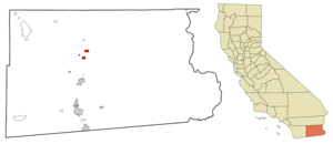
mapsize = 250x200px
map_caption = Location in Imperial County and the state ofCalifornia
mapsize1 =
map_caption1 =
subdivision_type = Country
subdivision_type1 = State
subdivision_type2 = County
subdivision_name =United States
subdivision_name1 =California
subdivision_name2 = Imperial
government_type =
leader_title =
leader_name =
established_date =
area_magnitude =
area_total_km2 = 9.6
area_total_sq_mi = 3.7
area_land_km2 = 9.6
area_land_sq_mi = 3.7
area_water_km2 = 0
area_water_sq_mi = 0
elevation_ft = -177
elevation_m = -54
population_as_of = 2000
population_footnotes =
population_total = 7289
population_metro =
population_density_km2 = 759.3
population_density_sq_mi = 1970
timezone = Pacific (PST)
utc_offset = -8
latd = 33 |latm = 7 |lats = 34 |latNS = N
longd = 115 |longm = 30 |longs = 45 |longEW = W
timezone_DST = PDT
utc_offset_DST = -7
postal_code_type =ZIP code
postal_code = 92233
area_code = 760
blank_name = FIPS code
blank_info = 06-09878
blank1_name = GNIS feature ID
blank1_info = 1652681
footnotes =
website =Calipatria is a city in Imperial County,
California ,United States . It is part of theEl Centro, California Metropolitan Statistical Area . The population was 7,289 at the 2000 census, including 4000 inmates atCalipatria State Prison . The community is located along State Route 111.Geography
At elevation -184 feet (184 feet [56 meters] below sea level), Calipatria is the lowest city in the western hemisphere. The city claims to have the "world's tallest flagpole" at convert|184|ft|m, so their American flag will always fly above sea level. [ [http://www.calipatria.com/deptdtl.asp?Dept=20 History of Calipatria] ] This flagpole, in front of the local Chamber of Commerce, is far shorter than the 430 foot pole in
Aqaba ,Jordan , the 338 foot pole inSheboygan, Wisconsin , or even the 200 foot pole inDorris, California , but it is probably the tallest flagpole in the Imperial Valley.Calipatria is located at coor dms|33|7|34|N|115|30|45|W|city (33.126200, -115.512510)GR|1.
According to the
United States Census Bureau , the city has a total area of 3.7 square miles (9.6 km²), all of it land.Demographics
As of the
census GR|2 of 2000, there were 7,289 people, 899 households, and 756 families residing in the city. Thepopulation density was 1,965.8 people per square mile (758.6/km²). There were 961 housing units at an average density of 259.2/sq mi (100.0/km²). The racial makeup of the city was 32.39% White, 21.32% Black or African American, 0.73% Native American, 0.63% Asian, 0.03% Pacific Islander, 42.65% from other races, and 2.25% from two or more races. 57.35% of the population were Hispanic or Latino of any race.There were 899 households out of which 50.4% had children under the age of 18 living with them, 61.2% were married couples living together, 17.6% had a female householder with no husband present, and 15.8% were non-families. 14.1% of all households were made up of individuals and 5.6% had someone living alone who was 65 years of age or older. The average household size was 3.55 and the average family size was 3.90.
In the city the population was spread out with 16.3% under the age of 18, 12.3% from 18 to 24, 52.6% from 25 to 44, 15.0% from 45 to 64, and 3.8% who were 65 years of age or older. The median age was 33 years. For every 100 females there were 363.4 males. For every 100 females age 18 and over, there were 497.5 males.
The median
income for a household in the city was $30,962, and the median income for a family was $31,302. Males had a median income of $31,350 versus $20,063 for females. Theper capita income for the city was $13,970. About 20.4% of families and 24.2% of the population were below thepoverty line , including 28.9% of those under age 18 and 17.8% of those age 65 or over.Calipatria is one of the state's poorest cities in income per capita due to agricultural paychecks and a declined economy in the 1990s.
Hispanic s mostly ofMexican descent are three-fourths of the people (excluding the multiracial body of state prison convicts). The city was first called "Sante Patria" (as in "Saint of the Motherland") is founded byIrish American andIrish Mexican soldiers, whom deserted both in the Mexican-American War (1850's) and from the Union and/or Confederate armies after theAmerican Civil War (1860's) but Calipatria also has a large Arab population fromJordan ,Lebanon andSyria , descendants of agriculture laborers in the 1920s. Fact|date=April 2008Politics
In the state legislature Calipatria is located in the 40th Senate District, represented by Democrat
Denise Moreno Ducheny , and in the 80th Assembly District, represented by RepublicanBonnie Garcia . Federally, Calipatria is located inCalifornia's 51st congressional district , which has a Cook PVI of D +7 [cite web | title = Will Gerrymandered Districts Stem the Wave of Voter Unrest? | publisher = Campaign Legal Center Blog | url=http://www.clcblog.org/blog_item-85.html | accessdate = 2007-10-20] and is represented by DemocratBob Filner .ister cities
*flagicon|Palestine
Jericho ,Palestinian Authority References
External links
* [http://www.desertmuseum.org/desert/sonora.html Map of the Sonoran Desert]
* [http://www.calipatria.com/ Official city Web site]
Wikimedia Foundation. 2010.