- Tijuana (municipality)
Infobox Settlement
name = Tijuana
settlement_type = Municipality
subdivision_type = Country
subdivision_name =Mexico
subdivision_type1 = State
subdivision_name1 =Baja California
image_shield = escudotijuana.png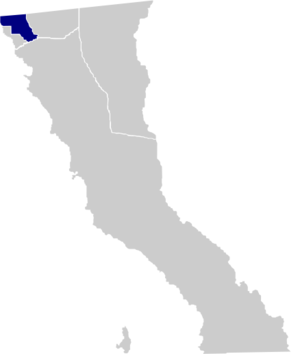
map_caption = Location of Tijuana inBaja California .
mapsize=150px
motto="Aquí Empieza La Patria"
(English: "The Homeland Starts Here")
population_as_of=2005
population_total=1410687
population_note=Data source: [http://www.inegi.gob.mx/est/contenidos/espanol/sistemas/conteo2005/localidad/iter/ INEGI]
population_density_km2=auto
area_total_km2=879.2
leader_title = Municipal president
leader_name =Jorge Ramos Hernández
leader_party = PAN
subdivision_type2 = Municipal seat
subdivision_name2 =Tijuana
subdivision_type3 = Largest city
subdivision_name3 =Tijuana
blank_name =INEGI code
blank_info = 004
timezone = PST
utc_offset = -8
timezone_DST = PDT
utc_offset_DST = -7
latd = 32 | latm = 32 | latNS = N
longd = 117 | longm = 3 | longEW = W
established_title=Municipality established
established_date=December 29 ,1953 [es icon pp. 78–79, [http://redalyc.uaemex.mx/redalyc/pdf/530/53010102.pdf La Transformación de Baja California en Estado, 1931–1952] , Lawrence Douglas Taylor Hansen, "Estudios Fronterizos", 1, #1 (Jan-June 2000), UABC, Mexicali, pp. 47–87.]
website=es icon [http://www.tijuana.gob.mx/ Ayuntamiento de Tijuana]
footnotes=Source: [http://www.e-local.gob.mx/work/templates/enciclo/bajacalifornia/municipios/02004a.htm Enciclopedia de los Municipios de México]Tijuana is a municipality in the Mexican state of
Baja California . Its municipal seat is located in the city ofTijuana . According to the 2005 census, it had a population of 1,410,687 inhabitants.Jorge Ramos Hernández of theNational Action Party (PAN) is the currentmunicipal president .Tijuana is bordered to the south by the municipalities of Playas de Rosarito and Ensenada; to the east, by the municipality of Tecate; to the west, by the
Pacific Ocean ; and to the north, by the international border with the United States, specifically the County of San Diego,California . The area of the municipality of Tijuana is 879.2 km² (339.46 sq mi); the municipality includes part of theCoronado Islands , located off the coast of the municipality in thePacific Ocean .Tijuana's precise location is coord|32|31|N|117|01|W|. It lies just south of
San Diego, California . The adjacent city and former borough of Tijuana isPlayas de Rosarito .Boroughs
The municipality of Tijuana is divided into administrative boroughs ("delegaciones", in Spanish) of which the city of Tijuana occupies nine, which are in turn divided into colonias. These boroughs offer administrative services such as
urban planning ,civil registry , inspection, verification,public work s and community development and are served by a "delegado".The boroughs are:
* Centenario — This is the borough with the largest number of factories andmaquiladora s. Its largest colony is "Ciudad Industrial" ("Industrial City"). Three of the city's most important streets,Boulevard Bellas Artes ,Boulevard Industrial andMexican Federal Highway 2 , are located here.
* Centro — This is the historical midpoint of Tijuana; themunicipal palace is located here as well as most of the tourist zones, such asAvenida Revolución and the business district. TheTijuana Cultural Center (CECUT for CEntro CUltural de Tijuana) is located here as well as the [http://www.plazariotijuana.com.mx Plaza Río Tijuana] , until recently the largest mall in the state, within the Zona Rio.
*Cerro Colorado — The "Cerro Colorado" ("Red Hill") is located here and it is surrounded by houses. Because of its height many of the area's antennae for radio and television stations are located on its peak.
* La Mesa — This is the where theMorelos Park , the largest public park in the city, is located, as well as the Plaza Mundo Divertido, the new Macroplaza and the CETYS University.
*Mesa de Otay — In this borough sits the Tijuana International Airport as well as theOtay Mesa entry to theUnited States . The Tijuana campus of theAutonomous University of Baja California and theFriendship Park are also located here as well as manymaquiladora s.
*Playas de Tijuana — This is the westernmost borough of the city bordered by thePacific Ocean on the west and theUnited States border on the north. This is where the beaches of Tijuana are located (hence the name) and it is also one of the two exits to the south towardsRosarito andEnsenada .
* La Presa — This is the largest borough in size and theAbelardo L. Rodríguez Dam is located within its limits, hence its name ("Presa" translates as "Dam" in English). The newCorredor Tijuana 2000 s and theTijuana-Tecate free road run through it.
*San Antonio de los Buenos — This is mostly a residential area although it also has two industrial parks.
*Sánchez Taboada — Like the previous borough this is mostly a residential area."Rosarito" was a delegation of Tijuana until it became its own municipality in 1995.
Major communities
*El Refugio
*La Joya
*Pórtico de San Antonio
*Terrazas del Valle
*Tijuana References
*es icon [http://www.inegi.gob.mx/est/contenidos/espanol/sistemas/conteo2005/localidad/iter/ Link to tables of population data from the 2005 Census] ,
Instituto Nacional de Estadística, Geografía e Informática (INEGI).
*es icon [http://www.e-local.gob.mx/work/templates/enciclo/bajacalifornia/municipios/02004a.htm Tijuana] , " [http://www.e-local.gob.mx/wb2/ELOCAL/ELOC_Enciclopedia Enciclopedia de los Municipios de México] ",Instituto Nacional para el Federalismo y el Desarrollo Municipal ,SEGOB . Accessed on lineNovember 15 ,2007 .External links
*es icon [http://www.tijuana.gob.mx/ Ayuntamiento de Tijuana] Official government website.
*es icon [http://www.paramitijuana.com/ Para mi Tijuana] Dedicated to a safe and secure Tijuana, A Tijuana la quiero Segura

Wikimedia Foundation. 2010.