- Tijuana Municipality, Baja California
-
Tijuana Municipality — Municipality — Municipio de Tijuana
Municipality of Tijuana
Coat of armsMotto: The Homeland Starts Here Location of Tijuana in Baja California.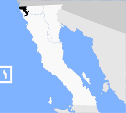
Coordinates: 32°32′N 117°3′W / 32.533°N 117.05°WCoordinates: 32°32′N 117°3′W / 32.533°N 117.05°W Country Mexico State Baja California Municipal seat Tijuana Largest city Tijuana Municipality established December 29, 1953[1] Government – Municipal president Carlos Bustamante Anchondo (PRI) Area – Total 879.2 km2 (339.5 sq mi) Population (2010) – Total 1,559,683 – Density 1,774/km2 (4,594.6/sq mi) Data source: INEGI Time zone PST (UTC-8) – Summer (DST) PDT (UTC-7) INEGI code 004 Website (Spanish) Ayuntamiento de Tijuana Source: Enciclopedia de los Municipios de México Tijuana Municipality is a municipality in the Mexican state of Baja California. Its municipal seat is located in the city of Tijuana. According to the 2010 census, the municipality had a population of 1,559,683 inhabitants, of whom 1,300,983, or 83.4%, lived in the city of Tijuana. Carlos Bustamante Anchondo of the PRI is the current municipal president.
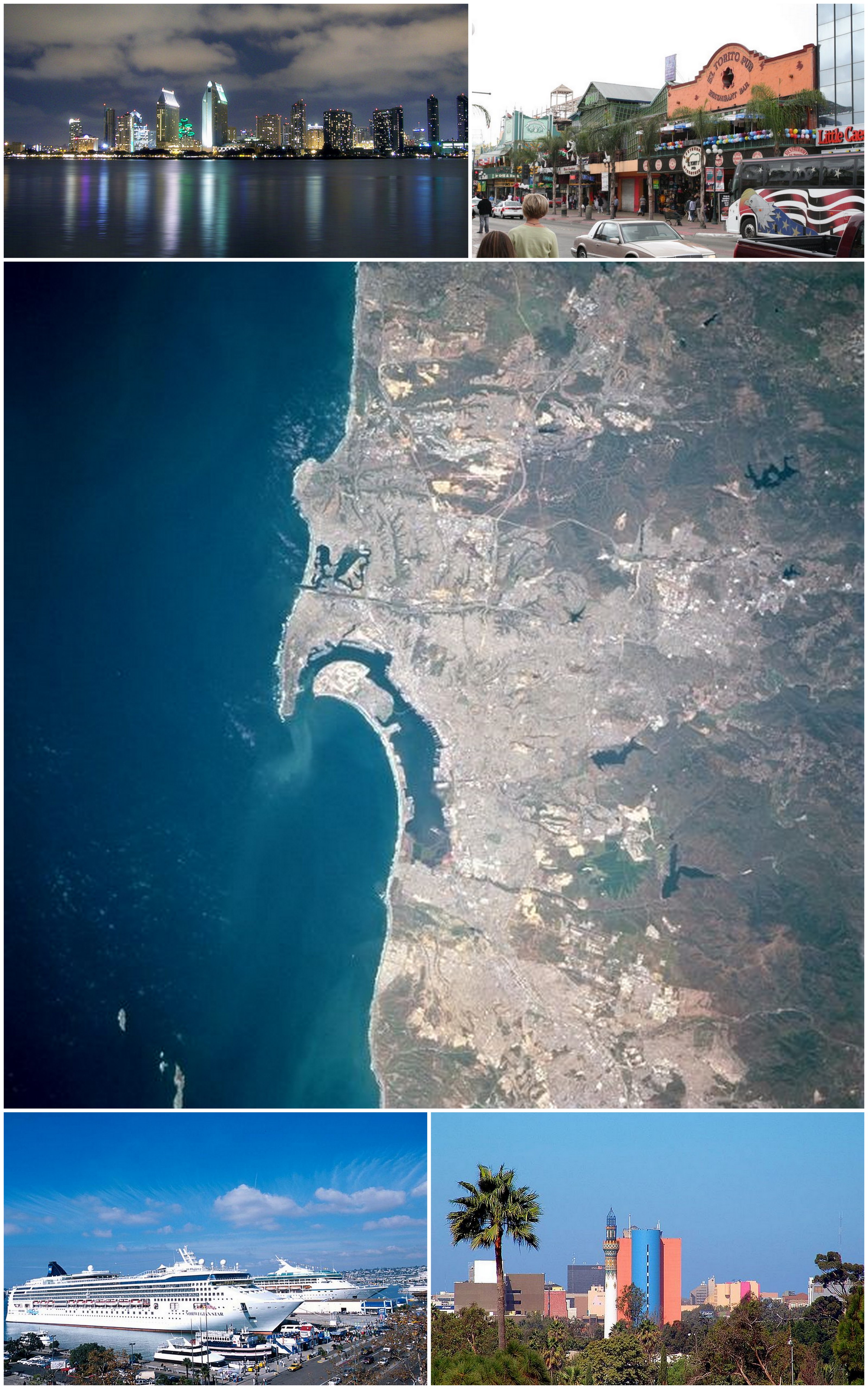
Tijuana is bordered to the south by the municipalities of Rosarito Beach and Ensenada; to the east, by the municipality of Tecate; to the west, by the Pacific Ocean; and to the north, by the international border with the United States, specifically the County of San Diego, California. The area of the municipality of Tijuana is 879.2 km² (339.46 sq mi); the municipality includes part of the Coronado Islands, located off the coast of the municipality in the Pacific Ocean.
The city of Tijuana's precise location is 32°32′05″N 117°02′37″W / 32.53472°N 117.04361°W. It lies just south of San Diego, California. The adjacent city and former borough of Tijuana is Rosarito Beach.
Contents
Boroughs
The municipality of Tijuana is divided into nine administrative boroughs. The Tijuana metropolitan area occupies all of borough seats. The boroughs are in turn divided into colonias or ejidos. These boroughs offer administrative services such as urban planning, civil registry, inspection, verification, public works and community development and are served by a delegado.
- Centenario — This is the borough with the largest number of factories and maquiladoras. Its largest colony is Ciudad Industrial ("Industrial City"). Three of the city's most important streets, Boulevard Bellas Artes, Boulevard Industrial and Mexican Federal Highway 2, are located here. This delegacion contains the Otay Mesa entry to the United States and the Friendship Park (Parque de la amistad).
- Centro — This is the historical midpoint of Tijuana; the municipal palace is located here as well as most of the tourist zones, such as Avenida Revolución and the business district. The Tijuana Cultural Center (CECUT for CEntro CUltural de Tijuana) is located here as well as the Plaza Río Tijuana, until recently the largest mall in the state, within the Zona Rio.
- Cerro Colorado — The Cerro Colorado ("Red Hill") is located here and it is surrounded by houses. Because of its height many of the area's antennae for radio and television stations are located on its peak.
- La Mesa — This is the where the Morelos Park, the largest public park in the city, is located, as well as the Plaza Mundo Divertido, the new Macroplaza and the CETYS University.
- Mesa de Otay — In this borough sits the Tijuana International Airport. The Tijuana campus of the Autonomous University of Baja California and the Technologico are also located here as well as many maquiladoras.
- Playas de Tijuana[2] — This is the westernmost borough of the city bordered by the Pacific Ocean on the west and the United States border on the north. This is where the beaches of Tijuana are located (hence the name) and it is also one of the two exits to the south towards Rosarito and Ensenada.
- La Presa — This is the largest borough in size and the Abelardo L. Rodríguez Dam is located within its limits, hence its name ("Presa" translates as "Dam" in English). The new Corredor Tijuana 2000 s and the Tijuana-Tecate free road run through it.
- San Antonio de los Buenos — This is mostly a residential area although it also has two industrial parks.
- Sanchez Taboada — Like the previous borough this is mostly a residential area, but within its borders are located many "maquiladoras" specially at Pacific Industrial Park.
Major cities
The largest localities (cities, towns, and villages) are:[3]
Name 2010 Census Population Tijuana 1,300,983 El Refugio 36,400 Pórticos de San Antonio 34,232 La Joya 26,860 Terrazas del Valle 20,421 Villa del Prado Segunda Sección 18,226 Las Delicias 15,486 Villa del Campo 13,906 Villa del Prado 12,303 El Niño 8,999 San Luis 8,571 Maclovio Rojas 7,279 Quinta del Cedro 5,704 Parajes del Valle 3,595 Lomas del Valle 3,352 Los Valles 3,135 Total Municipality 1,559,683 References
- ^ (Spanish) pp. 78–79, La Transformación de Baja California en Estado, 1931–1952, Lawrence Douglas Taylor Hansen, Estudios Fronterizos, 1, #1 (Jan-June 2000), UABC, Mexicali, pp. 47–87.
- ^ "Bourough of Playas de Tijuana". City of Tijuana. http://www.tijuana.gob.mx/Delegaciones/Delegaciones.asp?delegacion=6. Retrieved July 21, 2011.
- ^ 2010 census tables: INEGI
- (Spanish) Link to tables of population data from the 2005 Census, Instituto Nacional de Estadística, Geografía e Informática (INEGI).
- (Spanish) Tijuana, Enciclopedia de los Municipios de México, Instituto Nacional para el Federalismo y el Desarrollo Municipal, SEGOB. Accessed on line November 15, 2007.
External links
- (Spanish) Ayuntamiento de Tijuana Official government website.
- (Spanish) Para mi Tijuana Dedicated to a safe and secure Tijuana, A Tijuana la quiero Segura
Articles relating to Tijuana Municipality Municipalities and communities of Tijuana Municipality, Baja California Boroughs Centenario | Centro | Cerro Colorado | La Mesa | La Presa | Mesa de Otay | Playas de Tijuana | San Antonio de los Buenos | Sánchez Taboada

Cities El Refugio | Las Delicias | La Joya | Pórticos de San Antonio | Terrazas del Valle | Tijuana | Villa del Campo | Villa del Prado
 State of Baja California
Major cities 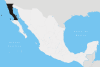
Regions Baja California Desert · Baja California Gold Coast · Colorado River Delta · Sierra Juárez and San Pedro Mártir pine-oak forests
Metro areas Municipalities Ensenada · Mexicali · Rosarito Beach · Tecate · Tijuana
San Diego–Tijuana History • Geography • Geology • Populace • Economy • Transportation • Education • Communication • Other Infrastructure • CultureCounties and
MunicipalitiesRosarito Beach • San Diego • Tecate • Tijuana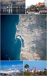
Global cities Large cities
100k - 250kCities and towns
20k - 99kCoronado • El Cajon • El Refugio • Encinitas • Fallbrook • Imperial Beach • La Joya • La Mesa • La Presa • Lemon Grove • National City • Pórticos de San Antonio • Poway • Rancho San Diego • Rosarito Beach • San Marcos • Santee • Spring Valley • Tecate • Terrazas del Valle • VistaCities and towns
10k-19kAlpine • Bonita • Bostonia • Casa de Oro-Mount Helix • Las Delicias • Ramona • Rancho San Diego • San Diego Country Esates • Solana Beach • Villa del Campo • Villa del Prado • Winter GardensBodies of water Agua Hedionda Lagoon • Batiquitos Lagoon • El Capitan Lake • Abelardo L. Rodriguez • Lake Hodges • Lake Sutherland • Lower Otay Reservoir • Loveland Reservoir • Mission Bay • Pacific Ocean • San Elijo Lagoon • San Diego Bay • San Vicente Reservoir • Sweetwater Reservoir • Tijuana River EstuarySub-regions Anza Borrego • Coronado Peninsula • Cuyamaca • East County • Mountain Empire • North County • Palm Valley • Rosarito • San Diego • South Bay • Tecate • TijuanaMajor cities 
Municipalities Ensenada Municipality · Rosarito Beach Municipality · Tijuana Municipality
Metro areas Bodies of water Tijuana River · Bahia de Todos Santos
Categories:- Municipalities of Baja California
- Tijuana Municipality


Wikimedia Foundation. 2010.