- Corning, California
-
City of Corning — city — Location in Tehama County and the state of California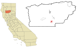
Coordinates: 39°55′34″N 122°10′50″W / 39.92611°N 122.18056°WCoordinates: 39°55′34″N 122°10′50″W / 39.92611°N 122.18056°W Country  United States
State  California
County Tehama Area[1] – Total 3.550 sq mi (9.193 km2) – Land 3.550 sq mi (9.193 km2) – Water 0 sq mi (0 km2) 0% Elevation 276 ft (84 m) Population (2010) – Total 7,663 – Density 2,158.6/sq mi (833.6/km2) Time zone Pacific (PST) (UTC-8) – Summer (DST) PDT (UTC-7) ZIP codes 96021, 96029 Area code(s) 530 FIPS code 06-16322 GNIS feature ID 0277491 Website corning.org Corning is a city in Tehama County, California, two hours north of Sacramento and one half hour northwest of Chico California United States. The population was 7,663 at the 2010 census, up from 6,741 at the 2000 census. The City has the most I-5 trucking and traveler services south of Medford, Oregon and north of Bakersfield, California. It is best known to travelers as the Olive City with its landmark business, the "Olive Pit", serving travelers for several generations at the Corning Road / Solano Ave interchange of Interstate 5. There you can find specialty olives, olive oil, olive products and food. Corning is also known for "the place to deal" through its regional Auto and Truck Dealerships providing Ford, Chevrolet and Dodge, Jeep and Chrysler. Corning is home to Lindsay brand Olives (Bell Carter Foods). More recently, Corning has become the center of the California boutique olive oil industry with three separately owned gourmet olive oil presses in operation at Corning Olive Oil Company and Lucero Olive Oil in Corning, and Pacific Sun in nearby Gerber; all are award winning products. There are also automotive and diesel service and repair businesses available along with lodging at eight motor hotels and motels close to services within the city and two more motor hotels located on the grounds of the Rolling Hills Casino 1-1/2 miles south on I-5.
Contents
Geography
Corning is located at 39°55′34″N 122°10′50″W / 39.92611°N 122.18056°W (39.926182, -122.180489)[2].
According to the United States Census Bureau, the city has a total area of 3.55 square miles (9.2 km2), all of it land.
Demographics
2010
The 2010 United States Census[3] reported that Corning had a population of 7,663. The population density was 2,158.8 people per square mile (833.5/km²). The racial makeup of Corning was 5,510 (71.9%) White, 44 (0.6%) African American, 201 (2.6%) Native American, 82 (1.1%) Asian, 11 (0.1%) Pacific Islander, 1,496 (19.5%) from other races, and 319 (4.2%) from two or more races. Hispanic or Latino of any race were 3,271 persons (42.7%).
The Census reported that 7,638 people (99.7% of the population) lived in households, 19 (0.2%) lived in non-institutionalized group quarters, and 6 (0.1%) were institutionalized.
There were 2,630 households, out of which 1,193 (45.4%) had children under the age of 18 living in them, 1,136 (43.2%) were opposite-sex married couples living together, 533 (20.3%) had a female householder with no husband present, 179 (6.8%) had a male householder with no wife present. There were 224 (8.5%) unmarried opposite-sex partnerships, and 12 (0.5%) same-sex married couples or partnerships. 633 households (24.1%) were made up of individuals and 259 (9.8%) had someone living alone who was 65 years of age or older. The average household size was 2.90. There were 1,848 families (70.3% of all households); the average family size was 3.44.
The population was spread out with 2,479 people (32.4%) under the age of 18, 864 people (11.3%) aged 18 to 24, 1,931 people (25.2%) aged 25 to 44, 1,617 people (21.1%) aged 45 to 64, and 772 people (10.1%) who were 65 years of age or older. The median age was 29.2 years. For every 100 females there were 94.5 males. For every 100 females age 18 and over, there were 89.5 males.
There were 2,871 housing units at an average density of 808.8 per square mile (312.3/km²), of which 1,302 (49.5%) were owner-occupied, and 1,328 (50.5%) were occupied by renters. The homeowner vacancy rate was 3.1%; the rental vacancy rate was 8.4%. 3,765 people (49.1% of the population) lived in owner-occupied housing units and 3,873 people (50.5%) lived in rental housing units.
2000
As of the census[4] of 2000, there were 6,741 people, 2,422 households, and 1,642 families residing in the city. The population density was 2,320.3 people per square mile (894.4/km²). There were 2,614 housing units at an average density of 899.8 per square mile (346.8/km²). The racial makeup of the city was 74.48% White, 0.52% African American, 2.18% Native American, 0.53% Asian, 0.09% Pacific Islander, 17.42% from other races, and 4.78% from two or more races. Hispanic or Latino of any race were 50.82% of the population.
There were 2,422 households out of which 40.2% had children under the age of 18 living with them, 45.1% were married couples living together, 16.3% had a female householder with no husband present, and 32.2% were non-families. 26.9% of all households were made up of individuals and 14.0% had someone living alone who was 65 years of age or older. The average household size was 2.76 and the average family size was 3.33.
In the city the population was spread out with 32.5% under the age of 18, 10.0% from 18 to 24, 28.0% from 25 to 44, 17.7% from 45 to 64, and 11.8% who were 65 years of age or older. The median age was 31 years. For every 100 females there were 92.9 males. For every 100 females age 18 and over, there were 90.5 males.
The median income for a household in the city was $25,357, and the median income for a family was $32,151. Males had a median income of $30,563 versus $19,736 for females. The per capita income for the city was $12,357. About 21.1% of families and 26.3% of the population were below the poverty line, including 33.6% of those under age 18 and 15.6% of those age 65 or over.
These compare to the national median household income of $45,135 and national per capita income of $23,201. 69.4% of the Residents in the city have graduated from High School or achieved further education compared to 80.35% nationally.
Politics
In the state legislature Corning is located in the 4th Senate District, represented by Republican Doug LaMalfa, and in the 2nd Assembly District, represented by Republican Jim Nielsen. Federally, Corning is located in California's 2nd congressional district, which has a Cook PVI of R +13[5] and is represented by Republican Wally Herger.
Major industries
Corning, known as the Olive City, is home to the Bell Carter Olive Company, which is the world's largest ripe olive cannery. Corning also has a significant agriculture industry centered around olives, olive oil, dried plums (prunes) including the "Sunsweet" label, walnuts, and almonds and is the home of the Rolling Hills Casino and Sevillano Links Golf Course, a championship 18 hole course.
Transportation
Interstate 5 serves Corning as does the California Northern Railroad. The California Northern has been leasing and operating the 110.7-mile (178.2 km) short line between Davis and Tehama through Corning from Southern Pacific (now Union Pacific) since September 26, 1993. The line was built by Southern Pacific's subsidiary, the Northern Railway Company, in August/September 1882.
Notable former & current residents
- Mark Acre, Former Major League Baseball pitcher
- Clair Engle, U.S. Senator
- Ralph Goings, American Artist
- Lee Grissom, Major League Baseball pitcher
- Mark Risley, Emmy-winning director
- France Silva, Medal of Honor recipient, veteran of the Boxer Rebellion
- Jeff Stover, NFL Player
References
- ^ U.S. Census
- ^ "US Gazetteer files: 2010, 2000, and 1990". United States Census Bureau. 2011-02-12. http://www.census.gov/geo/www/gazetteer/gazette.html. Retrieved 2011-04-23.
- ^ All data are derived from the United States Census Bureau reports from the 2010 United States Census, and are accessible on-line here. The data on unmarried partnerships and same-sex married couples are from the Census report DEC_10_SF1_PCT15. All other housing and population data are from Census report DEC_10_DP_DPDP1. Both reports are viewable online or downloadable in a zip file containing a comma-delimited data file. The area data, from which densities are calculated, are available on-line here. Percentage totals may not add to 100% due to rounding. The Census Bureau defines families as a household containing one or more people related to the householder by birth, opposite-sex marriage, or adoption. People living in group quarters are tabulated by the Census Bureau as neither owners nor renters. For further details, see the text files accompanying the data files containing the Census reports mentioned above.
- ^ "American FactFinder". United States Census Bureau. http://factfinder.census.gov. Retrieved 2008-01-31.
- ^ "Will Gerrymandered Districts Stem the Wave of Voter Unrest?". Campaign Legal Center Blog. http://www.clcblog.org/blog_item-85.html. Retrieved 2008-02-10.
External links
- City of Corning official website
- TehamaPulse.com is an events calendar for Tehama County, including Corning, CA.
Municipalities and communities of Tehama County, California Cities 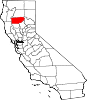
CDPs Bend | Flournoy | Gerber | Lake California | Las Flores | Los Molinos | Manton | Mineral | Paskenta | Paynes Creek | Proberta | Rancho Tehama Reserve | Richfield | Vina
Unincorporated
communitiesDairyville | Dales | El Camino | Gerber-Las Flores | Henleyville | Lyonsville | Kirkwood | Mill Creek | Red Bank | Reeds Creek
Categories:- Incorporated cities and towns in California
- Cities in Tehama County, California


Wikimedia Foundation. 2010.