- Manton, California
-
Manton — census-designated place — Location in Tehama County and the state of California
Coordinates: 40°25′8″N 121°51′49″W / 40.41889°N 121.86361°WCoordinates: 40°25′8″N 121°51′49″W / 40.41889°N 121.86361°W Country  United States
State  California
County Tehama Area[1] – Total 17.722 sq mi (45.901 km2) – Land 17.696 sq mi (45.833 km2) – Water 0.026 sq mi (0.067 km2) 0.15% Elevation 2,008 ft (612 m) Population (2010) – Total 347 – Density 19.6/sq mi (7.6/km2) Time zone Pacific (PST) (UTC-8) – Summer (DST) PDT (UTC-7) ZIP code 96059 Area code(s) 530 FIPS code 06-45512 GNIS feature ID 1659048 Manton is a census-designated place (CDP) in Tehama County, California, United States. The population was 347 at the 2010 census, down from 372 at the 2000 census.
In August 2005, the town was overrun by a forest fire which destroyed several homes and forced the evacuation of the entire town. There were no injuries.
The town is also the home, as of June 2006, of the St. John of San Francisco Monastery, an Orthodox Christian men's monastery belonging to the Diocese of the West of the Orthodox Church in America (OCA).
Contents
Geography
Manton is located at 40°25′8″N 121°51′49″W / 40.41889°N 121.86361°W (40.419020, -121.863519)[2].
According to the United States Census Bureau, the CDP has a total area of 17.7 square miles (46 km2), 99.85% of it land and 0.15% of it water.
Demographics
2010
The 2010 United States Census[3] reported that Manton had a population of 347. The population density was 19.6 people per square mile (7.6/km²). The racial makeup of Manton was 312 (89.9%) White, 0 (0.0%) African American, 20 (5.8%) Native American, 1 (0.3%) Asian, 0 (0.0%) Pacific Islander, 7 (2.0%) from other races, and 7 (2.0%) from two or more races. Hispanic or Latino of any race were 35 persons (10.1%).
The Census reported that 331 people (95.4% of the population) lived in households, 16 (4.6%) lived in non-institutionalized group quarters, and 0 (0%) were institutionalized.
There were 146 households, out of which 29 (19.9%) had children under the age of 18 living in them, 90 (61.6%) were opposite-sex married couples living together, 8 (5.5%) had a female householder with no husband present, 6 (4.1%) had a male householder with no wife present. There were 5 (3.4%) unmarried opposite-sex partnerships, and 0 (0%) same-sex married couples or partnerships. 37 households (25.3%) were made up of individuals and 20 (13.7%) had someone living alone who was 65 years of age or older. The average household size was 2.27. There were 104 families (71.2% of all households); the average family size was 2.67.
The population was spread out with 51 people (14.7%) under the age of 18, 16 people (4.6%) aged 18 to 24, 52 people (15.0%) aged 25 to 44, 141 people (40.6%) aged 45 to 64, and 87 people (25.1%) who were 65 years of age or older. The median age was 53.9 years. For every 100 females there were 110.3 males. For every 100 females age 18 and over, there were 120.9 males.
There were 180 housing units at an average density of 10.2 per square mile (3.9/km²), of which 123 (84.2%) were owner-occupied, and 23 (15.8%) were occupied by renters. The homeowner vacancy rate was 0%; the rental vacancy rate was 7.4%. 277 people (79.8% of the population) lived in owner-occupied housing units and 54 people (15.6%) lived in rental housing units.
2000
As of the census[4] of 2000, there were 372 people, 159 households, and 114 families residing in the CDP. The population density was 21.0 people per square mile (8.1/km²). There were 205 housing units at an average density of 11.6 per square mile (4.5/km²). The racial makeup of the CDP was 90.32% White, 0.27% African American, 1.34% Native American, 0.27% Asian, 1.34% Pacific Islander, 1.88% from other races, and 4.57% from two or more races. Hispanic or Latino of any race were 8.33% of the population.
There were 159 households out of which 17.0% had children under the age of 18 living with them, 62.9% were married couples living together, 6.9% had a female householder with no husband present, and 28.3% were non-families. 21.4% of all households were made up of individuals and 9.4% had someone living alone who was 65 years of age or older. The average household size was 2.30 and the average family size was 2.64.
In the CDP the population was spread out with 18.0% under the age of 18, 3.5% from 18 to 24, 19.9% from 25 to 44, 37.1% from 45 to 64, and 21.5% who were 65 years of age or older. The median age was 51 years. For every 100 females there were 104.4 males. For every 100 females age 18 and over, there were 113.3 males.
The median income for a household in the CDP was $28,333, and the median income for a family was $34,375. Males had a median income of $30,000 versus $21,094 for females. The per capita income for the CDP was $19,127. About 9.4% of families and 18.1% of the population were below the poverty line, including 43.1% of those under age 18 and 8.2% of those age 65 or over.
Politics
In the state legislature Manton is located in the 4th Senate District, represented by Republican Doug LaMalfa, and in the 2nd Assembly District, represented by Republican Jim Nielsen. Federally, Manton is located in California's 2nd congressional district, which has a Cook PVI of R +13[5] and is represented by Republican Wally Herger.
Utilities
The Volta powerhouses, currently owned by Pacific Gas and Electric Company, are located here.
References
- ^ U.S. Census
- ^ "US Gazetteer files: 2010, 2000, and 1990". United States Census Bureau. 2011-02-12. http://www.census.gov/geo/www/gazetteer/gazette.html. Retrieved 2011-04-23.
- ^ All data are derived from the United States Census Bureau reports from the 2010 United States Census, and are accessible on-line here. The data on unmarried partnerships and same-sex married couples are from the Census report DEC_10_SF1_PCT15. All other housing and population data are from Census report DEC_10_DP_DPDP1. Both reports are viewable online or downloadable in a zip file containing a comma-delimited data file. The area data, from which densities are calculated, are available on-line here. Percentage totals may not add to 100% due to rounding. The Census Bureau defines families as a household containing one or more people related to the householder by birth, opposite-sex marriage, or adoption. People living in group quarters are tabulated by the Census Bureau as neither owners nor renters. For further details, see the text files accompanying the data files containing the Census reports mentioned above.
- ^ "American FactFinder". United States Census Bureau. http://factfinder.census.gov. Retrieved 2008-01-31.
- ^ "Will Gerrymandered Districts Stem the Wave of Voter Unrest?". Campaign Legal Center Blog. http://www.clcblog.org/blog_item-85.html. Retrieved 2008-02-10.
External links
Municipalities and communities of Tehama County, California Cities 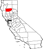
CDPs Bend | Flournoy | Gerber | Lake California | Las Flores | Los Molinos | Manton | Mineral | Paskenta | Paynes Creek | Proberta | Rancho Tehama Reserve | Richfield | Vina
Unincorporated
communitiesDairyville | Dales | El Camino | Gerber-Las Flores | Henleyville | Lyonsville | Kirkwood | Mill Creek | Red Bank | Reeds Creek
Categories:- Census-designated places in Tehama County, California


Wikimedia Foundation. 2010.