- Walnut Grove, California
Infobox Settlement
official_name = Walnut Grove, California
settlement_type = CDP
imagesize =
image_caption =
image_
imagesize =
image_caption =
image_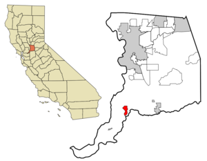
mapsize = 250x200px
map_caption = Location in Sacramento County and the state ofCalifornia
mapsize1 =
map_caption1 =
subdivision_type = Country
subdivision_type1 = State
subdivision_type2 = County
subdivision_name =United States
subdivision_name1 =California
subdivision_name2 = Sacramento
government_type =
leader_title =
leader_name =
established_date =
area_magnitude =
area_total_km2 = 9
area_total_sq_mi = 3.4
area_land_km2 = 8.1
area_land_sq_mi = 3.1
area_water_km2 = 0.9
area_water_sq_mi = 0.3
elevation_ft = 10
elevation_m = 3
population_as_of = 2000
population_footnotes =
population_total = 669
population_metro =
population_density_km2 = 74.3
population_density_sq_mi = 196.8
timezone = PST
utc_offset = -8
latd = 38 |latm = 14 |lats = 37 |latNS = N
longd = 121 |longm = 30 |longs = 44 |longEW = W
timezone_DST = PDT
utc_offset_DST = -7
postal_code_type =ZIP code
postal_code = 95690
area_code = 916
blank_name = FIPS code
blank_info = 06-83374
blank1_name = GNIS feature ID
blank1_info = 1660121
footnotes =
website =Walnut Grove is a
census-designated place (CDP) in Sacramento County,California ,United States . It is part of the Sacramento–Arden-Arcade–Roseville Metropolitan Statistical Area. The population was 669 at the 2000 census.Geography
Walnut Grove is located at coor dms|38|14|37|N|121|30|44|W| (38.243490, -121.512100)GR|1.
According to the
United States Census Bureau , the CDP has a total area of 3.5square mile s (8.9km² ), of which, 3.1 square miles (8.1 km²) of it is land and 0.3 square miles (0.9 km²) of it (9.86%) is water.Demographics
As of the
census GR|2 of 2000, there were 669 people, 245 households, and 159 families residing in the CDP. Thepopulation density was 214.8 people per square mile (83.1/km²). There were 282 housing units at an average density of 90.5/sq mi (35.0/km²). The racial makeup of the CDP was 49.78% White, 1.49% African American, 3.14% Native American, 21.23% Asian, 0.15% Pacific Islander, 19.13% from other races, and 5.08% from two or more races. Hispanic or Latino of any race were 46.79% of the population.There were 245 households out of which 31.0% had children under the age of 18 living with them, 43.3% were married couples living together, 15.5% had a female householder with no husband present, and 35.1% were non-families. 31.0% of all households were made up of individuals and 14.3% had someone living alone who was 65 years of age or older. The average household size was 2.73 and the average family size was 3.46.
In the CDP the population was spread out with 25.3% under the age of 18, 11.4% from 18 to 24, 28.1% from 25 to 44, 18.4% from 45 to 64, and 16.9% who were 65 years of age or older. The median age was 35 years. For every 100 females there were 95.0 males. For every 100 females age 18 and over, there were 96.9 males.
The median income for a household in the CDP was $40,179, and the median income for a family was $39,667. Males had a median income of $41,563 versus $23,417 for females. The
per capita income for the CDP was $14,939. About 14.0% of families and 11.3% of the population were below thepoverty line , including 12.9% of those under age 18 and 3.0% of those age 65 or over.History
Established in 1850 by John W. Sharp, Walnut Grove is one of the earliest settlements along the Sacramento River. Sharp journeyed west from Ohio with his young family and chose the site of Walnut Grove because of the abundant walnut and oak forests in the area. The town quickly prospered as an agricultural center and riverboat stop (the forests were timbered for steamboat firewood) and a major shipping port by 1865 for agricultural produce, and fish, with the Bartlett Pear as its primary product. By 1870 it was a thriving town full of small businesses (many owned by the Sharp family), a school, post office, and Union Guard Armory.
After Sharp's death in 1880, the heirs sold a large portion of the estate to Alex Brown and her son Alex. The Brown family subsequently became heavily involved in the commercial life of the community, operating a general store, hotel, an asparagus packing house, and the well-known Bank of Alex Brown. Due to the demands for rich agricultural land, its size stayed compact but has the distinction of being the only river town along the Sacramento River to occupy both the east and west riverbanks.
For years a ferry connected between, until the first bridge was opened in 1916. The bridge, since replaced by a modern span, was the first cantilevered counter-weight bascule drawbridge constructed west of the Mississippi River. It was officially opened by the Governor of California who traveled with various dignitaries to Walnut Grove on the gubernatorial yacht.
As early as 1914 a large Japanese community lived in Walnut Grove. About 67 Japanese-owned businesses (with names and addresses) are listed in the Nichi-Bei Nenkan (Japanese American Yearbook) of 1914 - including one tofu shop - Sakai Tofu-ya. There was still a tofu shop in town in 1975, according to The Book of Tofu.
ites of interest
<
>Walnut Grove's location has made it the site of a rare collection of very tall radio and television transmission towers. The first major tower here was the KXTV/KOVR/KCRA Tower built in 1962, which dominated the skyline for over twenty years with its 472 meter height. In 1985 the old tower was joined by taller structures. The guyedKXTV/KOVR Tower is, with a height of 624.5 m, one of the tallest constructions in the world. Two other guyed towers of similar height are the 608.7 meter highChannel 40 Tower and the 609.7 meter highHearst-Argyle Tower . Towers sited here at the natural corner of theCalifornia Central Valley have line of sight coverage of flat valley floor for over 100 kilometers (60 miles) to the north and to the south-southeast, and quite good coverage into the Sierra foothills and mountains across the valley to the northeast and east. However, these towers and their guy-wires are a significant hazard to aircraft, which can otherwise freely cross most of the Central Valley at 200 meters altitude.<
>Chan Tin-San is commonly credited as the earliest resident of Locke. He was the first Chinese to construct a building on the Locke brothers' property, where he realized the business potential of the Southern Pacific wharf and warehouse. After the October 1916 fire which destroyed the Walnut Grove Chinatown, a number of Chung-San District people moved to the area and Locke was officially established. Lee Bing, the leader of the group, financed nine of the buildings. Locke is one of the only towns in the United States built entirely by Chinese. It was built in 1915 and burned down twice. Locke was a bustling place with gambling houses, merchant stores and a movie house all owned by the Chinese. Locke today is much like it was many years ago. Most of the original buildings are still standing. The Southern Pacific wharf and warehouse was built in three stages, the first in 1906. It grew to over 800 feet in length. During the harvest season a half dozen or more fruit packers used to rent space in the warehouse, among them were Scobel & Day, Simons & French, Earl Fruit Company, and the California Packing Corporation. The rail spur served the warehouse and connected with the Walnut Grove Branch line. The warehouse operated two freight elevators which raised produce from the decks of the riverboats. The warehouse is now used to store and launch pleasure boats. Politics
In the state legislature Walnut Grove is located in the 5th Senate District, represented by Democrat
Michael Machado , and in the 15th Assembly District, represented by RepublicanGuy S. Houston . Federally, Walnut Grove is located inCalifornia's 10th congressional district , which has a Cook PVI of D +9 [cite web | title = Will Gerrymandered Districts Stem the Wave of Voter Unrest? | publisher = Campaign Legal Center Blog | url=http://www.clcblog.org/blog_item-85.html | accessdate = 2008-02-10] and is represented by DemocratEllen Tauscher .References
External links
* [http://www.nps.gov/history/nr/twhp/wwwlps/lessons/locke/locke.htm "“Locke and Walnut Grove: Havens for Early Asian Immigrants in California”", a National Park Service Teaching with Historic Places (TwHP) lesson plan]
Wikimedia Foundation. 2010.