- Rancho Murieta, California
Infobox Settlement
official_name = Rancho Murieta, California
settlement_type = CDP
imagesize =
image_caption =
image_
imagesize =
image_caption =
image_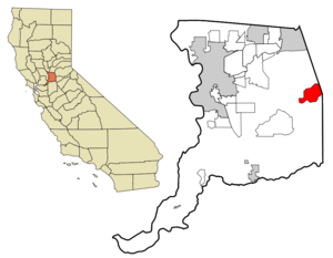
mapsize = 250x200px
map_caption = Location in Sacramento County and the state ofCalifornia
mapsize1 =
map_caption1 =
Security Force = 5 Patrol Cars
subdivision_type = Country
subdivision_type1 = State
subdivision_type2 = County
subdivision_name =United States
subdivision_name1 =California
subdivision_name2 = Sacramento
government_type =
leader_title =
leader_name =
established_date =
area_magnitude =
area_total_km2 = 30.9
area_total_sq_mi = 12
area_land_km2 = 30.8
area_land_sq_mi = 11.9
area_water_km2 = 0.1
area_water_sq_mi = 0.1
elevation_ft = 167
elevation_m = 51
population_as_of = 2000
population_footnotes =
population_total = 4193
population_metro =
population_density_km2 = 135.7
population_density_sq_mi = 349.4
timezone = PST
utc_offset = -8
latd = 38 |latm = 30 |lats = 11 |latNS = N
longd = 121 |longm = 5 |longs = 5 |longEW = W
timezone_DST = PDT
utc_offset_DST = -7
postal_code_type =ZIP code
postal_code = 95683
area_code = 916
blank_name = FIPS code
blank_info = 06-59506
blank1_name = GNIS feature ID
blank1_info = 1820537
footnotes =
website =Rancho Murieta is a
census-designated place (CDP) and guard-gated private community in Sacramento County,California ,United States . It is part of the Sacramento–Arden-Arcade–Roseville Metropolitan Statistical Area. The population was 4,193 at the 2000 census. It is located in the foothills of the Sierra Nevada mountains, about 25 miles east of Sacramento.Geography
Rancho Murieta is located at 38°30′11″N, 121°5′5″W (38.503068, -121.084643)GR1.
According to the United States Census Bureau, the CDP has a total area of 11.9
square mile s (31.0km² ), of which, 11.9 square miles (30.8 km²) of it is land and 0.1 square miles (0.1 km²) of it (0.42%) is water.Demographics
As of the
census GR|2 of 2000, there were 4,193 people, 1,783 households, and 1,408 families residing in the CDP. Thepopulation density was 352.4 people per square mile (136.0/km²). There were 1,857 housing units at an average density of 156.1/sq mi (60.3/km²). The racial makeup of the CDP was 91.03% White, 1.93% African American, 0.36% Native American, 2.72% Asian, 0.07% Pacific Islander, 1.07% from other races, and 2.81% from two or more races. Hispanic or Latino of any race were 4.63% of the population.There were 1,783 households out of which 23.7% had children under the age of 18 living with them, 73.6% were married couples living together, 3.5% had a female householder with no husband present, and 21.0% were non-families. 17.9% of all households were made up of individuals and 8.6% had someone living alone who was 65 years of age or older. The average household size was 2.35 and the average family size was 2.64.
In the CDP the population was spread out with 18.8% under the age of 18, 2.6% from 18 to 24, 21.6% from 25 to 44, 35.0% from 45 to 64, and 21.9% who were 65 years of age or older. The median age was 49 years. For every 100 females there were 95.9 males. For every 100 females age 18 and over, there were 92.6 males.
The median income for a household in the CDP was $82,130, and the median income for a family was $89,635. Males had a median income of $70,382 versus $36,923 for females. The
per capita income for the CDP was $44,010. About 1.8% of families and 2.0% of the population were below thepoverty line , including 1.7% of those under age 18 and 1.5% of those age 65 or over.Government
Local
Rancho Murieta's governing bodies are the Rancho Murieta Home Owner's Association (RMA), The Murieta Townhouses, Inc. (MTI) and the Villa and Village HOAs. The Sacramento County Rancho Murieta Community Services District provides water, sewer, and security services to the CID. The RMA provides landscape and street maintenance, and enforcement of the CC&R's.
tate and Federal
In the state legislature Rancho Murieta is located in the 1st Senate District, represented by Republican
Dave Cox , and in the 10th Assembly District, represented by RepublicanAlan Nakanishi . Federally, Rancho Murieta is located inCalifornia's 3rd congressional district , which has a Cook PVI of R +7 [cite web | title = Will Gerrymandered Districts Stem the Wave of Voter Unrest? | publisher = Campaign Legal Center Blog | url=http://www.clcblog.org/blog_item-85.html | accessdate = 2008-02-10] and is represented by RepublicanDan Lungren .Rancho Murieta Country Club
It is best known in the Sacramento region for the Rancho Murieta Country Club, which hosted the
Raley's Senior Gold Rush , aSenior PGA Tour event, until 1995.Telephone Prefixes
Telephone numbers for wired telephones working out of the Rancho Murieta
central office follow the format (916) 354-xxxx and 314-xxxx.External links
* [http://www.ranchomurieta.com News coverage of the community]
* [http://www.ranchomurietaonline.com Rancho Murieta Forums ]
* [http://www.preservemurieta.org Group out to preserve Rancho Murieta ]
Wikimedia Foundation. 2010.