- Sacramento Mather Airport
-
Sacramento Mather Airport 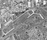
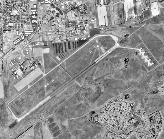
USGS aerial photo as of 17 Aug 1998 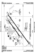
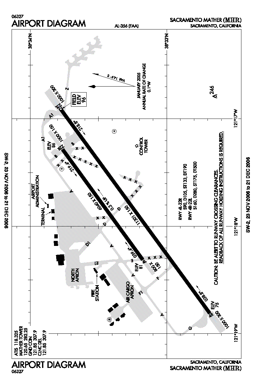
FAA airport diagram IATA: MHR – ICAO: KMHR – FAA LID: MHR Summary Airport type Public Owner Sacramento County Serves Sacramento, California Elevation AMSL 96 ft / 29 m Coordinates 38°33′14″N 121°17′51″W / 38.55389°N 121.2975°W Runways Direction Length Surface ft m 4R/22L 11,301 3,445 Asphalt/Concrete 4L/22R 6,040 1,841 Asphalt Helipads Number Length Surface ft m H1 30 9 Asphalt H2 100 30 Asphalt Statistics (2005) Aircraft operations 101,000 Based aircraft 152 Source: FAA[1] and airport web page[2] Sacramento Mather Airport (IATA: MHR, ICAO: KMHR, FAA LID: MHR), also known as simply Mather Airport, is a county-owned public-use airport located 10 nautical miles (19 km) east of the central business district of Sacramento, in the city of Rancho Cordova, California, United States.[1] It is located on the site of the former Mather Air Force Base which was closed in 1993.
Contents
Facilities and aircraft
Sacramento Mather Airport covers an area of 2,875 acres (1,163 ha) at an elevation of 99 feet (30 m) above mean sea level. It has two runways: 4L/22R is 6,040 by 150 feet (1,841 x 46 m) with an asphalt pavement; 4R/22L is 11,301 by 150 feet (3,445 x 46 m) with a concrete and asphalt surface. The airport also has two helipads: H1 is 30 x 30 ft. (9 x 9 m); H2 is 100 x 100 ft. (30 x 30 m).[1]
For the 12-month period ending December 31, 2005, the airport had 101,000 aircraft operations, an average of 276 per day: 55% general aviation, 19% air taxi, 16% scheduled commercial and 10% military. At that time there were 152 aircraft based at this airport: 23% single-engine, 24% multi-engine, 2% jet, 24% helicopter and 27% military.[1]
Incidents
On February 17, 2000 an Emery Worldwide DC-8 cargo plane crashed shortly after take-off from this airport.[3][4]
References
- ^ a b c d FAA Airport Master Record for MHR (Form 5010 PDF), effective 2008-07-31.
- ^ Mather Airport, official Sacramento County Airport System website.
- ^ "Emery DC-8 cargo plane crashes near Sacramento, California". CNN.com, retrieved December 13, 2006.
- ^ "Safety Board Finds Poor Maintenance Caused Sacramento, Calif., Airport Crash". AccessMyLibrary.com, retrieved December 13, 2006.
External links
- FAA Airport Diagram (PDF), effective 20 October 2011
- FAA Terminal Procedures for MHR, effective 20 October 2011
- Resources for this airport:
- AirNav airport information for KMHR
- ASN accident history for MHR
- FlightAware airport information and live flight tracker
- NOAA/NWS latest weather observations
- SkyVector aeronautical chart, Terminal Procedures for KMHR
Categories:- Central Valley of California
- Airports in Sacramento County, California
Wikimedia Foundation. 2010.