- Courtland, California
-
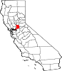
Courtland — census-designated place — 
 Courtland
Coordinates: 38°19′52″N 121°34′07″W / 38.33111°N 121.56861°WCoordinates: 38°19′52″N 121°34′07″W / 38.33111°N 121.56861°W Country  United States
State  California
County Sacramento Area[1] - Total 1.800 sq mi (4.662 km2) - Land 1.800 sq mi (4.662 km2) - Water 0 sq mi (0 km2) 0% Elevation 13 ft (4 m) Population (2010) - Total 355 - Density 197.2/sq mi (76.1/km2) Time zone Pacific (PST) (UTC-8) - Summer (DST) PDT (UTC-7) ZIP code 95615 Area code(s) Area code 916 GNIS feature ID 1655931[2] Courtland is a census-designated place in Sacramento County, California, United States. Courtland is located along the Sacramento River 17 miles (27 km) south-southwest of Sacramento. Courtland has a post office with ZIP code 95615, which was established in 1872.[3] Courtland was named after Courtland Sims, son of James V. Simes, a landowner who opened a steamer landing in the community in 1870.[4]
Geography
According to the United States Census Bureau, the CDP covers an area of 1.8 square miles (4.7 km²), all of it land.
Demographics
The 2010 United States Census[5] reported that Courtland had a population of 355. The population density was 197.2 people per square mile (76.1/km²). The racial makeup of Courtland was 247 (69.6%) White, 0 (0.0%) African American, 6 (1.7%) Native American, 4 (1.1%) Asian, 0 (0.0%) Pacific Islander, 75 (21.1%) from other races, and 23 (6.5%) from two or more races. Hispanic or Latino of any race were 200 persons (56.3%).
The Census reported that 277 people (78.0% of the population) lived in households, 78 (22.0%) lived in non-institutionalized group quarters, and 0 (0%) were institutionalized.
There were 115 households, out of which 31 (27.0%) had children under the age of 18 living in them, 57 (49.6%) were opposite-sex married couples living together, 12 (10.4%) had a female householder with no husband present, 5 (4.3%) had a male householder with no wife present. There were 7 (6.1%) unmarried opposite-sex partnerships, and 3 (2.6%) same-sex married couples or partnerships. 34 households (29.6%) were made up of individuals and 18 (15.7%) had someone living alone who was 65 years of age or older. The average household size was 2.41. There were 74 families (64.3% of all households); the average family size was 3.01.
The population was spread out with 77 people (21.7%) under the age of 18, 38 people (10.7%) aged 18 to 24, 79 people (22.3%) aged 25 to 44, 95 people (26.8%) aged 45 to 64, and 66 people (18.6%) who were 65 years of age or older. The median age was 41.1 years. For every 100 females there were 102.9 males. For every 100 females age 18 and over, there were 109.0 males.
There were 138 housing units at an average density of 76.7 per square mile (29.6/km²), of which 77 (67.0%) were owner-occupied, and 38 (33.0%) were occupied by renters. The homeowner vacancy rate was 0%; the rental vacancy rate was 0%. 167 people (47.0% of the population) lived in owner-occupied housing units and 110 people (31.0%) lived in rental housing units.
References
- ^ U.S. Census
- ^ U.S. Geological Survey Geographic Names Information System: Courtland, California
- ^ ZIP Code Lookup
- ^ Durham, David L. (1998). California's Geographic Names: A Gazetteer of Historic and Modern Names of the State. Quill Driver Books. p. 471. ISBN 9781884995149.
- ^ All data are derived from the United States Census Bureau reports from the 2010 United States Census, and are accessible on-line here. The data on unmarried partnerships and same-sex married couples are from the Census report DEC_10_SF1_PCT15. All other housing and population data are from Census report DEC_10_DP_DPDP1. Both reports are viewable online or downloadable in a zip file containing a comma-delimited data file. The area data, from which densities are calculated, are available on-line here. Percentage totals may not add to 100% due to rounding. The Census Bureau defines families as a household containing one or more people related to the householder by birth, opposite-sex marriage, or adoption. People living in group quarters are tabulated by the Census Bureau as neither owners nor renters. For further details, see the text files accompanying the data files containing the Census reports mentioned above.
Municipalities and communities of Sacramento County, California County seat: Sacramento Cities Citrus Heights | Elk Grove | Folsom | Galt | Isleton | Rancho Cordova | Sacramento
CDPs Antelope | Arden-Arcade | Carmichael | Clay | Courtland | Elverta | Fair Oaks | Florin | Foothill Farms | Franklin | Freeport | Fruitridge Pocket | Gold River | Herald | Hood | La Riviera | Lemon Hill | Mather | McClellan Park | North Highlands | Orangevale | Parkway | Rancho Murieta | Rio Linda | Rosemont | Vineyard | Walnut Grove | Wilton
Unincorporated
communitiesLocke | Paintersville | Parkway-South Sacramento | Ryde | Sloughhouse
Ghost towns Mormon Island | Sutterville
Categories:- Census-designated places in Sacramento County, California
- Populated places established in 1872
- Populated places in California with Hispanic majority populations


Wikimedia Foundation. 2010.