- Isleton, California
Infobox Settlement
official_name = Isleton, California
settlement_type =City
imagesize =
image_caption =
image_
imagesize =
image_caption =
image_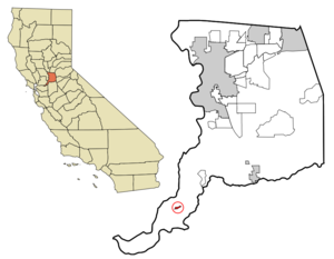
mapsize = 250x200px
map_caption = Location in Sacramento County and the state ofCalifornia
mapsize1 =
map_caption1 =
subdivision_type = Country
subdivision_type1 = State
subdivision_type2 = County
subdivision_name =United States
subdivision_name1 =California
subdivision_name2 = Sacramento
government_type =
leader_title =
leader_name =
established_date =
area_magnitude =
area_total_km2 = 1.2
area_total_sq_mi = 0.5
area_land_km2 = 1
area_land_sq_mi = 0.4
area_water_km2 = 0.2
area_water_sq_mi = 0.1
elevation_ft = 10
elevation_m = 3
population_as_of = 2000
population_footnotes =
population_total = 828
population_metro =
population_density_km2 = 690
population_density_sq_mi = 1656
timezone = PST
utc_offset = -8
latd = 38 |latm = 9 |lats = 43 |latNS = N
longd = 121 |longm = 36 |longs = 33 |longEW = W
timezone_DST = PDT
utc_offset_DST = -7
postal_code_type =ZIP code
postal_code = 95641
area_code = 916
blank_name = FIPS code
blank_info = 06-36882
blank1_name = GNIS feature ID
blank1_info = 0277531
footnotes =
website =Isleton is a city in Sacramento County,
California ,United States . The population was 828 at the 2000 census. Located on an island amid the slough wetlands of theSacramento-San Joaquin River Delta .The city has many preserved 19th-century era storefronts along its main street, some of which show distinct Chinese influences. Chinese began immigrating to Isleton around 1875, and at its peak, the Chinese population numbered approximately 1,500. A Chinese "tong" (community organization) building in Isleton was featured on a July 2008 episode of the
PBS program "History Detectives ".Isleton is part of the Sacramento–Arden-Arcade–Roseville Metropolitan Statistical Area.
Geography
Isleton is located at coor dms|38|9|43|N|121|36|33|W|city (38.161861, -121.609269)GR|1.
According to the
United States Census Bureau , the city has a total area of 0.5square mile s (1.2km² ), of which, 0.4 square miles (1.0 km²) of it is land and 0.1 square miles (0.2 km²) of it (13.04%) is water.Demographics
As of the
census GR|2 of 2000, there were 828 people, 343 households, and 209 families residing in the city. Thepopulation density was 2,071.4 people per square mile (799.2/km²). There were 384 housing units at an average density of 960.6/sq mi (370.7/km²). The racial makeup of the city was 69.57% White, 1.45% African American, 1.45% Native American, 9.78% Asian, 0.24% Pacific Islander, 10.02% from other races, and 7.49% from two or more races. Hispanic or Latino of any race were 26.93% of the population.There were 343 households out of which 29.7% had children under the age of 18 living with them, 39.9% were married couples living together, 14.9% had a female householder with no husband present, and 38.8% were non-families. 32.7% of all households were made up of individuals and 14.0% had someone living alone who was 65 years of age or older. The average household size was 2.41 and the average family size was 3.08.
In the city the population was spread out with 25.5% under the age of 18, 6.8% from 18 to 24, 27.1% from 25 to 44, 24.3% from 45 to 64, and 16.4% who were 65 years of age or older. The median age was 38 years. For every 100 females there were 102.4 males. For every 100 females age 18 and over, there were 103.6 males.
The median income for a household in the city was $33,958, and the median income for a family was $40,833. Males had a median income of $39,306 versus $22,500 for females. The
per capita income for the city was $19,767. About 12.4% of families and 15.0% of the population were below thepoverty line , including 25.0% of those under age 18 and 6.0% of those age 65 or over.Politics
In the state legislature Isleton is located in the 5th Senate District, represented by Democrat
Michael Machado , , and in the 15th Assembly District, represented by RepublicanGuy S. Houston . Federally, Isleton is located inCalifornia's 10th congressional district , which has a Cook PVI of D +9 [cite web | title = Will Gerrymandered Districts Stem the Wave of Voter Unrest? | publisher = Campaign Legal Center Blog | url=http://www.clcblog.org/blog_item-85.html | accessdate = 2008-02-10] and is represented by DemocratEllen Tauscher .In 2004, Isleton cast 197 votes for
John Kerry , 160 forGeorge W. Bush , and 5 for minor-party candidates [http://www.sos.ca.gov/elections/sov/2004_general/contents.htm] .External links
Wikimedia Foundation. 2010.