- Chowchilla River
-
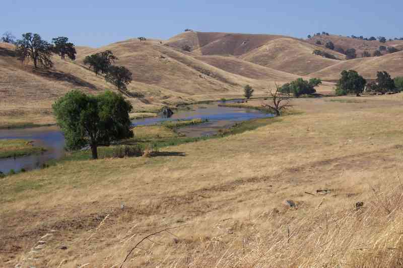
Chowchilla River River  The Chowchilla River below Buchanan Dam in Madera County, California.
Country United States State California Counties Merced, Madera, Mariposa Source Sierra Nevada Range - coordinates 37°20′40″N 119°50′16″W / 37.34444°N 119.83778°W [1] Mouth San Joaquin River - elevation 131 ft (40 m) [1] - coordinates 37°6′21″N 120°30′38″W / 37.10583°N 120.51056°W [1] Length 54.2 mi (87 km) [2] Basin 254 sq mi (658 km2) Discharge for below Buchanan Dam - average 99.8 cu ft/s (3 m3/s) - max 30,000 cu ft/s (850 m3/s) - min 0 cu ft/s (0 m3/s) 
 Location of the mouth of the Chowchilla River in California
The Chowchilla River is a river in central California and a minor tributary of the San Joaquin River. It flows for 54.2 miles (87.2 km) from the western side of the Sierra Nevada Range to the San Joaquin River system.[2] Most of the lower half of the river forms the border between Merced and Madera County.
Contents
Course
The river begins as three separate forks in southern Mariposa County.
West Fork
The West Fork (officially known as West Fork Chowchilla River) is formed by the confluence of Jones Creek and Snow Creek, north of the town of Bootjack, California. It flows roughly south from Bootjack, receiving Pegleg Creek, Humbug Creek, Italian Creek and Blade Creek before converging with the Middle Fork.
Middle Fork
The Middle Fork (officially known as Middle Fork Chowchilla River) is formed by the confluence of Magoon Creek and Fox Creek, on the east side of Magoon Hill in the Sierra Nevadas. It flows roughly south along the west side of Stumpfield Mountain, receiving a few unnamed tributaries, before converging with the West Fork.
East Fork
The East Fork (officially known as East Fork Chowchilla River) is the longest of the three forks and is formed by the confluence of several small, unnamed streams on the south side of Chowchilla Mountain, in the Sierra National Forest. It flows roughly south past the locality of Harris Ranch, receiving Oliver Creek and several other small, unnamed tributaries along the way. It converges with the West Fork south of Bailey Flats, and a few miles south of where the Middle and West Forks converge.
Main river
The Chowchilla River begins in name at the point where the West and East forks converge and flows southwest to Eastman Lake. The lake, which holds 150,000 acre feet (190,000,000 m3) of water from the Chowchilla, was created in 1975 by the construction of Buchanan Dam, an earth and rockfill structure which is 205 ft (62 m) high and 1800 ft (550 m) long. The lake and dam's primary purpose is flood control and irrigation. In the summer months, Eastman Lake is a popular boating, fishing, camping and hiking destination for residents of the Madera and Chowchilla areas.
Below Eastman Lake, the river continues roughly west, past the City of Chowchilla, to the San Joaquin River System.
Lower river
Seven miles downstream of Eastman Lake, the Chowchilla's water is diverted into both the Berenda and Ash sloughs, with excess water continuing down the main river channel. The river flows west-southwest for most of the rest of the journey before flowing west in the last few miles. The last two miles (3 km) of the river doubles as an irrigation canal for farms located along its banks.
The main river channel ends abruptly about three miles (5 km) east of the San Joaquin River. The river has never had a defined natural outlet to the San Joaquin, as evidenced by the fact that the riverbed shrinks considerably in size as it travels west. A natural outlet never existed because the river only has a seasonal flow, and natural water flow would normally dry up before it had a chance to reach the San Joaquin. In rare years of torrential rains, there would still be water in the river at the end of the riverbed, at which point the water would simply flood the area past the end of the riverbed. Those floodwaters would eventually find their way into the San Joaquin River.
As part of the Lower San Joaquin River Flood Control Project, a diversion canal was built to connect the end of the riverbed with the Eastside Bypass, allowing the Chowchilla's water a controlled outlet to the San Joaquin River during years of heavy rains.
The Chowchilla River serves at the outlet of the Madera Canal.
Tributaries
In addition to many small unnamed streams, the Chowchilla River receives the water from the following streams:
- Rock Creek
- Willow Creek
- Split Rock Creek
- Cow Creek
Towns
Towns along the Chowchilla River include:
- Harris Ranch (Unincorporated)
- Bootjack (Unincorporated)
- Raymond (Unincorporated)
- Chowchilla
Crossings
There are numerous crossings over the Chowchilla River in Madera and Merced Counties. Crossings are listed here beginning at the source and working downstream:
- Madera County above Eastman Lake
- Bailey Flats Road
- Green Mountain Road
- Madera County below Eastman Lake
- Eastman Lake Park Access Road
- Santa Fe Drive
- Santa Fe Railroad next to Santa Fe Drive crossing
- Road 19
- Road 15
- State Route 99
- Road 13
- Avenue 26
- Road 11
- Hemlock Road
- Road 8
- Avenue 25
- Road 5½
- Road 5
- Merced County
- South Orchard Way
- State Route 59
See also
References
- ^ a b c U.S. Geological Survey Geographic Names Information System: Chowchilla River
- ^ a b U.S. Geological Survey. National Hydrography Dataset high-resolution flowline data. The National Map, accessed March 11, 2011
External links
- Wildernet - Eastman Lake
- San Joaquin River White Paper
- The point where the Chowchilla River is directed to a diversion canal (Windows Live Local or Google Maps)
Sacramento River Valley Pit River • McCloud River • Mill Creek • Deer Creek • Battle Creek •Stony Creek •Butte Creek • Feather River • Yuba River • Bear River • American River • Cache Creek • Putah CreekSan Joaquin River Valley Mokelumne River • Cosumnes River • Calaveras River • Stanislaus River • Tuolumne River • Clavey River • Merced River • Mariposa Creek • Chowchilla River • Fresno RiverTulare Basin Central Valley Project Infrastructure Dams Auburn Dam · B.F. Sisk Dam · Folsom Dam · Friant Dam · Lewiston Dam · New Melones Dam · Nimbus Dam · O'Neill Dam · Red Bluff Diversion Dam · San Justo Dam · Shasta Dam · Sly Park Dam · Spring Creek Dam · Sugar Pine Dam · Trinity Dam · Whiskeytown Dam
Reservoirs Folsom Lake · Millerton Lake · Lake Natoma · New Melones Lake · O'Neill Forebay · San Luis Reservoir · Sugar Pine Reservoir · Shasta Lake · Trinity Lake · Whiskeytown Lake
Aqueducts and canals Clear Creek Tunnel · Contra Costa Canal · Corning Canal · Delta Cross Channel · Delta–Mendota Canal · Friant-Kern Canal · Madera Canal · San Luis Canal · Tehama-Colusa Canal
Rivers American River · Clear Creek · Chowchilla River · Kern River · Sacramento River · San Joaquin River · San Luis Creek · Stanislaus River
Categories:- Tributaries of the San Joaquin River
- Chowchilla, California
- Rivers of Mariposa County, California
- Rivers of Madera County, California
- Rivers of Merced County, California

Wikimedia Foundation. 2010.