- Tuolumne River
-
Tuolumne River River 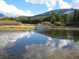 The Tuolumne River flows through Tuolumne Meadows in Yosemite National Park
Country United States State California Districts Stanislaus County, Tuolumne County, Mariposa County Tributaries - left Falls Creek (California), Middle Fork Tuolumne River, South Fork Tuolumne River - right Clavey River City Modesto, California Primary source Lyell Fork Tuolumne River [1] Secondary source Dana Fork Tuolumne River Source confluence Tuolumne Meadows - location Yosemite National Park - elevation 8,583 ft (2,616 m) [2] - coordinates 37°52′32″N 119°21′11″W / 37.875565°N 119.353194°W Mouth San Joaquin River - location Modesto - elevation 26 ft (8 m) Length 148.7 mi (239 km) Basin 1,960 sq mi (5,076 km2) Discharge for mouth; max and min above La Grange Diversion Dam - average 2,483 cu ft/s (70 m3/s) - max 130,000 cu ft/s (3,681 m3/s) - min 61 cu ft/s (2 m3/s) 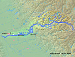 Map of the Tuolumne River watershed
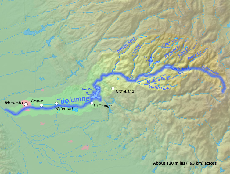
The Tuolumne River (
 /tuːˈɒləmiː/; Yokutsan: Tawalimnu)[3] is a California river that flows nearly 150 miles (240 km) from the central Sierra Nevada (U.S.) to the San Joaquin River in the Central Valley. The river flows from the Sierra Crest on the west Sierra slope, through the Sierra foothills of the Sierra Nevada, to Don Pedro Reservoir, through farmland in the Central Valley, to its mouth near Modesto.
Slightly larger than its counterpart in the south, the Merced River, the Tuolumne River's upper watershed was shaped by glaciations in the previous Ice Age, which produced Hetch Hetchy Valley and the Grand Canyon of the Tuolumne. The river has been a source of controversy for many years, especially from Hetch Hetchy Valley. Much of its water is now diverted to San Francisco from Hetch Hetchy Reservoir, which fills the valley in the Sierra Nevada once compared to famous Yosemite Valley. More water is diverted from La Grange Diversion Dam to irrigate farmland in the Central Valley, which leaves the lower course of the river with less than 60% of its historic flow. Despite these extensive water system developments, the Tuolumne is still a popular area in Yosemite National Park, although far less visited than the Merced River.
Contents
Course
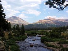 The Dana Fork of the Tuolumne River
The Tuolumne headwaters are along ~35 mi (56 km) of the Sierra Crest from the triple watershed point with the Stanislaus River southward over Mount Dana and the triple point for the Dana & Lyell Forks (37°49′05″N 119°13′02″W / 37.818056°N 119.217238°W) to the Upper San Joaquin triple point near Mount Lyell. The Tuolumne source is the confluence of the Dana Fork (from Mount Dana) and the Lyell Fork (from Mount Lyell) in the Tuolumne Meadows. After the subsequent confluence with Cold Canyon & Conness Creek, the Tuolumne flows through Glen Aulin (Gaelic: beautiful valley) where the valley walls pull away from each other and become steeper and the meandering riverbed is quite level and forms deep pools. Just northwest of Glen Aulin, the River presents spectacular waterfalls, including LeConte Falls and Waterwheel Falls, both known for the "waterwheel" phenomenon whereby descending water hits rocks below and wheels back upward.
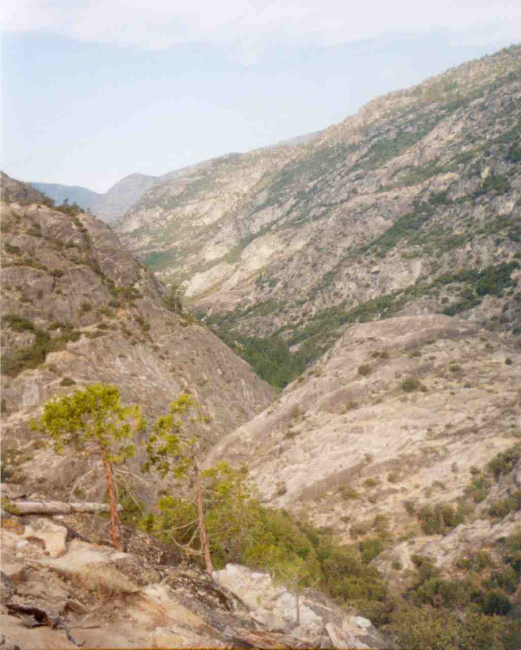
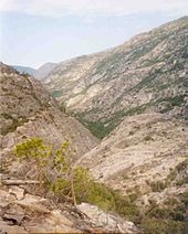 The Grand Canyon of the Tuolumne, looking west. Muir Gorge cuts diagonally across the middleground.
At this point, the Tuolumne enters the Grand Canyon of the Tuolumne. This canyon is a deep, roughly 'V'-shaped gorge. The walls are not as steep and bare as those of Yosemite Valley. The flora of the valley bottom is a haphazard melange of chaparral, manzanita scrub and oak woodland characteristic of the foothills and lowlands with a coniferous forest reminiscent of (but different from) that found above the canyon rim. This vegetation clings and clambers up every ledge of the valley walls to the top, giving it a lusher appearance than Yosemite Valley, though this area in fact experiences a drier climate. Class IV whitewater is in an 18-mile section from Meral's Pool to Ward's Ferry Bridge.[4]
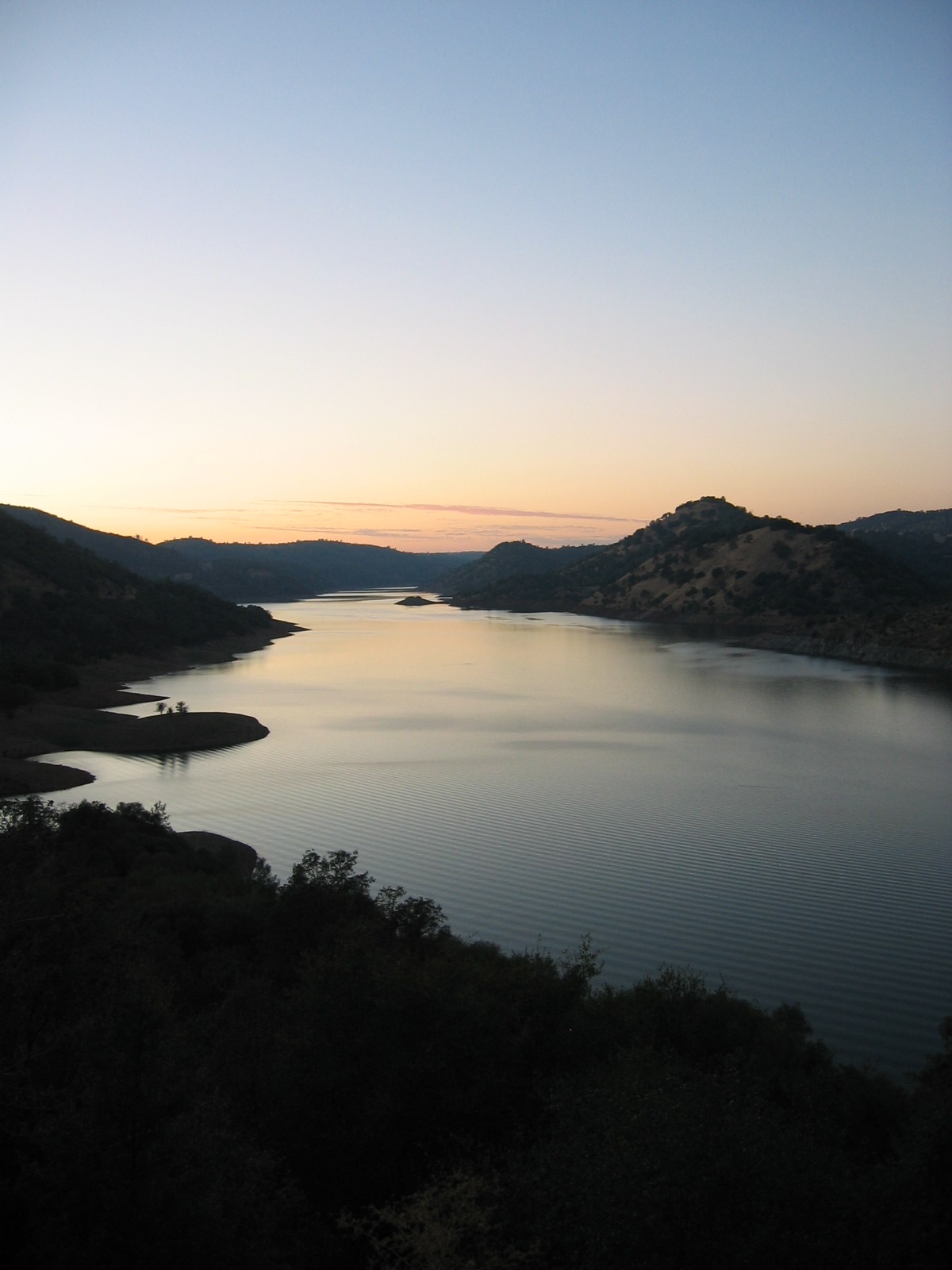
 Don Pedro Reservoir
Below the Grand Canyon lies Hetch Hetchy Valley. The river bottom flattens again, and the canyon walls pull away and become steeper, in a fashion similar to that of Yosemite Valley; this valley was once perhaps the most spectacular part of the Tuolumne's course. However, at the bottom of Hetch Hetchy Valley stands O'Shaughnessy Dam, which floods the entire valley under the Hetch Hetchy Reservoir. Before the river leaves the dam, Falls Creek, Tiltill Creek and Rancheria Creek enter from the right. Below the dam, the river flows through the Stanislaus National Forest, within which it is joined by Cherry Creek, the South Fork of the Tuolumne River, and the Middle Fork of the Tuolumne River. Far below the town of Groveland, the river is designated Wild and Scenic. This portion is popular for rafting and kayaking and is joined by the Clavey River. Still farther downstream lie Don Pedro Dam and Don Pedro Reservoir. These reservoirs provide electricity and divert water to serve farms in the Modesto Irrigation District and Turlock Irrigation District, and cities in the San Francisco Bay Area.
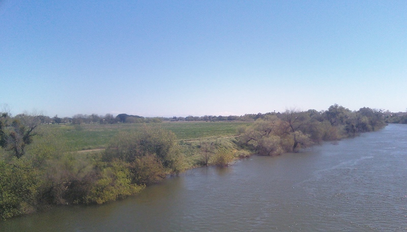
 The Tuolumne River in West Modesto.
Towns along the Tuolumne River:
Cities along the Tuolumne River:
The Modesto Airport lies next to the Tuolumne River. Between the airport and the river lies Veterans' Park.
History
The Native Americans along the Tuolumne were the Paiutes and Miwoks. The Miwoks lived along the western part of the Tuolumne from Big Oak Flat down to the valley floor, while the Paiutes camped primarily east of that point towards the high Sierra Nevada. The Washoe Indians also visited the area. The Tuolumne River Trust was founded in 1981.[5]
See also
References
- ^ "Tuolumne Meadows". Yosemite Region. SierraFlyFisher.com. http://www.sierraflyfisher.com/tours/yosemiteregion.htm. Retrieved 2010-08-24. "The Dana and Lyell Forks converge to form the main Tuolumne river"
- ^ "USGS Elevation Web Service Query". United States Geological Survey. http://gisdata.usgs.gov/xmlwebservices2/elevation_service.asmx?op=getElevation. Retrieved 2010-02-19.
- Dana/Lyell confluence: Query of "...-119.353194&Y_Value=37.875565..." returns 8583.48455954725 ft
- ^ The Indian tribes of North America. http://books.google.com/books?id=Xpx6WoPz7xIC&pg=PA505&lpg=PA505&dq=indian+tribes+along+the+stanislaus+river#v=snippet&q=tuolumne&f=false. Retrieved 3 April 2011.
- ^ "Tuolumne River Rafting & Kayaking". Guide to Rafting and Kayaking. CaliforniaWhiteWater.com. http://www.californiawhitewater.com/rivers/tuolumne/. Retrieved 2010-08-24.
- ^ Tuolumne.org "Vision and Goals". Tuolumne River Trust. http://www.tuolumne.org/ Tuolumne.org. Retrieved 2010-08-24.
- Informational Site about rafting on the Tuolumne River
- News and information about rafting the Tuolumne River
Sacramento River Valley Pit River • McCloud River • Mill Creek • Deer Creek • Battle Creek •Stony Creek •Butte Creek • Feather River • Yuba River • Bear River • American River • Cache Creek • Putah CreekSan Joaquin River Valley Mokelumne River • Cosumnes River • Calaveras River • Stanislaus River • Tuolumne River • Clavey River • Merced River • Mariposa Creek • Chowchilla River • Fresno RiverTulare Basin Categories:- Tributaries of the San Joaquin River
- Wild and Scenic Rivers of the United States
- Landforms of Yosemite National Park
- Hetch Hetchy Project
- Biosphere reserves of the United States
- Geography of Modesto, California
- Rivers of Mariposa County, California
- Rivers of Stanislaus County, California
- Rivers of Tuolumne County, California


Wikimedia Foundation. 2010.