- Don Pedro Reservoir
-
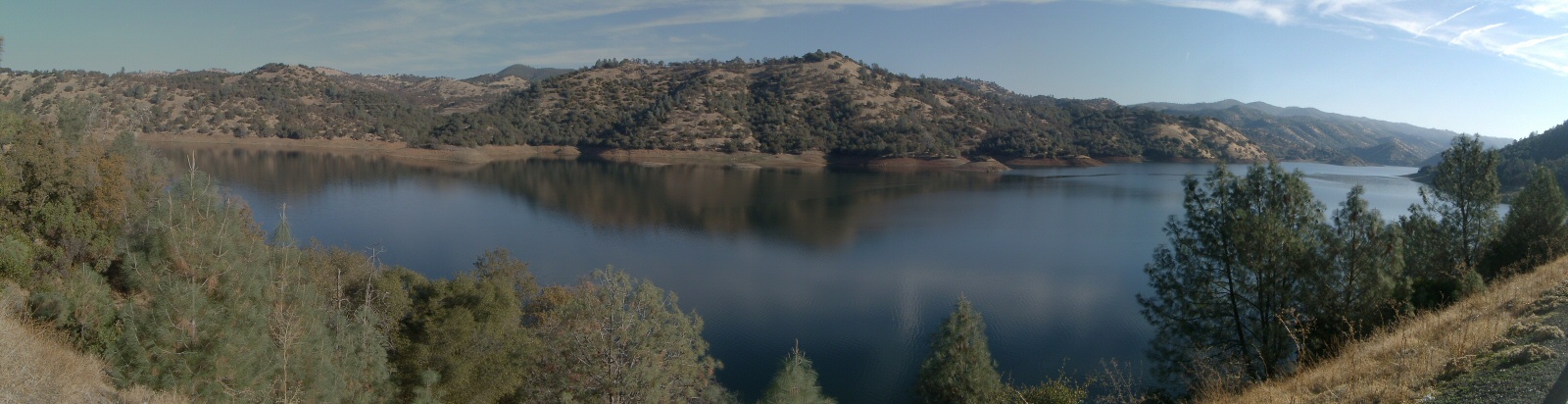
Don Pedro Reservoir 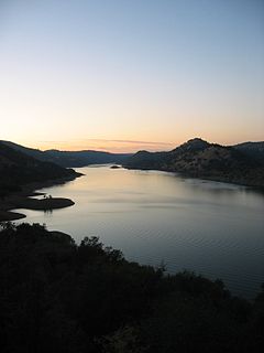
Location Stanislaus National Forest
Tuolumne County, CaliforniaCoordinates 37°44′29″N 120°22′25″W / 37.7415°N 120.3735°WCoordinates: 37°44′29″N 120°22′25″W / 37.7415°N 120.3735°W Lake type Reservoir Primary inflows Tuolumne River Primary outflows Tuolumne River Catchment area 1,500 sq mi (3,900 km2) Basin countries United States Surface area 13,000 acres (5,300 ha) Water volume 2,030,000 acre·ft (2.50 km3) Shore length1 160 mi (260 km) Surface elevation 245 m (804 ft) Islands Laughlin Ridge References U.S. Geological Survey Geographic Names Information System: 1 Shore length is not a well-defined measure. Don Pedro Reservoir is an artificial lake formed by the construction of the Don Pedro Dam across the Tuolumne River in the Stanislaus National Forest of Tuolumne County, California in the foothills of the Sierra Nevada. Communities located nearby are Moccasin and La Grange.
Also referenced as Don Pedro Lake when the name is qualified, the first projects in 1923 are generally referred to as the Old Don Pedro Dam and reservoir, and the 1971 upgrades are the New Don Pedro Dam and reservoir. Don Pedro Reservoir takes its name from Don Pedros Bar.[1] Pierre ("Don Pedro") Sainsevain was one of the first prospectors after the discovery of gold in 1848.
Contents
Background
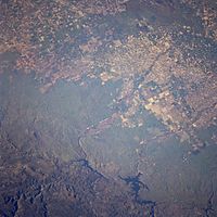 Overhead of Don Pedro Reservoir (bottom right) upstream of irrigated land in the Central Valley.
The reservoir's shoreline is approximately 160 mi (260 km), has submerged some 26 mi (42 km) of Tuolumne River bed, and has a surface area of about 13,000 acres (5,300 ha). The 2,030,000 acre·ft (2.50 km3) stored here comes from a watershed of over 1,500 sq mi (3,900 km2), and is used by the Modesto Irrigation District (MID) and the Turlock Irrigation District (TID) for the irrigation of several hundred square miles of productive Central Valley farm land. Some of the water is treated by the MID and used as drinking water in Modesto. The two irrigation districts and the BLM control the land 15 feet (4.6 m) above the high lake level, so there are no private boat docks on lakefront parcels. There are three public boat ramps.
The 5 largest artificial lakes in California are:
- 4.55,000,000 acre feet (68 km3) Lake Shasta
- 3.54,000,000 acre feet (67 km3) Lake Oroville
- 2.45,000,000 acre feet (56 km3) Trinity Lake
- 2.42,000,000 acre feet (52 km3) New Melones Lake
- 2.3,000,000 acre feet (3.7 km3) Lake Don Pedro
Hetch Hetchy project
While Lake Don Pedro is not part of the Hetch Hetchy Aqueduct, its tunnels cross under the upper end of the reservoir. Lake Don Pedro could easily be tied into that system in the future, and the efforts of the Restore Hetch Hetchy group to drain the reservoir in the Hetch Hetchy Valley depend largely on that possibility. The San Francisco Public Utilities Commission (SFPUC), of which Hetch Hetchy Water and Power is a division, provided about 45% of the funds for construction of the 1971 New Don Pedro Dam and so has the right to store 570,000 acre feet (700,000,000 m3) of water in the reservoir. Each year, San Francisco takes about 230,000 acre feet (280,000,000 m3). The rights of the MID and the TID are senior to those of SFPUC, however, so in dry years MID and TID can draw down the reservoir to meet their own needs before providing water to San Francisco's Hetch Hetchy Water and Power.

See also
- List of largest reservoirs of California
References
- ^ Who was Don Pedro? Don Pedro Recreation Agency
- Department of Water Resources (2009). "Station Meta Data: Don Pedro Reservoir (DNP)". California Data Exchange Center. State of California. http://cdec.water.ca.gov/cgi-progs/profile?s=DNP&type=res. Retrieved 2009-04-01.
- Barnes, Dwight H. (1987). "The First Don Pedro". The Greening of Paradise Valley: The First 100 Years of the Modesto Irrigation District. Modesto, CA: City of Modesto. OCLC 16224503. http://www.mid.org/about/100-years/chpt_12.htm. Retrieved 2009-04-09.
- Sukhwant Virk; Josh Hinkey (31 August 2007). "Don Pedro Dam:". UC Davis. http://cee.engr.ucdavis.edu/faculty/lund/dams/Don%20Pedro/donpedro.htm#Photographs. Retrieved 2009-04-09.
External links
Categories:- Lakes of Tuolumne County, California
- Reservoirs in California
- San Joaquin River
- Buildings and structures in Tuolumne County, California


Wikimedia Foundation. 2010.