- Mount Dana
-
Mount Dana 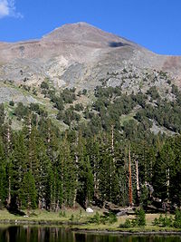
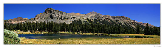
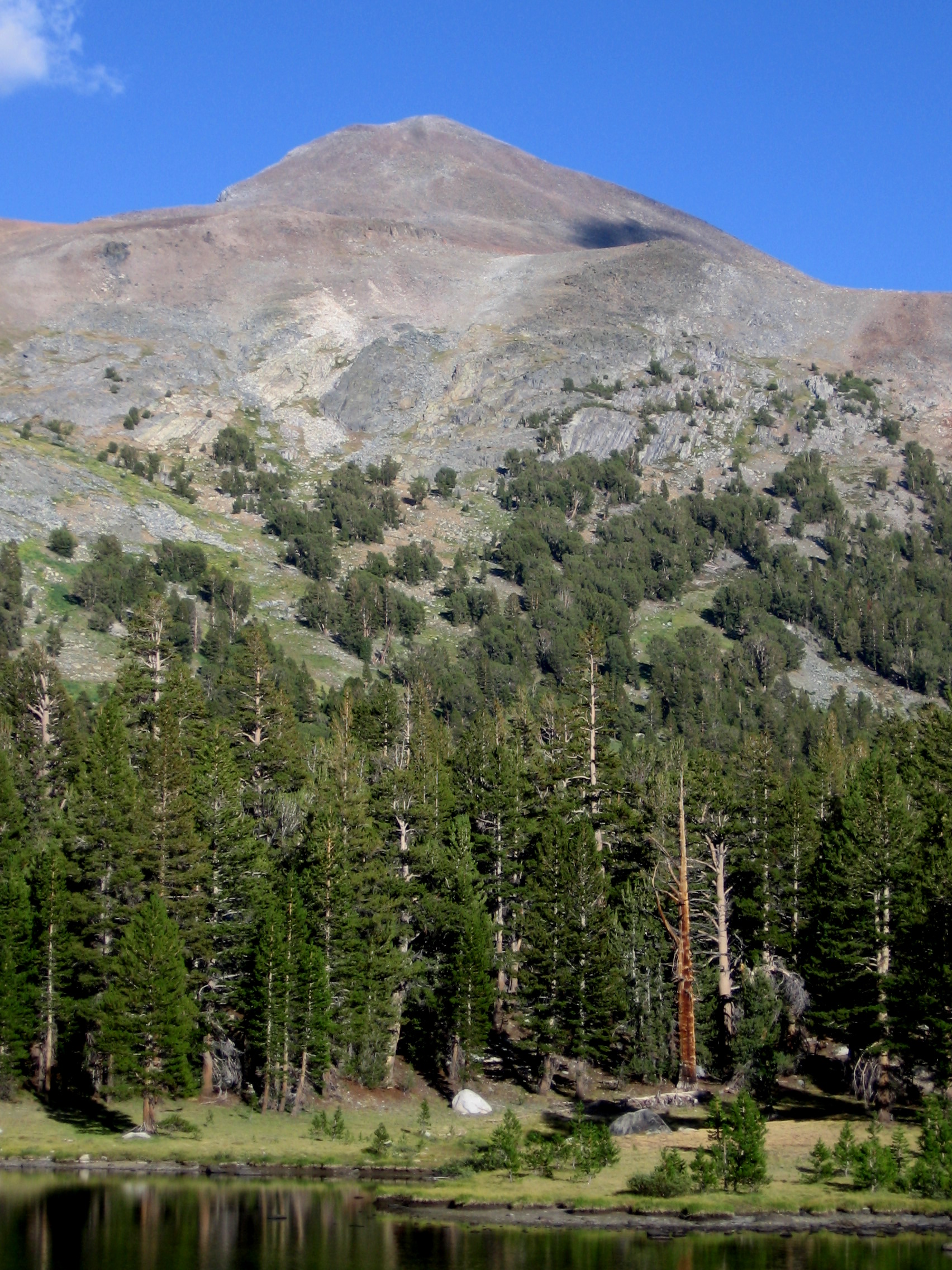
Mount Dana as seen from the west. The hike to the top goes up this face.Elevation 13,061 ft (3,981 m) NAVD 88[1] Prominence 2,417 ft (737 m) [2] Parent peak Mount Conness [3] Location Location Mono / Tuolumne counties, California, USA Range Sierra Nevada Coordinates 37°53′59.6″N 119°13′15.9″W / 37.899889°N 119.221083°WCoordinates: 37°53′59.6″N 119°13′15.9″W / 37.899889°N 119.221083°W[1] Topo map USGS Mount Dana Geology Type Metamorphic rock Age of rock Cretaceous Climbing First ascent 1863 by William H. Brewer, and Charles F. Hoffmann [4] Easiest route Hike Mount Dana is a mountain on the eastern edge of Yosemite National Park in the U.S. state of California. At an elevation of 13,061 feet (3,981 m), it is the second highest mountain in Yosemite (after Mount Lyell). Mount Dana is the highest peak in Yosemite that is a simple hike to the summit. Mount Dana is named after James Dwight Dana, who was a professor of geology at Yale College.[5]
Mount Dana is composed of prebatholithic rock that is mostly reddish metamorphic rock, which was composed by metavolcanics of surfacing magma from the Mesozoic Era.[6][7]
Mount Dana's northern face includes a small, receding glacier known as the Dana Glacier. The Dana Meadows lie at the foot of the mountain. From the top, lakes throughout Dana Meadows, Mono Lake, and many other mountains are in view.
Hike
From the Tioga Pass Road there are many easy routes. (class 1), available that lead to the summit along the mountain's western or southern slopes. These routes rise 3,108 feet (947 m) in elevation in 2.9 miles (4.7 km), (a 20.3% average grade). The trail is not frequently maintained.
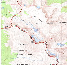 Mount Dana Topographic Map
There is a clearly marked path leading just above tree line. After topping a ridge, a set of use-paths and ducked routes are present, with the main path running along the easterly ridgeline. Additionally, numerous alternate trail segments begin and end at various points on the southwestern face, making parts of this hike a difficult class 2. The path segments turn into scree toward the summit, where a shallow stone-walled shelter and register are found. Significant snow fields on the mountain slopes can exist late into the summer season. Total round trip hiking time can be anywhere between 3 and 12 hours depending many factors, such as acclimatization to elevation.
After reaching a plateau above the tree line, almost all vegetation disappears with the exception of lichen and a few high alpine Sky Pilot (Polemonium eximium). Fauna are largely limited to spiders and insects, such as black/brown grasshoppers. The only mammals other than humans are marmots and American Pikas which are lagomorphs related to rabbits.
Thunderstorms are known to arise suddenly, making the rocks slippery, and the hiking dangerous year round.
Even experienced hikers can face altitude sickness, due to the high elevation.[8]

References
- ^ a b "Mount Dana". NGS data sheet. U.S. National Geodetic Survey. http://www.ngs.noaa.gov/cgi-bin/ds_mark.prl?PidBox=HR2738.
- ^ "Mount Dana, California". Peakbagger.com. http://www.peakbagger.com/peak.aspx?pid=2620. Retrieved 2009-08-05.
- ^ "California P2000 list page". Peaklist.org. http://www.PeakList.org/USlists/CAP2000.html. Retrieved 2008-09-21.
- ^ Roper, Steve (1976). The Climber's Guide to the High Sierra. Sierra Club Books. p. 332. ISBN 0-87156-147-6.
- ^ Farquhar, Francis P. (1926). Place Names of the High Sierra. San Francisco: Sierra Club. http://www.yosemite.ca.us/library/place_names_of_the_high_sierra/d.html. Retrieved 2009-06-08.
- ^ "America's Volcanic Past - Yosemite National Park". USGS/Cascades Volcano Observatory. September 20, 2002. http://vulcan.wr.usgs.gov/LivingWith/VolcanicPast/Places/volcanic_past_yosemite.html. Retrieved July 11, 2006.
- ^ "Biology 314 -- Sierra Nevada, pages 69-94". Sonoma State University. http://www.sonoma.edu/users/c/cannon/bio314chapter4_part2.html. Retrieved August 8, 2006.
- ^ Cymerman, A; Rock, PB. Medical Problems in High Mountain Environments. A Handbook for Medical Officers. USARIEM-TN94-2. US Army Research Inst. of Environmental Medicine Thermal and Mountain Medicine Division Technical Report. http://archive.rubicon-foundation.org/7976. Retrieved 2009-03-05.
External links
Categories:- Mountains of Yosemite National Park
- Mountains of Mono County, California
- Mountains of Tuolumne County, California
Wikimedia Foundation. 2010.