- Mount Conness
-
Mount Conness 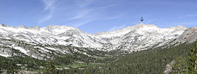
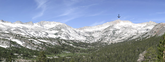
Mount Conness seen from Saddlebag Lake Road.Elevation 12,649 ft (3,855 m) NAVD 88[1] Prominence 2,630 ft (802 m) [2] Parent peak Mount Ritter [3] Listing SPS peak [4] Location Location Mono / Tuolumne counties, California, USA Range Sierra Nevada Coordinates 37°58′01″N 119°19′17″W / 37.967040447°N 119.321287011°WCoordinates: 37°58′01″N 119°19′17″W / 37.967040447°N 119.321287011°W[1] Topo map USGS Tioga Pass [2] Climbing First ascent Clarence King and James T. Gardiner, 1864 [5] Easiest route Scramble, class 2 [4] Mount Conness is a mountain in the Sierra Nevada range, to the west of the Hall Natural Area. Conness is on the boundary between the Inyo National Forest and Yosemite National Park. The Conness Glacier lies north of the summit.
Contents
History
Mount Conness is named for John Conness (1821–1909), a native of Ireland who came to United States in 1833.[6] Conness was a member of California legislature (1853–1854, 1860–1861) and the United States Senator from California (1863–1869). He resided in Massachusetts from 1869 until his death in 1909.[7]
In 1860 Josiah Dwight Whitney, Jr. was appointed State Geologist of California and he organized the California Geological Survey (1863–1870). Whitney, along with William H. Brewer, Clarence King, James T. Gardiner, Charles F. Hoffmann, Lorenzo G. Yates, Richard D. Cotter and others, made an extensive survey of California, including the Sierra Nevada and Yosemite region. Whitney wrote:
"Mount Conness bears the name of a distinguished citizen of California, now a United States Senator, who deserves more than any other person, the credit of carrying the bill, organizing the Geological Survey of California, through the Legislature, and who is chiefly to be credited for another great scientific work, the Survey of the 40th Parallel."[8]
Clarence King, a geologist for the Survey and the first to ascend Mount Conness along with James T. Gardiner in 1864, wrote:
"I recognized the old familiar summit... and that firm peak with titan strength and brow so square and solid, it seems altogether natural we should have named it for California’s statesman, John Conness."[9]
The members of the Whitney Survey were naturally appreciative of Senator Conness for helping their cause.
Climbing
Conness is a training ground for alpine climbing since it utilizes all aspects of mountaineering: trails, scrambling, and glacier trekking; all at a high altitude for California. Usually climbers camp near Tioga Pass and begin the climb at dawn. It takes about a full day to summit.
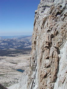
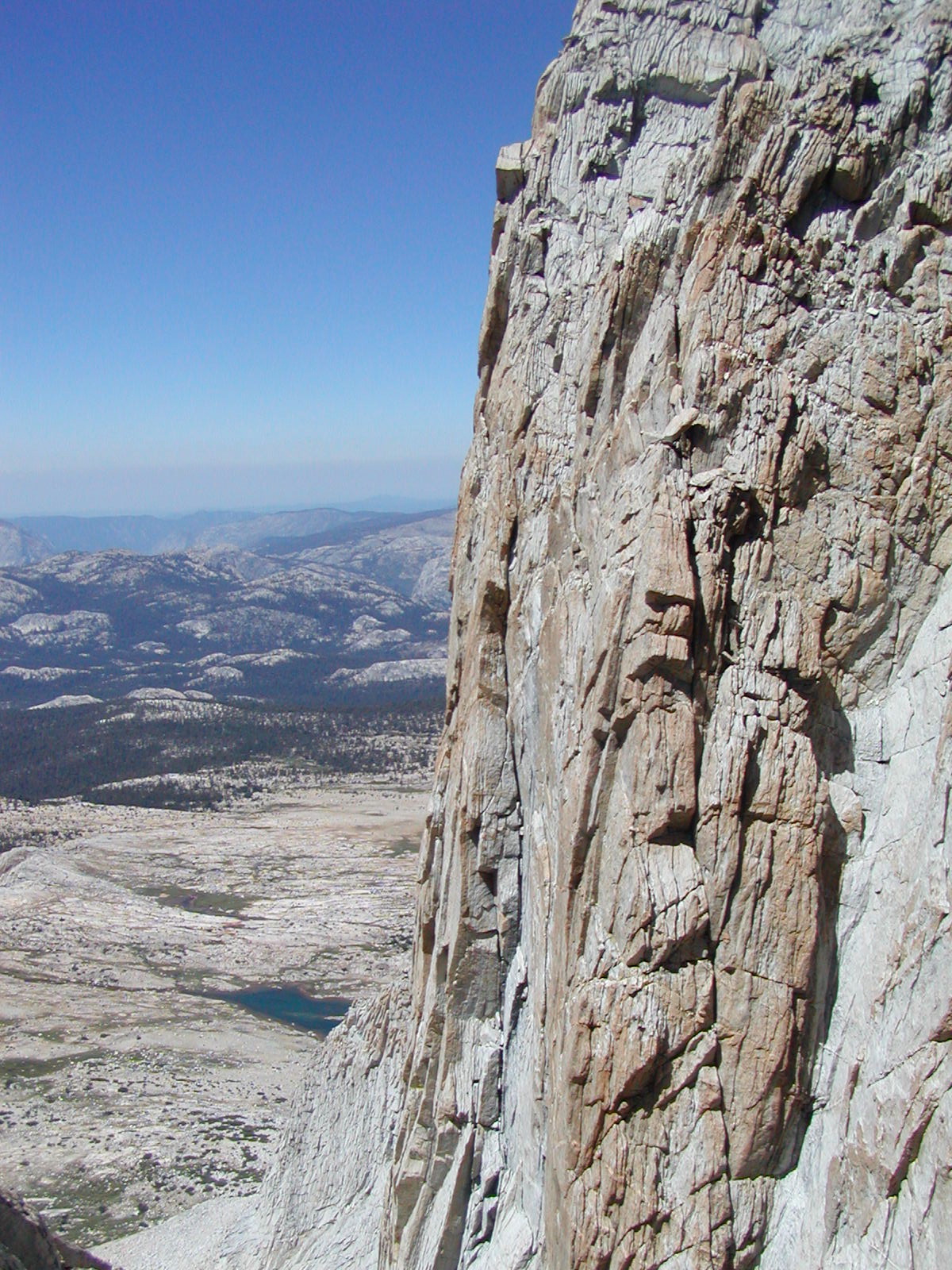
The summit block consists of class 2 scrambling along a knife edge ridge leading to the summit consisting of spectacular views to the east of the Conness Glacier and to the west toward Tuolumne Meadows.
References
- ^ a b "Mount Conness". NGS data sheet. U.S. National Geodetic Survey. http://www.ngs.noaa.gov/cgi-bin/ds_mark.prl?PidBox=HR2743. Retrieved 2009-02-23.
- ^ a b "Mount Conness, California". Peakbagger.com. http://www.peakbagger.com/peak.aspx?pid=2601. Retrieved 2009-02-23.
- ^ "California P2000 List Page". Peaklist.org. http://www.PeakList.org/USlists/CAP2000.html. Retrieved 2008-09-21.
- ^ a b "Sierra Peaks Section List". Angeles Chapter, Sierra Club. http://angeles.sierraclub.org/sps/spslist.pdf. Retrieved 2009-08-05.
- ^ Whitney, Josiah Dwight Jr. (1870). Yosemite Guide Book. http://www.yosemite.ca.us/library/the_yosemite_book/chapter_4.html#page_92. Retrieved 2009-01-04.
- ^ Farquhar, Francis P. (1926). Place Names of the High Sierra. San Francisco: Sierra Club. p. 15. http://www.yosemite.ca.us/library/place_names_of_the_high_sierra/c.html#page_15. Retrieved 2009-08-09.
- ^ "Conness, John". Biographical Directory of the United States Congress. http://bioguide.congress.gov/scripts/biodisplay.pl?index=c000695. Retrieved 2009-08-09.
- ^ Whitney, Josiah Dwight Jr. (1870). Yosemite Guide Book. http://www.yosemite.ca.us/library/the_yosemite_book/chapter_4.html#page_90. Retrieved 2009-01-04.
- ^ King, Clarence (1872). Mountaineering in the Sierra Nevada. p. 328. http://www.yosemite.ca.us/library/mountaineering_in_the_sierra_nevada/13.html#page_328. Retrieved 2009-01-04.
External links
- "Mount Conness". SummitPost.org. http://www.summitpost.org/page/150473.
- "Mount Conness". TheBackcountry.org. http://www.thebackcountry.org/trail/mount-conness-00.html.
- "Climbing Mt Conness (photo essay)". WebShots.com. http://outdoors.webshots.com/album/553742775TcpwPd.
- "Climb of Mount Conness - North Ridge". http://sepwww.stanford.edu/~morgan/adventures/yosemite/trips2002/conness_north_ridge.html.
- Farquhar, Francis P. (1926). Place Names of the High Sierra. San Francisco: Sierra Club. p. 15. http://www.yosemite.ca.us/library/place_names_of_the_high_sierra/c.html#page_15.
Categories:- Mountains of Yosemite National Park
- Mountains of Mono County, California
- Mountains of Tuolumne County, California
Wikimedia Foundation. 2010.