- Conness Glacier
-
Conness Glacier 
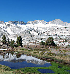
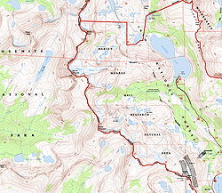
Type Mountain glacier Location Mount Conness, Mono County, California, USA Coordinates 37°58′05″N 119°19′09″W / 37.96806°N 119.31917°WCoordinates: 37°58′05″N 119°19′09″W / 37.96806°N 119.31917°W Terminus talus Status retreating The Conness Glacier is a glacier located on the steep northeast cirque on Mount Conness, east of the Sierra Nevada crest.[1] The glacier is situated at about 11,500 feet (3,500 m)[2] and can be seen from Saddlebag Lake to the east. The glacier is the largest glacier in the Sierra Nevada north of Tioga Pass or Highway 120. In 2004, a study found that since 1900, Conness Glacier had lost half its surface area.[3]
See also
References
- ^ "Conness Glacier, USGS TIOGA PASS (CA) Topo Map". USGS Quad maps. TopoQuest. http://www.topoquest.com/map.asp?lat=37.97013&lon=-119.31688&size=l&u=4&datum=nad27&layer=DRG. Retrieved 2008-07-05.
- ^ Google Earth elevation for GNIS coordinates.
- ^ Basagic, Hassan; Andrew G. Fountain. "Glaciers and Glacier Change in the Sierra Nevada, California" (pdf). U.S. Geological Survey. http://www.fs.fed.us/psw/mtnclim/talks/pdf/basagic_fountain_poster_mtnclim2006.pdf. Retrieved 2007-01-23.
Categories:- Glaciers of California
- Sierra Nevada (U.S.)
- Landforms of Mono County, California
- California geography stubs
Wikimedia Foundation. 2010.

