- Mokelumne Hill, California
-
Mokelumne Hill — census-designated place — Location in Calaveras County and the state of California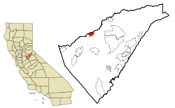
Coordinates: 38°18′02″N 120°42′23″W / 38.30056°N 120.70639°WCoordinates: 38°18′02″N 120°42′23″W / 38.30056°N 120.70639°W Country  United States
State  California
County Calaveras Area[1] – Total 3.082 sq mi (7.981 km2) – Land 3.079 sq mi (7.974 km2) – Water 0.003 sq mi (0.007 km2) 0.09% Elevation 1,470 ft (448 m) Population (2010) – Total 646 – Density 209.6/sq mi (80.9/km2) Time zone Pacific (PST) (UTC-8) – Summer (DST) PDT (UTC-7) ZIP code 95245 Area code(s) 209 FIPS code 06-48480 GNIS feature ID 0228901 Reference #: 269 Mokelumne Hill (also, Big Bar, Mok Hill, and The Hill) is a census-designated place (CDP) in Calaveras County, California, United States. The population was 646 at the 2010 census, down from 774 at the 2000 census. It is commonly referred to as "Moke Hill" by locals. The town takes its name from the neighboring Mokelumne River, which in turn is Miwok for the "people of Mokel," the likely name of an Indian village in the area.
Contents
History
Mokelumne Hill was one of the richest gold mining towns in California. Founded in 1848 by a group of Oregonians, the placers were so rich that the miners risked starvation rather than head to Stockton to replenish their supplies (one finally did and made it rich by becoming a merchant). Soon after, gold was discovered in the nearby hills, so much so that miners were restricted to claims of 16 square feet (1.5 m2), and yet many of those claims were reported to have paid up to $20,000.
By 1850 the town was one of the largest in the area, with its population reaching as high as 15,000 with people of all nationalities: Americans, Frenchmen, Germans, Spaniards, Chileans, Mexicans, Chinese, and others. Besides racial tensions, the easy gold attracted criminal elements, and the town gained a reputation as one of the bawdiest in the area. Notorious bandit Joaquin Murietta is said to have been a frequent visitor to the gambling venues. Violence was a major problem as well. In 1851, there was at least one homicide a week for seventeen consecutive weeks. A "vigiliance committee" was formed and by 1852, the worst of the crime was eliminated. That year, the town became the county seat. By the 1860s the gold started to run out and the town's population and importance diminished. When San Andreas became the new county seat in 1866, Mokelumne Hill's status declined even further. The town today is a quiet place, with lots of tourism due to its historic status. From 1959-1977 Mokelumne Hill was home to Lucile S. Davidson. She was known as "The shoe lady of Mokelumne Hill" She was in The Stockton 'Record' and later in the Guinness Book Of World Records for having the largest privately owned glass shoe collection in the world. The first post office was established in 1851.[2]
Mokelumne Hill is registered as California Historical Landmark #269.
Landmarks
- The I.O.O.F. Hall (CHL #256) is said to be California's first three-story building to be erected outside the coastal towns.
- The Congregational Church building (CHL #261) is the oldest such in the state.
- The Leger Hotel (CHL #663) is one of the oldest continuously-operating hotels in California. One of its buildings was the county courthouse when the town was the county seat.
- The original elementary school in Mokelumne Hill, which is still standing but has been converted to a private residence, was built in 1852 and was used until 1964. Unconfirmed legend has it that a bond issue to build the school failed, but citizens of the town built it anyway.
- The basement of the Leger Hotel was the first meeting place of E Clampus Vitus.
Geography
According to the United States Census Bureau, the CDP has a total area of 3.1 square miles (8.0 km²), over 99% of it land.
Demographics
2010
The 2010 United States Census[3] reported that Mokelumne Hill had a population of 646. The population density was 209.6 people per square mile (80.9/km²). The racial makeup of Mokelumne Hill was 571 (88.4%) White, 3 (0.5%) African American, 12 (1.9%) Native American, 4 (0.6%) Asian, 0 (0.0%) Pacific Islander, 26 (4.0%) from other races, and 30 (4.6%) from two or more races. Hispanic or Latino of any race were 66 persons (10.2%).
The Census reported that 646 people (100% of the population) lived in households, 0 (0%) lived in non-institutionalized group quarters, and 0 (0%) were institutionalized.
There were 299 households, out of which 63 (21.1%) had children under the age of 18 living in them, 129 (43.1%) were opposite-sex married couples living together, 31 (10.4%) had a female householder with no husband present, 14 (4.7%) had a male householder with no wife present. There were 24 (8.0%) unmarried opposite-sex partnerships, and 5 (1.7%) same-sex married couples or partnerships. 99 households (33.1%) were made up of individuals and 38 (12.7%) had someone living alone who was 65 years of age or older. The average household size was 2.16. There were 174 families (58.2% of all households); the average family size was 2.71.
The population was spread out with 102 people (15.8%) under the age of 18, 39 people (6.0%) aged 18 to 24, 119 people (18.4%) aged 25 to 44, 245 people (37.9%) aged 45 to 64, and 141 people (21.8%) who were 65 years of age or older. The median age was 51.4 years. For every 100 females there were 88.9 males. For every 100 females age 18 and over, there were 84.4 males.
There were 354 housing units at an average density of 114.9 per square mile (44.4/km²), of which 205 (68.6%) were owner-occupied, and 94 (31.4%) were occupied by renters. The homeowner vacancy rate was 2.8%; the rental vacancy rate was 18.3%. 447 people (69.2% of the population) lived in owner-occupied housing units and 199 people (30.8%) lived in rental housing units.
2000
As of the census[4] of 2000, there were 774 people, 340 households, and 227 families residing in the CDP. The population density was 252.5 people per square mile (97.3/km²). There were 362 housing units at an average density of 118.1 per square mile (45.5/km²). The racial makeup of the CDP was 94.96% White, 0.26% Black or African American, 1.55% Native American, 0.39% Asian, 0.13% from other races, and 2.71% from two or more races. 4.26% of the population were Hispanic or Latino of any race.
There were 340 households out of which 24.1% had children under the age of 18 living with them, 48.8% were married couples living together, 13.5% had a female householder with no husband present, and 33.2% were non-families. 27.1% of all households were made up of individuals and 11.2% had someone living alone who was 65 years of age or older. The average household size was 2.28 and the average family size was 2.71.
In the CDP the population was spread out with 21.7% under the age of 18, 5.7% from 18 to 24, 21.6% from 25 to 44, 30.5% from 45 to 64, and 20.5% who were 65 years of age or older. The median age was 46 years. For every 100 females there were 95.9 males. For every 100 females age 18 and over, there were 89.4 males.
The median income for a household in the CDP was $35,526, and the median income for a family was $37,237. Males had a median income of $36,382 versus $25,385 for females. The per capita income for the CDP was $17,281. About 3.7% of families and 7.7% of the population were below the poverty line, including 6.8% of those under age 18 and 3.9% of those age 65 or over.
Politics
In the state legislature Mokelumne Hill is located in the 1st Senate District, represented by Republican Dave Cox, and in the 25th Assembly District, represented by Republican Kristin Olsen. Federally, Mokelumne Hill is located in California's 3rd congressional district, which has a Cook PVI of R +7[5] and is represented by Republican Dan Lungren.
References
- ^ U.S. Census
- ^ Durham, David L. (1998). California's Geographic Names: A Gazetteer of Historic and Modern Names of the State. Quill Driver Books. p. 804. ISBN 9781884995149.
- ^ All data are derived from the United States Census Bureau reports from the 2010 United States Census, and are accessible on-line here. The data on unmarried partnerships and same-sex married couples are from the Census report DEC_10_SF1_PCT15. All other housing and population data are from Census report DEC_10_DP_DPDP1. Both reports are viewable online or downloadable in a zip file containing a comma-delimited data file. The area data, from which densities are calculated, are available on-line here. Percentage totals may not add to 100% due to rounding. The Census Bureau defines families as a household containing one or more people related to the householder by birth, opposite-sex marriage, or adoption. People living in group quarters are tabulated by the Census Bureau as neither owners nor renters. For further details, see the text files accompanying the data files containing the Census reports mentioned above.
- ^ "American FactFinder". United States Census Bureau. http://factfinder.census.gov. Retrieved 2008-01-31.
- ^ "Will Gerrymandered Districts Stem the Wave of Voter Unrest?". Campaign Legal Center Blog. http://www.clcblog.org/blog_item-85.html. Retrieved 2007-10-20.
External links
- Edith Irvine Collection includes photographs of Mokelumne Hill
Municipalities and communities of Calaveras County, California City 
CDPs Arnold | Avery | Copperopolis | Dorrington | Forest Meadows | Mokelumne Hill | Mountain Ranch | Murphys | Rail Road Flat | Rancho Calaveras | San Andreas | Vallecito | Valley Springs | Wallace | West Point
Unincorporated
communitiesAlabama Hill | Big Bar | Big Meadow | Big Trees | Big Trees Village | Big Valley | Blue Lake Junction | Blue Lake Springs | Bummerville | Burson | Calaveritas | Camp Connell | Camp Pardee | Campo Seco | Canyon View | Carmen City | Cave City | Cedar Vista | Copper Cove Subdivision | Copper Cove Village | Cottage Springs | Douds Landing | Douglas Flat | Ebbetts Pass Highlands | Felix | Fisher Place | Fly-In Acres | Fort Jones | Fourth Crossing | Fuchs | Ganns | Glencoe | Goodmans Corner | Grizzly Ridge | Hams | Hanford Hill | Happy Valley | Hathaway Pines | Hathaways Mountain Pines | Independence | Indian Creek | Indian Hills | Jenny Lind | Jesus Maria | La Honda Park | Lake Camanche Ranches | Lakemont Pines | Lakeside Terrace | Lilac Park | Lombardi | Lost City | Lynn Park Acres | Manuel Mill | McKay | Meadowmont | Milton | Mother Lode Acres | Mountain Ranch Subdivision | Mountain Retreat | Mumbert Acres | Oak Grove | Oak Park Estates | Paloma | Pinebrook | Ponderosa Park | Porter | Quail Oaks | Red Apple | Rich Gulch | Rocky Hill | Sandoz | Sandy Gulch | Scenic Valley Ranchos | Sheep Ranch | Sherman Acres | Skyhigh | Snowshoe Springs | South Camanche Shore | Sunset Point | Tamarack | Tamarack Springs | Telegraph City | The Shores of Poker Flat | Timber Trails | Toyanza Subdivision | Toyon | White Pines | Wilseyville | Wyldewood
Former
settlementsAltaville | Antelope House | Balaklava Hill | Blue Mountain | Brownsville | Buckeye Hill | Camanche | Camp Spirito | Carson Hill | Chichi | El Dorado Bar | Fremont Valley | Greasertown | Hodson | Independence Flat | Lower Calaveritas | Mammoth Cave | McLeans Bar | McLeans Ferry | Melones | Mill Valley | North American House | Norval | Oregon Bar | Pattees Ranch | Poverty Bar | Sandy Bar | Spanish Bar | Stony Bar | Stoutenburg | Taylors Bar | Tremont House | Yaqui Camp
Categories:- Census-designated places in Calaveras County, California
- California Historical Landmarks
- Former county seats in California


Wikimedia Foundation. 2010.