- Santa Paula Airport
Infobox Airport
name = Santa Paula Airport
nativename =
nativename-a =
nativename-r =

image-width =
caption =
IATA = SZP
ICAO = KSZP
FAA = SZP
type = Public
owner =
operator = Santa Paula Airport Association
city-served =
location = Santa Paula, California
elevation-f = 245
elevation-m = 74.7
coordinates = Coord|34|20|50|N|119|03|40|W|type:airport_region:US|display=inline,title
website =
metric-elev =
metric-rwy =
r1-number = 4/22
r1-length-f = 2,650
r1-length-m = 808
r1-surface =Asphalt
h1-number = H1
h1-length-f = 60
h1-length-m = 18
h1-surface = Asphalt
stat-year =
stat1-header =
stat1-data =
stat2-header =
stat2-data =
footnotes =Santa Paula Airport Airport codes|SZP|KSZP|SZP is a privately-owned public-use
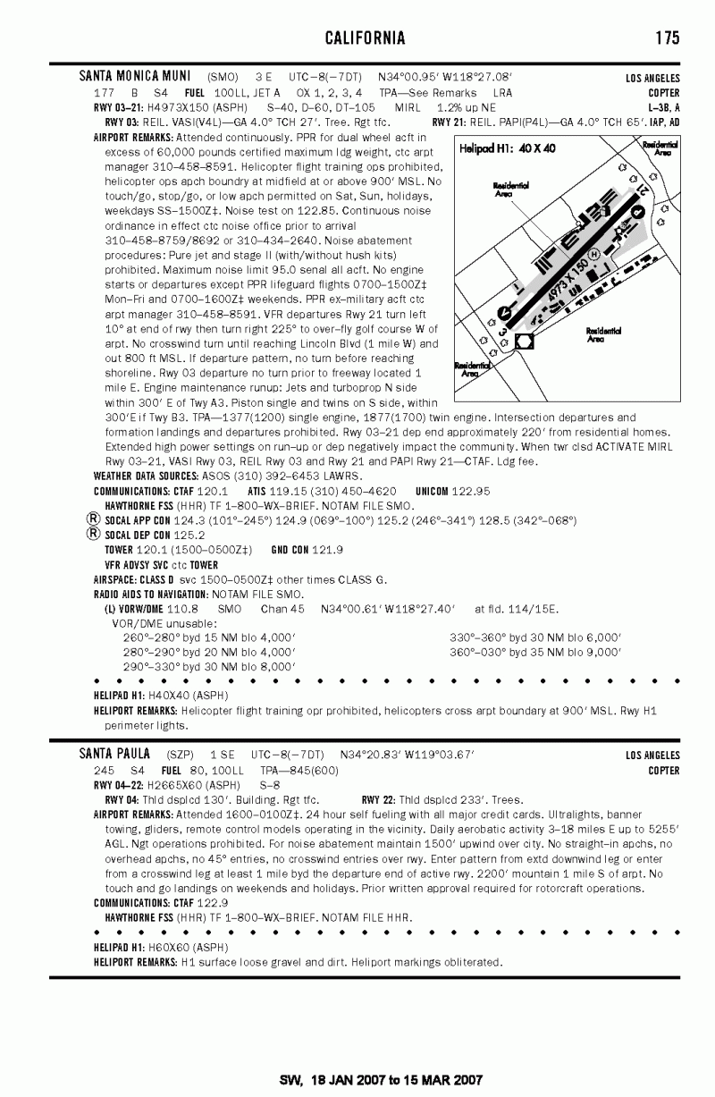
airport located one mile (2 km) southeast of thecentral business district (CBD) of Santa Paula, a city in Ventura County,California , USA. The airport has onerunway and onehelipad exclusively serving privately-operatedgeneral aviation aircraft with no scheduled commercial service.History
Santa Paula Airport was originally established in 1927 when a local rancher purchased an OX-5 and based it at the small dirt airstrip on his ranch. Not long after, a hangar was constructed, drawing more local aircraft owners to the airstrip. One year later the Santa Clara Valley flooded following the collapse of the St. Francis Dam, taking many lives and destroying acres of property along the Santa Clara River where the ranch was built. Recognizing an opportunity for an airport in the area, Ralph Dickenson and Dan Emmet obtained $1,000 from 19 local ranchers and purchased additional land adjacent to the river. In 1930, following two years of personal construction and development by these founders, the newly-named Santa Paula Airport opened to the public with a lavish celebration of
aerobatics , celebrity appearances, and aircraft. [ [http://www.santapaulaairport.org/history.html#photos History of the Airport’s Construction] ]Airport Today
Today Santa Paula Airport is a non-towered facility handling approximately 97,000 arrivals and/or departures a year, and is home to over 259 individual aircraft. As of February 2007, no
Fixed Base Operator s are currently headquartered at the airfield. [ [http://www.airnav.com/airport/kszp AirNav KSZP Airport Statistical Data] ]The airport today is smaller than local airports, primarily serving the local community and providing hangar space for pilots of nearby communities. Much of the original 1930’s-era facilities still exist and are used today, giving the airport a very authentic representation of the
Golden Age of Aviation . As a result of the airport’s history and theme, manyvintage aircraft owners have long sought hangar space at the airport’s limited facilities for use and display.2005 Flood Disaster
On February 21st and 22nd, 2005, Santa Paula Airport was heavily damaged when the rain swollen Santa Clara River ate into the airport property destroying airplane tiedowns, ramp and approximately convert|600|ft|m of part of the western one-third of the runway. The airport’s only flight school CP Aviation moved to nearby Oxnard Airport as a result of the damage. CP Aviation has now moved back to Santa Paula as of 6/1/2007. Repairs began in March 2005 following the recession of floodwaters, and as of February 2007, the airport is again fully-open to the public. [ [http://www.santapaulaairport.org/update.html Santa Clara River Feb 2005 Flood Disaster Story] ]
Facilities
Santa Paula Airport covers 38
acre s and has onerunway and onehelipad :
* Runway 4/22: 2,650 x 60 ft (808 x 18 m), Surface:Asphalt
* Helipad H1: 60 x 60 ft (18 x 18 m), Surface: Asphalt*The Logsdon Cafe is a large restaurant adjacent the runway on the airport property.
*The [http://www.amszp.org/ Aviation Museum of Santa Paula] is headquartered at the airport.References
External links
* [http://www.rain.org/~stapaula/spair.html Santa Paula Airport Information]
* [http://www.santapaulaairport.org/history.html#contact Santa Paula Airport History]
* [http://www.santapaulainn.com/ The Santa Paula Inn]
* [http://www.santapaulaairport.org/update.html February 2005 Flood Information]
* [http://www.santapaulaairport.org/vcsh2photos.html February 2005 Flood Photos]
*US-airport-ga|SZP
Wikimedia Foundation. 2010.
