- Lake Casitas
-
Lake Casitas 
Location Los Padres National Forest
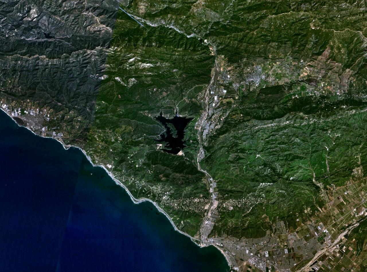
Ventura County, CaliforniaCoordinates 34°23′33″N 119°20′05″W / 34.3924°N 119.3346°WCoordinates: 34°23′33″N 119°20′05″W / 34.3924°N 119.3346°W Lake type Reservoir Primary inflows Coyote Creek Primary outflows Coyote Creek Catchment area 100 km2 (39 sq mi) Basin countries United States Max. length 5.3 km (3.3 mi) Max. width 3 km (1.9 mi) Surface area 1,100 acres (450 ha) Water volume 254,000 acre·ft (313,000,000 m3) Surface elevation 103 m (338 ft) Islands Main Island References U.S. Geological Survey Geographic Names Information System: Lake Casitas Lake Casitas is an artificial lake in the Los Padres National Forest of Ventura County, California, created by the construction of Casitas Dam on Coyote Creek, two miles (3 km) before it joins the Ventura River. Santa Ana Creek and North Fork Coyote Creek also flow into the lake. The dam was constructed of earth-fill and was completed in 1959. It is 279 ft (85 m) and was built by the United States Bureau of Reclamation. The lake has a capacity of 254,000 acre·ft (313,000,000 m3). The dam was built as part of the Ventura River Project. The project provides drinking water and water for irrigation. A secondary benefit is flood control. In the centre of Lake Casitas is 2 km Main Island, whose peak rises more than 500 feet (150 m) from the lake surface.
Human contact with the water is prohibited since it is used for drinking water, but fishing, boating and camping are permitted. During the 1984 Summer Olympics in Los Angeles, Lake Casitas hosted the canoeing and rowing events.[1] The lake was used as the site for filming the scenes of Camp Greenlake in the 19th century in the 2003 film Holes.
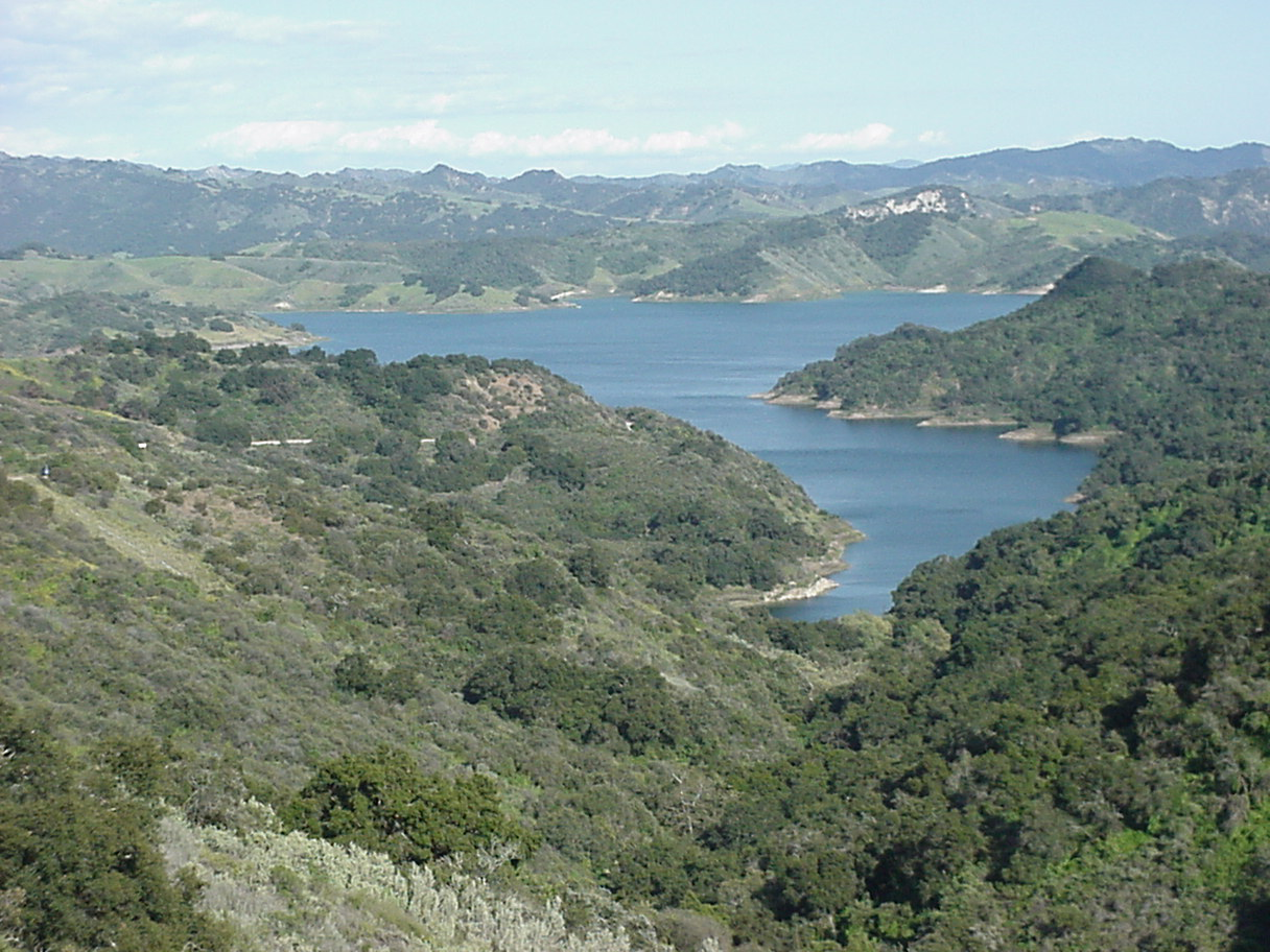
 Lake Casitas as seen looking eastward from California State Route 150.
See also
- List of largest reservoirs of California
References
- ^ 1984 Summer Olympics official report. Volume 1. Part 1. pp. 108-12.
- Bureau of Reclamation (2009). "Ventura River Project". U.S. Department of the Interior. http://www.usbr.gov/projects/Project.jsp?proj_Name=Ventura+River+Project. Retrieved 2009-09-29.
- Department of Water Resources (2009). "Station Meta Data: Lake Casitas (CSI)". California Data Exchange Center. State of California. http://cdec.water.ca.gov/cgi-progs/profile?s=CSI&type=dam. Retrieved 2009-10-11.
- U.S. Geological Survey (13 June 2000). "Feature Detail Report: Main Island". Geographic Names Information System (GNIS). U.S. Department of the Interior. http://geonames.usgs.gov/pls/gnispublic/f?p=gnispq:3:::NO::P3_FID:1870560. Retrieved 2009-10-12.
External links
- U.S. Geological Survey Geographic Names Information System: Lake Casitas
- Lake Casitas Recreation Area
Venues of the 1984 Summer Olympics Los Angeles Albert Gersten Pavilion · Eagle's Nest Arena · Los Angeles Memorial Coliseum · Los Angeles Memorial Sports Arena · Olympic Swim Stadium · Pauley Pavilion · Streets of Los AngelesSouthern California Anaheim Convention Center · Artesia Freeway · Coto de Caza · El Dorado Park · Fairbanks Ranch Country Club · Heritage Park Aquatic Center · Lake Casitas · Long Beach Arena · Long Beach Convention Center · Long Beach Shoreline Marina · Olympic Velodrome · Prado Regional Park · Raleigh Runnels Memorial Pool · Rose Bowl · Santa Anita Park · Santa Monica College · Streets of Mission Viejo · Streets of Santa Monica · The Forum · Titan Gymnasium · Weingart StadiumOther venues Harvard Stadium (Boston, Massachusetts) · Navy – Marine Corps Memorial Stadium (Annapolis, Maryland) · Stanford Stadium (Palo Alto, California)1936: Grünau Regatta Course • 1948: Henley Royal Regatta • 1952: Taivallahti • 1956: Lake Wendouree • 1960: Lake Albano • 1964: Lake Sagami • 1968: Virgilio Uribe Rowing and Canoeing Course • 1972: Eiskanal, Regattastrecke Oberschleißheim • 1976: Île Notre-Dame • 1980: Krylatskoye Sports Complex Canoeing and Rowing Basin • 1984: Lake Casitas • 1988: Han River Regatta Course/Canoeing Site • 1992: Canal Olímpic de Catalunya, Parc Olímpic del Segre • 1996: Lake Lanier, Ocoee Whitewater Center • 2000: Penrith Whitewater Stadium, Sydney International Regatta Centre • 2004: Olympic Canoe/Kayak Slalom Centre, Schinias Olympic Rowing and Canoeing Centre • 2008: Shunyi Olympic Rowing-Canoeing Park • 2012: Dorney Lake, Lee Valley White Water Centre • 2016: Lagoa Rodrigo de Freitas, Olympic Whitewater Stadium 1900: Seine • 1904: Creve Coeur Lake • 1908: Henley Royal Regatta • 1912: Djurgårdsbrunnsviken • 1920: Brussels–Scheldt Maritime Canal • 1924: Bassin d'Argentuil • 1928: Sloten • 1932: Long Beach Marine Stadium • 1936: Grünau Regatta Course • 1948: Henley Royal Regatta • 1952: Meilahti • 1956: Lake Wendouree • 1960: Lake Albano • 1964: Toda Rowing Course • 1968: Virgilio Uribe Rowing and Canoeing Course • 1972: Oberschleißheim Regatta Course • 1976: Île Notre-Dame • 1980: Krylatskoye Sports Complex Canoeing and Rowing Basin • 1984: Lake Casitas • 1988: Han River Regatta Course/Canoeing Site • 1992: Lake of Banyoles • 1996: Lake Lanier • 2000: Sydney International Regatta Centre • 2004: Schinias Olympic Rowing and Canoeing Centre • 2008: Shunyi Olympic Rowing-Canoeing Park • 2012: Dorney Lake • 2016: Lagoa Rodrigo de Freitas
 Categories:
- Landforms of Ventura County, California
- Rowing venues
- Reservoirs in California
- 1984 Summer Olympic venues
- Olympic canoeing venues
- Olympic rowing venues
- Buildings and structures in Ventura County, California


Wikimedia Foundation. 2010.