- Coastal California
-
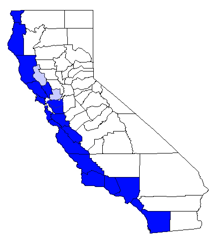
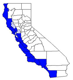 Counties commonly seen as constituting coastal California.
Coastal California refers to the coastal regions of the US state of California. The term is not primarily geographical as it also describes an area distinguished by sociological, economical and political attributes. The coastal regions of California tend to be more politically liberal, affluent and expensive than other regions of the state.[citation needed]
Contents
Geography
The area includes the North Coast, San Francisco Bay Area (including Silicon Valley), Central Coast, and South Coast. During the 2000 Census, roughly a third of households in coastal California had incomes exceeding $75,000, compared to 17.6% in the Central Valley[1] and 22.5% at the national average.[2]
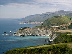
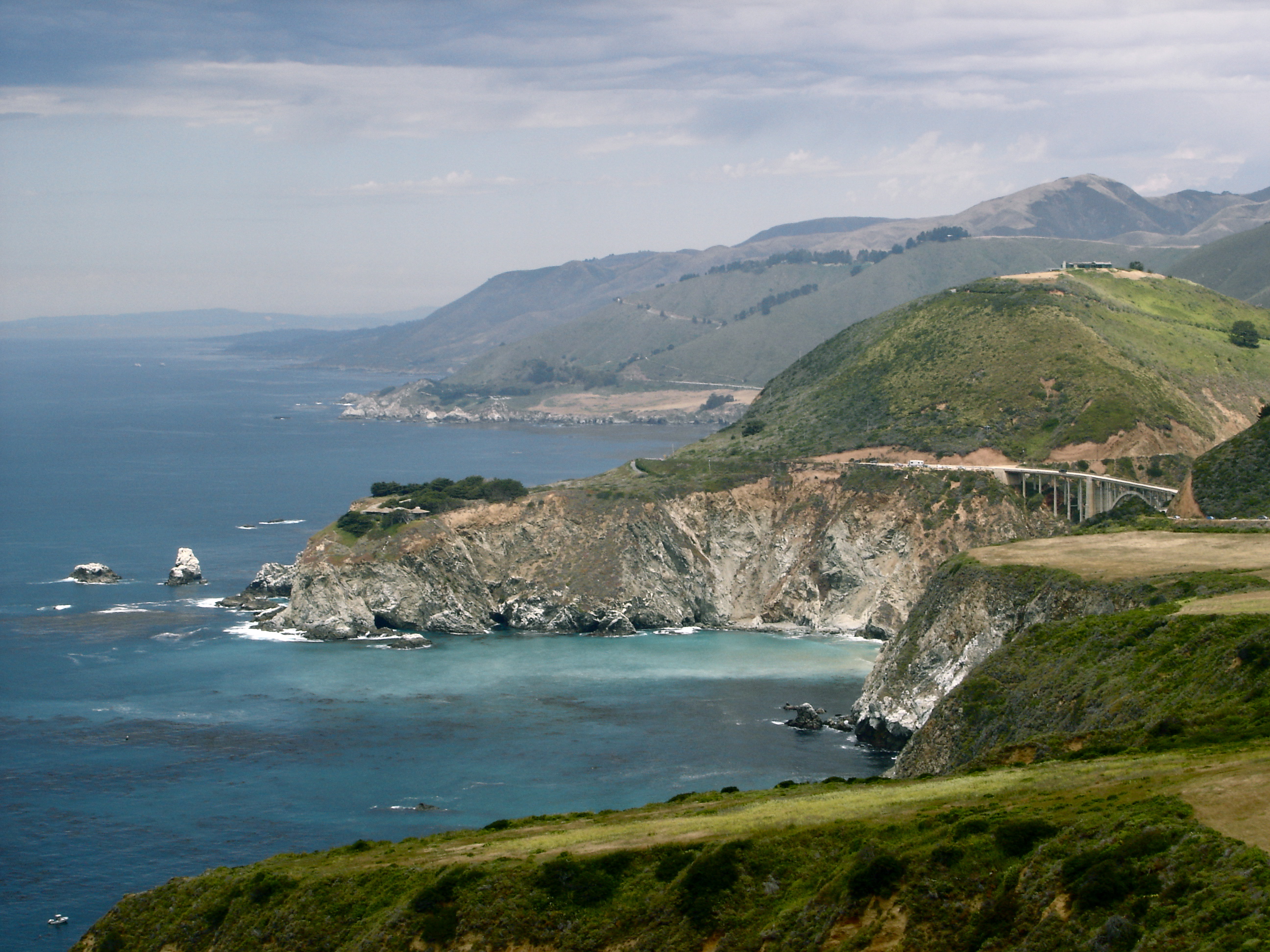
The region is renowned for being home to artisan communities such as Laguna Beach and Carmel as well as its natural beauty as found in the Redwood Forests of the North Coast. While the area has always been relatively expensive, when compared to inland regions and the national average, the recent real estate boom has left it as the most expensive housing market in the nation. An October 2004 CNN Money publication found that a 2,200-square-foot (200 m2) home in a "middle management neighborhood" would cost an average of $1.8 million.[3]
Government
Nearly all congressional districts in the region are left-leaning with a mean Cook Partisan Voting Index of D +13.3, meaning that a Democratic presidential candidate will, on average, be 13.3 percentage points ahead of his Republican opponent. The Cook Partisan Index in coastal California ranges from D +9 in California's 23rd congressional district, which includes coastal San Luis Obispo county to D +20 in the 30th district, which includes Malibu, West Los Angeles and Beverly Hills, to D +36 in Nancy Pelosi's 8th district, which includes most of San Francisco.
Of the counties of coastal California, only Del Norte County, San Luis Obispo County, Ventura County, Orange County, and San Diego County voted for incumbent Republican president George W. Bush in 2004. San Francisco County, the most Democratic county, voted 83% for Kerry. In 2008, only Del Norte and Orange Counties voted for John McCain with margins of less than 5% while San Francisco remained the most Democratic county, voting 84% for Barack Obama.[4]
Demographics by congressional district
District Location Cook Partisan Index % for McCain, 2008 Median Household Income[5] Per Capita Income[5] 1st district Del Norte, Humboldt, Mendocino, Napa, Yolo Counties and a portion of Sonoma County D +13 31.69% $38,918 $20,615 6th district Marin and Sonoma County D +23 22% $59,115 $33,036 9th district Oakland, Berkeley and the Oakland hills D +37 9.87% $52,322 $34,552 8th district City of San Francisco D +35 12.38% $44,314 $25,201 12th district San Francisco Peninsula including most of San Mateo County D +23 23.9% $70,307 $34,448 13th district Silicon Valley and East Bay, including Fremont, Union city and Hayward D +22 23.8% $62,415 $26,076 14th district Silicon Valley, including Redwood City, Mountain View, Sunnyvale, Palo Alto and most of Santa Cruz County D +21 24.9% $77,985 $43,063 15th district City of San Jose (western areas) D +15 29.7% $74,947 $32,617 16th district San Jose, Morgan Hill D +16 28.8% $67,689 $25,064 17th district Central Coast encompassing Monterey, Santa Cruz and San Benito County D +19 25.8% $49,234 $21,244 23rd district Coastal regions of San Luis Obispo, Santa Barbara and Ventura County D +12 32.3% $44,874 $20,747 24th district Inland regions of Santa Barbara and Ventura counties as well some coastline near Thousand Oaks R +4 46.3% $61,453 $26,998 30th district Western Los Angeles County, including Malibu, Santa Monica, Beverly Hills, West Hollywood and Hollywood D +18 27.9% $60,713 $47,498 33rd district Western Los Angeles County, including Culver City D +35 11.7% $31,655 $19,250 34th district Los Angeles D +22 23.1% $29,863 $11,816 35th district Los Angeles D +31 14.1% $32,156 $14,041 36th district Beach cities, Torrance as well as parts of Los Angeles D +12 33.5% $51,633 $28,962 37th district Long Beach, parts of Los Angeles and Compton D +26 18.7% $34,006 $14,286 38th district Eastern Los Angeles county and western San Gabriel Valley including Norwalk, Pomona, Santa Fe Springs, La Puente, the City of Industry, Montebello, and Pico Rivera, plus the unincorporated communities of Avocado Heights, Hacienda Heights, West Puente Valley D +18 26.6% $42,488 $14,021 39th district South-eastern Los Angeles County D +12 32.4% $45,307 $15,250 40th district Northern Orange County, including Buena Park and Orange R +8 51.1% $54,356 $22,434 44th district Orange County, including San Clemente and Riverside County, including the city of Riverside R +6 48.6% $51,578 $21,335 46th district Northern Orange County, including Costa Mesa, Fountain Valley, Huntington Beach, Los Alamitos, Seal Beach, and Westminster as well as parts of Long Beach and Los Angeles further north R +6 49.8% $61,567 $30,942 47th district Orange County, including Santa Ana, Garden Grove and Anaheim D +4 37.8% $41,618 $12,541 48th district Southern Orange County, including Aliso Viejo, Dana Point, Irvine, Laguna Beach, and parts of Newport Beach, San Juan Capistrano R +6 48.6% $69,663 $37,242 49th district Northern San Diego and South-western Riverside County R +10 53% $46,445 $19,659 50th district Northern San Diego County, including coastal communities such as Carlsbad but excluding La Jolla R +3 47.1% $59,813 $29,877 53rd district City of San Diego including La Jolla, Coronado and Imperial Beach D +14 29.9% $36,637 $21,715 Regional averages San Francisco Bay Area Districts: 6, 8, 9, 12, 13, 14, 15, 16 D +24 24.4% $63,637 $31,757 Central Coast Districts: 17 & 23rd D +15.5 29.1% $47,054 $20,995 Southern California Districts: 24, 30, 33rd, 34, 35, 36, 37, 38, 39, 40, 44, 46, 47, 48, 49, 50, 53rd D +9.12 35.31% $47,703 $24,289 Overall averages National Average EVEN
(by definition)45.7% $41,994 $21,587 Means for all districts Coastal California D +15.4 30.13% $51,895 $31,757

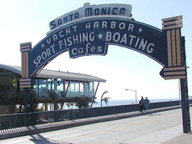
The Coastal Region of California has many Beaches including Malibu, Newport, Venice, Santa Monica, and many others. These beaches have about 2,000 people almost each day.See also
- California North Coast
- San Francisco Bay Area
- Central Coast of California
- South Coast (California)
- Greater Los Angeles Area
- Left Coast
- California State Route 1
- California Congressional Districts
References
- ^ "Stanford University, income in California". http://ccsre.stanford.edu/reports/report_13.pdf. Retrieved 2007-05-28.
- ^ "US Census Bureau, US household income". http://pubdb3.census.gov/macro/032000/hhinc/new04_001.htm. Retrieved 2007-05-28.
- ^ "CNN Money, housing markets". http://money.cnn.com/popups/2006/real_estate/best_worst/5.html. Retrieved 2007-05-28.
- ^ "Supplement to the Statement of Vote: Statewide Summary by County for United States President" (PDF). California Secretary of State. 2009-04-10. http://www.sos.ca.gov/elections/sov/2008_general/ssov/4-pres-statewide-summary-by-county.pdf. Retrieved 2009-08-21.
- ^ a b "US Census Bureau, 2000 Census income data by congressional district". http://factfinder.census.gov/servlet/DTTable?_bm=y&-context=dt&-ds_name=DEC_2000_110S&-mt_name=DEC_2000_110S_P052&-mt_name=DEC_2000_110S_P053&-mt_name=DEC_2000_110S_P082&-mt_name=DEC_2000_110S_P148A&-mt_name=DEC_2000_110S_H085&-CONTEXT=dt&-tree_id=609&-geo_id=500$50000US0601&-geo_id=500$50000US0606&-geo_id=500$50000US0608&-geo_id=500$50000US0609&-geo_id=500$50000US0612&-geo_id=500$50000US0613&-geo_id=500$50000US0614&-geo_id=500$50000US0615&-geo_id=500$50000US0616&-geo_id=500$50000US0617&-geo_id=500$50000US0623&-geo_id=500$50000US0624&-geo_id=500$50000US0630&-geo_id=500$50000US0633&-geo_id=500$50000US0634&-geo_id=500$50000US0635&-geo_id=500$50000US0636&-geo_id=500$50000US0637&-geo_id=500$50000US0638&-geo_id=500$50000US0639&-geo_id=500$50000US0640&-geo_id=500$50000US0644&-geo_id=500$50000US0646&-geo_id=500$50000US0647&-geo_id=500$50000US0648&-geo_id=500$50000US0649&-geo_id=500$50000US0650&-geo_id=500$50000US0653&-format=&-_lang=en. Retrieved 2007-05-31.
Categories:- Regions of California
Wikimedia Foundation. 2010.