- Oak Island Light
-
Oak Island Light 
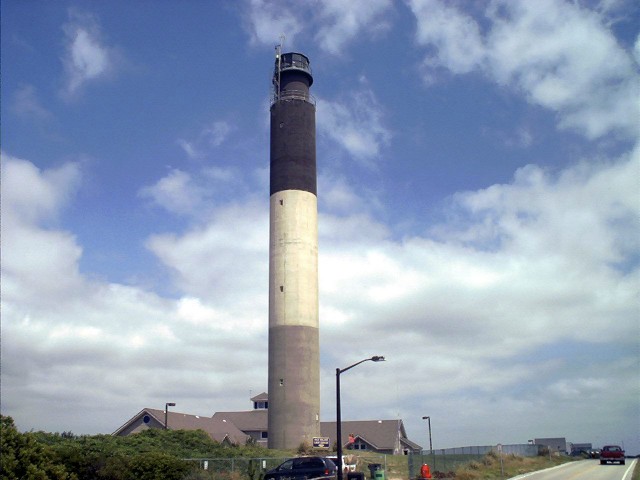
Oak Island Light Location Oak Island, Cape Fear River, North Carolina Year first constructed 1958 Year first lit 1958 Construction Portland concrete Tower shape Round Markings / pattern Bottom third of tower grey, second third white, third one black. Height 169 feet Current lens DCB-436 Aerobeacon Range 20 miles Characteristic Four flashes every 6 seconds. Admiralty number J2470 ARLHS number USA-558 USCG number 2-0810 The Oak Island Lighthouse is currently part of the United States Coast Guard station on Oak Island in North Carolina.
History
Being completed in 1958, the Oak Island Lighthouse is one of the newest lighthouses in the United States. It is made from concrete and stands 169 feet (51.5 m) tall. It replaced the Cape Fear Lighthouse, a steel skeleton lighthouse near Cape Fear on Bald Head Island. (That lighthouse was demolished afterwards to avoid confusion.) The lighthouse marks the mouth of the Cape Fear River with the second most powerful beacon in the world, only surpassed by a French lighthouse along the English Channel. It can be seen for 19 miles, which is needed to help ships avoid the dangerous Frying Pan Shoals.
The characteristic flashing pattern for the light is four one-second flashes every 10 seconds The heat given off by the light is so intense that workers must wear protective clothing in order to do repairs. Even then, they are only able to work on it for a short time. It has become the symbol for Oak Island and can be seen on many of the souvenirs sold there.
The top third of the lighthouse is black; the middle third is white, while the bottom third is grey. These colors are not painted on the structure, having instead been mixed into the concrete at the time the tower was constructed.[1]
Recently
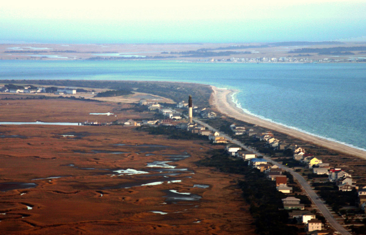
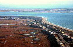 Oak Island Lighthouse from the air
The Oak Island Lighthouse was recently designated as surplus by the Coast Guard (though it intends to continue operating the beacon). The town of Caswell Beach was recently given ownership of the lighthouse and adjacent oceanfront property by the Federal Government in return for its agreement to maintain the property for parks and recreation purposes. The lighthouse is open Wednesdays and Saturdays 10 A.M. - 2 P.M. for limited tour. Tours to the top must be scheduled in advance.
References
- ^ Rowlett, Russ. "Lighthouses of the United States: North Carolina". The Lighthouse Directory. University of North Carolina at Chapel Hill. http://www.unc.edu/~rowlett/lighthouse/nc.htm.
- "Historic Light Station Information and Photography: North Carolina". United States Coast Guard Historian's Office. http://www.uscg.mil/history/weblighthouses/LHNC.asp. Retrieved 2009-08-12.
Lighthouses of North Carolina Active: Bodie Island Light • Cape Hatteras Light • Cape Lookout Light • Currituck Beach Light • Oak Island Light • Ocracoke Light
Deactivated/Dismantled: Bald Head Light • Cape Fear Light • Diamond Shoal Light • Federal Point Light • Frying Pan Shoals Light • Hatteras Beacon • Price Creek Light • Roanoke Marshes Light • Roanoke River Light • Wade Point Light
Coordinates: 33°53′34″N 78°02′06″W / 33.892900°N 78.035100°W
Categories:- Buildings and structures in Brunswick County, North Carolina
- Lighthouses in North Carolina
- Visitor attractions in Brunswick County, North Carolina
- Transportation in Brunswick County, North Carolina
- North Carolina building and structure stubs
- United States lighthouse stubs

Wikimedia Foundation. 2010.