- North Carolina Highway 24
-
NC 24
Route information Maintained by NCDOT Length: 278 mi[2] (447 km) Existed: 1922[1] – present Major junctions West end:  I-485 in Charlotte
 I-77 in Charlotte


 I-73 / I-74 / US 220 in Biscoe
 I-95 near Fayetteville
 I-40 in Warsaw
 US 17 in Jacksonville
East end:  US 70 in Morehead City
Location Counties: Mecklenburg, Cabarrus, Stanly, Montgomery, Moore, Harnett, Cumberland, Sampson, Duplin, Onslow, Carteret Highway system ←  US 23
US 23US 25  →
→North Carolina Highway 24 is a North Carolina state highway. It is one of the longest in the state, running 278 miles (447 km) from Charlotte to Morehead City. About 100 miles (160 km) of NC 24 is cosigned with North Carolina Highway 27.
Contents
Route description
NC 24 is both one of the longest and most concurrent routes in the state. Besides the approximately 100-mile (160 km) concurrency with NC 27 between Johnsonville and Charlotte, this route also shares long stretches of pavement with:
- US 258 between Richlands and Jacksonville (16.5 miles)
- NC 50 between Kenansville and Warsaw (7.5 miles)
- NC 87 between Fayetteville and Spout Springs (18 miles)
- Shorter concurrencies with I-40, NC 903, US 421, US 701, US 17, NC 210 (twice), NC 22, NC 109, and NC 73.
All told, about half of the total length of NC 24 runs concurrent with other routes.
As a route, it is designated as a "High Priority Corridor" for North Carolina, and much of it is highly traveled, providing the most direct access between Charlotte, Fayetteville and Jacksonville. It passes near or through three major Military installations (Fort Bragg, Pope Air Force Base, and Camp Lejeune), as well as Morrow Mountain State Park, Lake Tillery and the Uwharrie National Forest. Most of the route east of I-40 is at least four lanes, with sections at or near freeway grade.
Along its eastern portions, NC 24 is known as Lejeune Boulevard thru Jacksonville, Freedom Way from the Camp Lejeune Main Gate to Swansboro, Corbett Avenue through Swansboro, Cedar Point Boulevard through Cedar Point, the W. B. McLean Highway through much of central Carteret County from JCT NC 58 to its terminus in Mansfield at US 70.
Termini
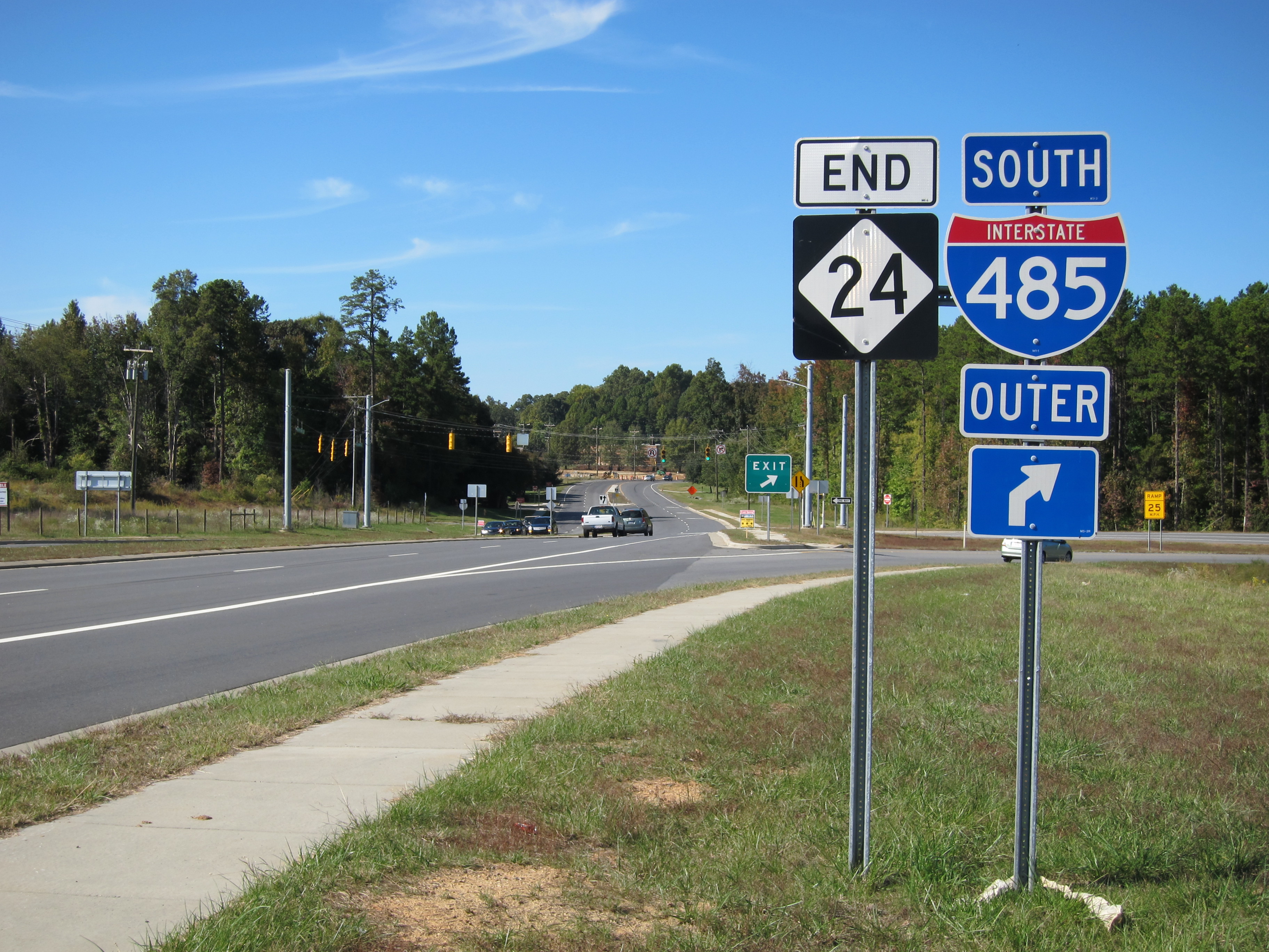
In March 2003, The state DOT rerouted the west end of NC 24 from US 74 to Interstate 77 (Exit 18). This was facilitated by following Harris Boulevard in east Charlotte instead of following NC 27. This added nearly 15 miles (24 km) onto the highway's length. On December 8, 2008, Interstate 485 opened in Northwest Mecklenburg County; at that same time NC 24 was extended again by 1 mile (1.6 km) to the new freeway (Exit 21) along West WT Harris Boulevard.
Before this rerouting, NC 24 was extraneous west of Johnsonville. It was concurrent with NC 27 over its entire length to its terminus at U.S. 74, at which point NC 27 continued while NC 24 did not.
NC 24's eastern terminus is at US 70 in Morehead City. This eastern segment leading to the terminus provides access to communities on the mainland side of the Bogue Sound.
Junction list
County Location Mile[2] Destinations Notes Mecklenburg Charlotte 0 I-485 – Pineville, HuntersvilleNC 24 begins 1 I-77 – Charlotte, Statesville2  US 21 (Statesville Road)
3  NC 115 (Old Statesville Road)
7.5  I-85 – Charlotte, Greensboro
8  US 29 (North Tryon Street)
9  NC 49 (University City Boulevard)
Exit also for UNC Charlotte 10 Old Concord Road 16.5  NC 27 west (Albemarle Road)
West end of NC 27 overlap Mint Hill 21 I-485 – Pineville, Concord22.5  NC 51 south (Blair Road)
Cabarrus Midland 30  US 601 – Monroe, Concord
Stanly Locust 35  NC 200 – Stanfield, Monroe, Concord
Red Cross 39  NC 205 south – Oakboro
Albemarle 49.5 

 US 52 north / NC 73 west / NC 138 south
North end of US 52 overlap and west end of NC 73 overlap 50 

US 52 south / US 52 Bus. – Norwood, WadesboroSouth end of US 52 overlap 51.5  NC 740 north – Badin
Montgomery 58 NC 73 east – Mount GileadEast end of NC 73 overlap; enter Uwharrie National Forest 66  NC 109 south – Mount Gilead
South end of NC 109 overlap Troy 69
NC 109 north / NC 109 Bus. – DentonNorth end of NC 109 overlap; south end of NC 109 Business overlap 70
 NC 134 north / NC 109 Bus. north (Main Street)
North end of NC 109 Business overlap Biscoe 76.5 


US 220 Alt. (Main Street)77 I-73 / I-74 / US 220 – Rockingham, AsheboroMoore 89  NC 705 – Robbins
94  NC 22 north – Ramseur, Greensboro
North end of NC 22 overlap Carthage 99 NC 22 south (McNeill Street)South end of NC 22 overlap 100 
 US 15 south / US 501 south – Pinehurst, Aberdeen
South end of US 15 & 501 overlap 102 US 15 north / US 501 north – SanfordNorth end of US 15 & 501 overlap Cameron 109
 To US 1 Bus. south – Southern Pines
110 US 1 – Southern Pines, SanfordHarnett Johnsonville 119 NC 27 east – LillingtonEast end of NC 27 overlap Spout Springs 122  NC 87 north – Sanford
North end of NC 87 overlap Cumberland Spring Lake 129  NC 690 west (Vass Road) – Vass
130  NC 210 north (Lillington Highway) – Lillington
North end of NC 210 overlap 131 NC 210 south (Murchison Road)South end of NC 210 overlap Fayetteville 137  US 401 (Skibo Road/Pamalee Drive) – Raeford, Lillington
140
US 401 Bus. / NC 87 south (MLK Jr. Highway)South end of NC 87 overlap 141 NC 210 north (Murchison Road)Eastbound exit and westbound entrance; north end of NC 210 overlap 142 
 I-95 Bus. / US 301 (Eastern Boulevard)
143  NC 53 east (Ceder Creek Road) / NC 210 south
South end of NC 210 overlap Vander 146 I-95 – Lumberton, Dunn, BensonSampson Roseboro 164  NC 242 (East Street) – Elizabethtown, Salemburg
Clinton 174 
 US 421 north / US 701 north (Faircloth Freeway) – Dunn, Newton Grove
North end of US 421 & 701 overlap 175 US 421 south / US 701 south (Faircloth Freeway) – WilmingtonSouth end of US 421 & 701 overlap 176
US 701 Bus. south (Southeast Boulevard)South end of US 701 Business overlap 177
US 701 Bus. north (Southeast Boulevard)North end of US 701 Business overlap Duplin Warsaw 187
 I-40 west / NC 24 Bus. – Benson
West end of Interstate 40 overlap NC 24 overlaps with Interstate 40 (exits 364 to 373) 196  I-40 east / NC 903 south – Wilmington, Magnolia
East end of I-40 overlap; south end of NC 903 overlap 198  NC 11 – Kenansville
200  NC 50 – Kenansville, Chinquapin
201 NC 903 north – Pink Hill, AlbertsonNorth end of NC 903 overlap Beulaville 211 
 NC 41 / NC 111 (Jackson Street) – Wallace
Onslow 222  US 258 west – Kinston
West end of US 258 overlap 231 NC 111 north (Catherine Lake Road) – Chinquapin, WallaceJacksonville 236 US 258 east (Richlands Highway) / NC 53 west (Burgaw Highway) – BurgawEast end of US 258 overlap 237 US 17 south – WilmingtonSouth end of US 17 overlap 240 Montford Landing Road Eastbound entrance and westbound exit 241 US 17 north – New BernNorth end of US 17 overlap Hubert 251  NC 172 south
NC 172 Restricted - Military Use Only Carteret Cape Carteret 262  NC 58 – Emerald Isle, Trenton
Morehead City 278 US 70 (Arendell Street)NC 24 ends Business routes

NC 24 Business
Location: Warsaw–Kenansville, North Carolina
NC 24 BusinessLocation: Jacksonville, North Carolina History
- 1922: NC 24 runs from Warsaw to Laurinburg, through Fayetteville. Most of this routing west of Fayetteville is now US 401.
- 1925: NC 24's western terminus is extended to the South Carolina line and its eastern terminus is extended to Kenansville.
- 1930: The route is extended east to Swansboro, using part of US 17. Also, NC 24 is rerouted through Kenansville, Beaulaville, Richlands, and Jacksonville; NC 24 still uses most of this route today. Furthermore, NC 24 is given a more direct route from Laurinburg to Wagram
- 1930s: NC 24 is rerouted numerous times after the introduction of new U.S. Highways to North Carolina.
- 1941: NC 24 west of Fayetteville is truncated; NC 87 and NC 78 take control of the truncated route.
- 1963: The western terminus of NC 24 is moved and extended to Charlotte; this produced the 106-mile (171 km) concurrency with NC 27.
- Mid 1960s: NC 24 is routed around Clinton and its routing through Fayetteville changed.
- Early 1970s: The construction of the Cape Fear River bridge at Fayetteville removed many zigzags of NC 24 in Fayetteville.
- 1982: NC 24 is routed along a four-lane bypass around Vander to access the newly built I-95.
- 2000: NC 24 is routed onto I-40 for a segment between exits 364 and 373 and onto NC 11 around Kenansville and Warsaw. The old route was signed as Business NC 24.
- 2003: NC 24 splits from NC 27 in eastern Charlotte to follow Harris Boulevard to its current western terminus at I-77.
- 2006: NC 24 is rerouted unto the Jacksonville Bypass US 17 for 4 miles (6.4 km). The old route is signed as Business Route 24.
- 2008: NC 24 western terminus is extended from I-77 to I-485 on December 8, 2008. The extension added 1 mile (1.6 km) to the route.
Photo gallery
-
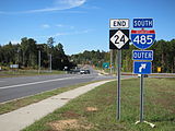
NC 24 End at Interstate 485 in Charlotte (2010-10-17).
See also
- U.S. Highway 17-1
- Camp Lejeune
- North Carolina Bicycle Route 6
- Croatan National Forest
- Fort Bragg
- Reed Gold Mine
- Uwharrie National Forest
References
- ^ NCRoads.com: N.C. 24
- ^ a b Google, Inc. Google Maps – NC 24 (Map). Cartography by Google, Inc. http://maps.google.com/maps?f=d&source=s_d&saddr=West+W+T+Harris+Boulevard&daddr=35.3982,-79.62103+to:35.00143,-78.65317+to:Unknown+road&hl=en&geocode=FX1sGwId5Rgu-w%3BFTgiHAIdWhRB-ykVIhAXlKZUiDGrX-tWvgextA%3BFVYUFgIdDtlP-ynjZU8Jd6CriTGeofhzzfnMGA%3BFecEEgIdNDNs-w&mra=dpe&mrcr=0&mrsp=2&sz=10&via=1,2&sll=35.378973,-78.839264&sspn=0.836406,1.783905&ie=UTF8&ll=35.447246,-79.238892&spn=3.342502,7.13562&z=8. Retrieved 2011-02-01.
External links
Categories:- State highways in North Carolina
- Transportation in Charlotte, North Carolina
- Transportation in Fayetteville, North Carolina
- Transportation in Mecklenburg County, North Carolina
- Transportation in Cabarrus County, North Carolina
- Transportation in Stanly County, North Carolina
- Transportation in Montgomery County, North Carolina
- Transportation in Moore County, North Carolina
- Transportation in Harnett County, North Carolina
- Transportation in Cumberland County, North Carolina
- Transportation in Sampson County, North Carolina
- Transportation in Duplin County, North Carolina
- Transportation in Onslow County, North Carolina
- Transportation in Carteret County, North Carolina

Wikimedia Foundation. 2010.