- Morrow Mountain State Park
-
Morrow Mountain State Park North Carolina State Park Natural Monument (IUCN III)  Morrow Mountain Overlook
Named for: Morrow Mountain Country United States State North Carolina County Stanly Location - coordinates 35°23′36″N 80°04′59″W / 35.39333°N 80.08306°WCoordinates: 35°23′36″N 80°04′59″W / 35.39333°N 80.08306°W - elevation 440 ft (134.1 m) Area 4,742 acres (1,919 ha) Highest point - coordinates 35°21′09″N 80°05′34″W / 35.3525°N 80.09278°W - elevation 905 ft (276 m) Founded 1939 Managed by North Carolina Department of Environment and Natural Resources 
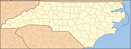 Location of Morrow Mountain State Park in North Carolina
Website : Morrow Mountain State Park Morrow Mountain State Park is a North Carolina state park in Stanly County, North Carolina, in the United States. Located near Albemarle, North Carolina (approx. 45 minutes NE of Charlotte, NC), it covers 4,742 acres (19 km²) within the ancient Uwharrie Mountains.
Contents
Geography
Morrow Mountain is one of the highest peaks in the ancient Uwharrie Mountains of central North Carolina. At one time they rose to nearly 20,000 feet (6,100 m) above sea level, but erosion has gradually worn them down to little more than high hills. Although the park contains several peaks, Morrow Mountain is a high point at 936 feet (285 m). However, the mountain still rises some 400 feet (120 m) above the surrounding lower terrain, and offers superb views of the surrounding countryside on a clear day. In addition to the mountains, the park also contains the Yadkin-Pee Dee River, one of central North Carolina's largest river systems. From the overlook atop Morrow Mountain the river can clearly be viewed.
Attractions
A scenic overlook located at the top of Morrow Mountain provides a panoramic view of the area. There is a large parking area at the top so people can stop and enjoy the views. Also, there is a picnic area, as well as a picnic shelter.
Lake Tillery
Part of the Uwharrie River and Pee Dee River system, Tillery was formed after the creation of the Tillery Dam in 1928. Morrow Mountain has a boat launch as well as a waterfront picnic area. There is a fishing access pier. A boardwalk connects the parking area to the boat launch area. Canoes can be rented daily during the summer. Spring and fall rentals are weekends only. There are no canoe rentals during the winter months.
Kron House
A renovation of the historical Kron House is on site. The house was built by a Scottish preacher, William McGregor, who sold it to Dr. Kron. Dr. Kron was one of the Southern Piedmont's most famous doctors. Kron was known for traveling days at a time, making house calls to those bitterly sick. Hailed as a frontier hero, Morrow Mountain State Park built a renovation of where his house was and now offers tours.
Camping
Morrow Mountain has 4 camping areas. The Group Camping area has three sites where RVs and trailers can be taken. The youth campsite is on the east side of the park, up a hill near the Tillery shoreline. Remote campsites are accessible through the Backpack Trail and have one latrine. The Cabins site is near the park office. The Cabins have modern conveniences such as stoves, grills and refrigerators. All have porches and a patio area. They can be rented per weekend. All campers must fill out a Morrow Mountain campsite application form before or upon showing up in the park. Fees are required.
Museum
A small museum commemorating the history of the Uwharries is on the far end of the Camp Office parking lot. Exhibits include Native Americans, area plant and animal communities, early explorers, and rocks and minerals. It is open 6 days a week from 9 to 5. It is self-guided tour.
Trails
With 32 miles (51 km) of trail in the park, Morrow Mountain is one of the most hiked state parks in North Carolina.
Backpack Trail-A one mile (1.6 km) trail, this white circle blazed trail takes backpackers to campsites 1, 2 and 3. It offshoots of the Morrow Mountain/Sugerloaf Mountain Trail and ends in Campsite 3 at the latrine. At the end of the Backpack Trail one can bushwalk due south to reach the Bridle Trail which one can then take to the Morrow Mountain Trail. Difficulty = Easy
Bridle Trail-Morrow Mountain State Park has 16 miles (26 km) of horse trails, which may also be used for hiking. In 2005, the Bridle Trail was split into 3 different trails. The Short Loop (White Horse Circle Blazes) includes a 3.5-mile (5.6 km) hike to and around Morrow Mountain. The Middle Loop is 5.2 miles (8.4 km) and follows the Short Loop trail as well as extra trail. The Long Loop is the 16-mile (26 km) trail, that circles the Morrow Mountain vicinity as well as the northern section of the park. Difficulty = Medium
- In 2006, the State Park renamed spurs of the trail, which now includes a quick .35 mile section known as Duck Blind Cove Spur Trail
Campground and Pool Trail-.8 miles; Easy; White Triangles. This one-way trail does exactly as its name sounds. Starting across from the Morrow Mountain pool, this easy trail runs through the woods connecting the pool, camp office and the three family campgrounds. The trail is most in woods, but also does run through some undergrowth. The Morrow Mountain amphitheatre is also near the end of the trail. The trail ends at campground #3, near the Rocks Trail.
Hattaway Mountain Trail-This two mile (3 km) loop is classified as strenuous. Starting at the Morrow Mountain pool, this trail goes about two tenths of a mile before hikers may choose their fate. Turning left means that they will immediately begin to climb Hattaway, a long half-mile trek straight up or they may turn right. If one turns left, after reaching the top of the mountain, the hiker will begin to immediately descend the mountain, sharply at first and then slowly. Upon reaching a ridge, the trail rolls up and down the Uwharrie hills for nearly a mile. Along the trail, some of the best autumn views can be seen, as hikers can see deep woods. Also, Hattaway offers one of the parks many quartz veins.
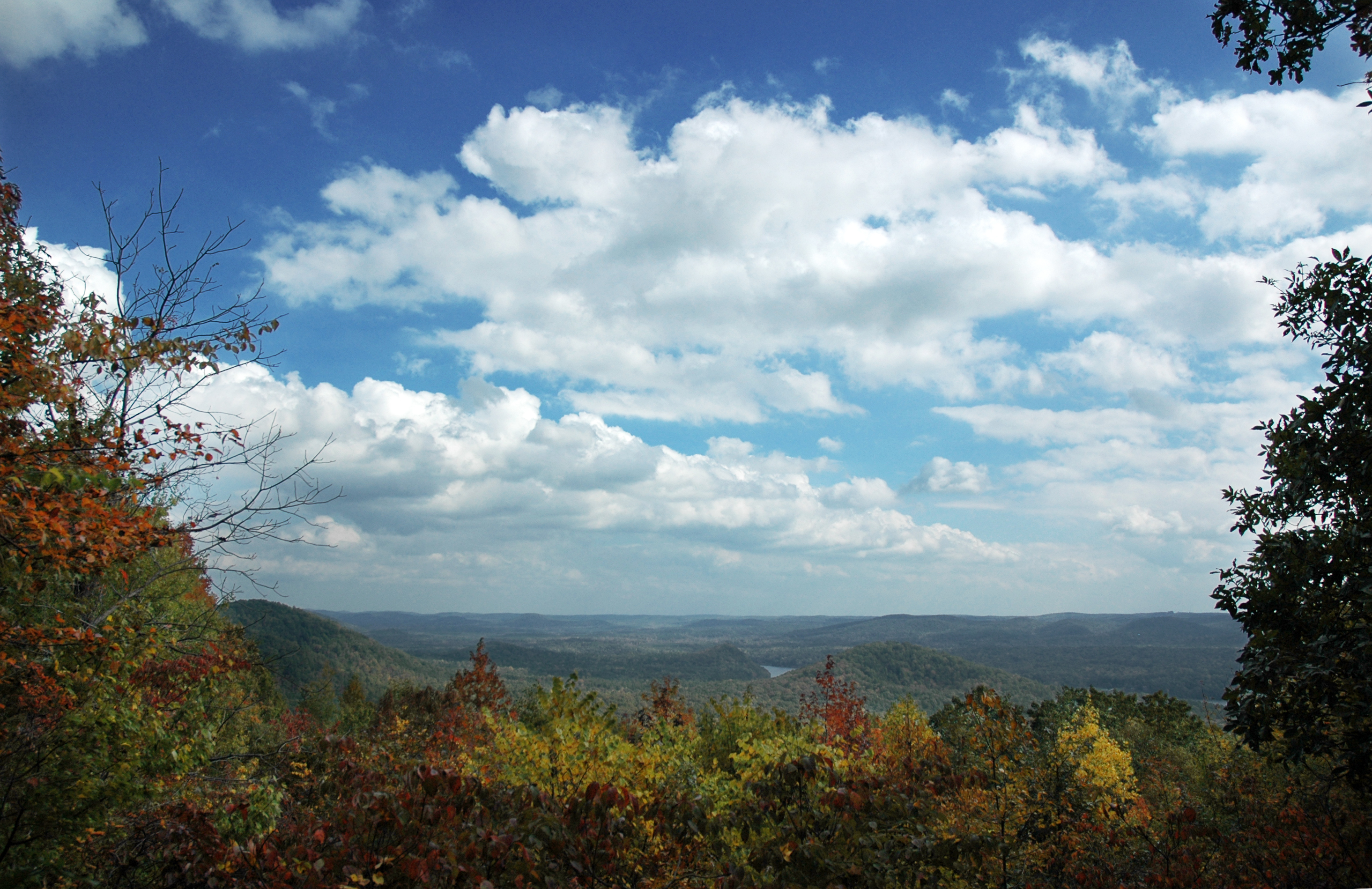
Fall Mountain Trail-A 4.1-mile (6.6 km) trail that encompasses Fall Mountain, in the parks eastern region. It is a moderate climb up and then a steep climb down to Falls Dam. From there, hikers walk the rest of the way along the shoreline of Lake Tillery. It is noteworthy to say that the trail's path is constantly shifting due to erosion. Difficulty = Medium. Orange Triangle Blazes.
 A view of Lake Tillery from the Fall Mountain Trail
Laurel Trail-.6 Miles; Easy; Red Hexagons. This short loop trails goes around the Morrow Mountain camping area, focusing in deep forest and large undergrowth. The trail starts the far end of the camp office parking lot and runs into a loop. Turning right will take you through a deep thicket of weeds, before finally emerging in deep woods. The trail crosses over many creeks and is the main way to connect to the Morrow Mountain trail. This short loop is the most popular trail in the park for children.
Morrow Mountain Trail-A 3-mile (one way) trail that starts at the camp office and ends with at the Mountain Loop Trail at the Overlook, the Morrow Mountain is the most hiked trail in the park. Going up Morrow Mountain (or going down) is a decent climb and for the rest of the trail (blue triangle blazes) the trail rolls up and down hills. The trail is the only way to get to the BackPack trail and also intermingles with the Sugerloaf Mountain trail for a mile. The trail takes hikers through deep flora, and at one point, called "The Jungle", takes hikers past some exotic trees. Medium Difficulty-3.0 miles.
Mountain Loop Trail-A .8-mile trail that walks around the top of Morrow Mountain, the loop trail provides some of the best views in the park. You may look down the trail into the depths of the park, seeing for nearly a mile. Bridges take you over gourges created by water flowance. The Mountain Loop also encompasses the afore mentioned Overlook Picnic Area. Difficulty = Easy. Red Square Blazes
Quarry Trail-A .6-mile trail takes hikers around the edge of the Morrow Mountain picnic area and into the former quarry. For much of the early 20th century, the area was mined for rocks. Hikers may enjoy the evenly cut paths and the washhouses. Near the end of the trail, there is a fork for hikers to closely inspect the quarry handiwork. Difficulty = Easy. Blue Hexagon blazes.
Rocks Trail-Is the most scenic trail in the park. A 1.25-mile (one way) easy trail, the Rocks trail slopes through the rolling hills of the Uwharrie woods. At the end, the Rocks trail goes into a massive rock outcropping at the lakeshore, where people can see for miles. The rocks are stable, but hikers must take care as a large "Warning" sign says. The view of Tillery from the Rocks Trail is one of the Uwharrie region's most famous views. Difficulty = Easy. Blue Square Blazes.
Sugerloaf Mountain Trail-Admittedly the most strenuous trail in the park, Sugerloaf is a tough haul. Most of the trail is winding hills, leading in a 2.5-mile (4.0 km) loop starting at the Bridle Trail parking lot. However, many should consider going down Sugerloaf Mountain. Upon reaching the top, the trail drops about 500 feet (150 m) in a quarter of a mile. After going down, the trail mixes with the Morrow Mountain Trail, before bending off back to the Bridle Trail parking lot. The view from the top of Sugerloaf is often clouded, but on a clear day, Sugerloaf's summit is one of the more scenic viewpoints in the park. Difficulty = Strenuous-2.5 Miles-Orange Diamonds
Three Rivers Trail-Officially considered the nature trail of the park, this trail has seen better days. Many of the piers that once dotted the Tillery shoreline have fallen in, but the trail is still widely hiked. The trail, starting in the Tillery parking lot, goes through the marshes and the woods, bringing all of the park's ecosystem into one short trail. After walking through marshland and coastline, the trail suddenly rockets up a small hill, where one can find the deep woods and wildflowers. The trail then slowly descends the mountain, where it stops. Blue Hexagons-.6 miles-Easy
Getting There
From Charlotte, take NC 24/NC 27 nearly 35 miles (56 km) into Albermarle. At the intersection of NC 740 and 24/27 follow NC 740 (Badin Road) for 1.8 miles (2.9 km). Turn right on Morrow Mountain Road, which in 3.2 miles (5.1 km) will take you to the park gates. There is an information cabin on the right as you enter. The Park Office is nearly 2 miles (3.2 km) down on the right. If you park in the trail hiking parking lot there is a mailbox with trail maps in case you do not stop at the information center.
Expansion?
On August 8, 2006, Alcoa announced that it was giving up 60% of its land assets in the Uwharries. Morrow Mountain was offered approximately 1,400 acres (5.7 km2) to buy. There is no immediate money to buy the land, but the State Park commission says it will likely buy the land and use the State Park Public Trust Fund.
External links
Categories:- Protected areas established in 1939
- Mountains of North Carolina
- North Carolina state parks
- Museums in Stanly County, North Carolina
- Natural history museums in North Carolina
- Protected areas of Stanly County, North Carolina
- Native American museums in North Carolina
- Historic house museums in North Carolina


Wikimedia Foundation. 2010.