- Mount Pisgah (North Carolina)
-
Mount Pisgah 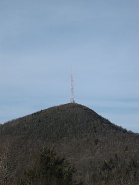
Mount Pisgah summitElevation 5,721 ft (1,744 m) Location Location Buncombe / Haywood counties, North Carolina, USA Range Appalachian Mountains Coordinates 35°25′32″N 82°45′25″W / 35.4255°N 82.7569°WCoordinates: 35°25′32″N 82°45′25″W / 35.4255°N 82.7569°W Topo map USGS Cruso Climbing Easiest route Hike Mount Pisgah is a mountain in the Appalachian Mountain Range and part of the Blue Ridge Mountains of North Carolina, United States. The mountain's height is 5,721 feet (1,744 m) and it sits approximately 15 miles (24 kilometers) southwest of Asheville near the crossing of the boundaries of Buncombe, Haywood, Henderson and Transylvania counties. It is located on the border of Buncombe and Haywood counties, close to the point where Henderson and Transylvania meet them, but not actually within the latter two counties. The mountain is easily accessible via a hiking trail from Blue Ridge Parkway.
Contents
History
Before the European Settlers entered this part of North Carolina, these mountains and valleys were the exclusive domain of Cherokee Indians. The Cherokees had their own names for Mount Pisgah and the Pisgah Ridge. The mountain was Elseetoss and the ridge was Warwasseeta, and around them the land was rich in game and lush with trees and other plant life.
The name Pisgah comes from the Bible, Deuteronomy 3:27. The Lord ordered Moses to the top of this mountain and told him to look in all directions, thus revealing the Promised Land to the tribes of Israel. There are at least two stories as to how this Biblical mountain's name came to be applied to this sylvan eminence in Western North Carolina:
- In 1776, General Griffith Rutherford led an expedition against the Cherokees. Accompanying this expedition as a chaplain was one James Hall. The men of the expedition saw the mountain from the French Broad River valley and saw a rich land around it—a land of milk and honey, a promised land. James Hall, preacher and soldier, is credited with drawing the parallel with the land that Moses saw from Pisgah and applying the Biblical appellation to this mountain.
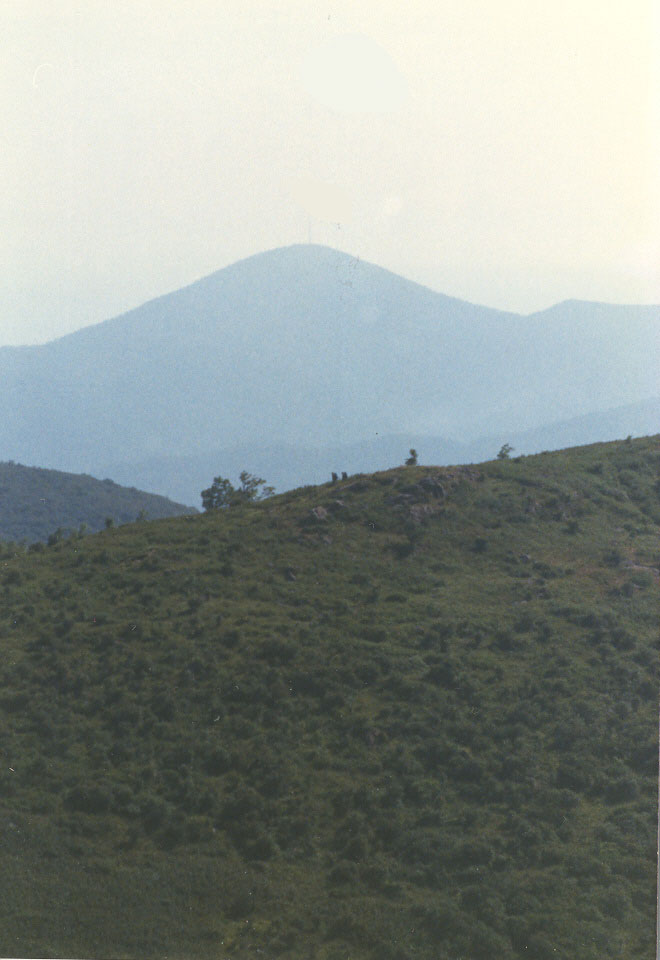
 View from Black Balsam Knob, 9.5 miles distant
- George Newton was a Presbyterian minister who lived and taught in the late 18th and early 19th centuries at what became Newton Academy in Asheville. Reverend Newton is credited with naming Mt. Pisgah. Because of the extensive view in all directions over a rich land, Reverend Newton felt there was similarity between this mountain and the one on which Moses stood.
The first recorded appearance of the name Mt. Pisgah in North Carolina was in 1808. In this year, part of Buncombe County was split off when Haywood County was created, and part of the new county line was along the "ridge dividing the waters of Pigeon and the French Broad River, to the top of Mount Pisgah."
Thomas Lanier Clingman was a state legislator, United States Congressman, United States Senator, Confederate General, and somewhat given to controversy. He left his mark the history of Western North Carolina through his famous argument with Dr. Elisha Mitchell (for whom Mt. Mitchell was named) and his mark on the land. Clingman's Dome in the Great Smoky Mountains National Park is named for him. He has been described as "an intrepid man of most arrogant and aggressive character, greatest self-confidence, unlimited assurance, prodigious conceit, stupendous aspiration, immense claims, more than common ability, no considerable attainment or culture, great boastfulness, and much curiosity."[1] Mr. Clingman owned 300 acres (1.2 km²) on and around the top of Mt. Pisgah. He owned this land from the 1830s until shortly before his death in 1897, when he sold this land to George W. Vanderbilt.
George Washington Vanderbilt was the grandson of the "commodore" Cornelius Vanderbilt. Mr. Vanderbilt began buying land south of Asheville in 1888, and by the time he finished, he owned about 125,000 acres (506 km²), including Mt. Pisgah. Near Asheville, he built his famous Biltmore House, the grounds of which Frederick Law Olmsted landscaped.
Two other famous names are associated with Vanderbilt and Biltmore Estate. In 1891, Gifford Pinchot, recently returned from studying forestry in Europe, became Chief Forester of Biltmore. Here, with Mr. Vanderbilt's strong support, he introduced scientific forestry to the United States. In 1898, Pinchot was named head of the Forestry Division of the United States Department of Agriculture.
Dr. Carl A. Schenck of the University of Darmstadt came to the United States to succeed Pinchot. When Dr. Schenck came to this country, there were fewer than half dozen trained foresters, and all had studied forestry in Europe. There was no place in the United States to study forestry.
With George W. Vanderbilt's support, Dr. Schenck founded the Biltmore Forestry School in 1898. Classes first met in the village of Biltmore, upstairs in what is now the headquarters of the Biltmore Company. This building is a Registered National Historic Landmark. The field school for the Biltmore Forestry School was near the foot of Mt. Pisgah. The United States Forest Service has done an excellent reconstruction of this school at the Cradle of Forestry in America.
In 1911, the United States Congress passed the Weeks Act. This monumental piece of legislation permitted the U.S. Forest Service for the first time to purchase forest lands. In 1914, the Forest Service purchased nearly 80,000 acres (320 km²), including Mt. Pisgah, from Edith Vanderbilt as a part of what is now the 479,000 acre (1940 km²) Pisgah National Forest.
In the Mount Pisgah area, the Vanderbilts kept 471 acres (1.9 km²) in Buck Springs Gap, about a mile (2 km) from Pisgah Inn. Here George W. Vanderbilt had constructed a popular log hunting lodge. The main lodge had four bedrooms, breezeway-connected building had two two-bedroom suites, and the kitchen/dining building was connected to the other two. There were several buildings near these buildings. Mr. Vanderbilt built Buck Springs Lodge just before the turn of the century, and the others were razed in 1961.
The Mt. Pisgah area has been a popular resort area for a number of years. The first Pisgah Inn opened about 1918. This rustic old Inn was a welcome journey's end for thousands of travelers escaping from the heat of the lowlands in the summer. Development of the modern Pisgah Inn began in the early 1960s. The original Inn was disassembled in 1990 due to safety concerns.
Most of the Blue Ridge Parkway in this area was built across land transferred from the U.S. Forest Service. The exception was the 471 acres (1.9 km²) around Buck Springs Lodge. The State of North Carolina purchased the land and the lodge in 1959 and transferred the land to the United States for the construction of the Blue Ridge Parkway. The Blue Ridge Parkway through the Mt. Pisgah area was opened for travel in the mid-1960s. The present Pisgah Inn was built in 1964.
Broadcasting controversy
The prominent tower in the picture at the crest of Mount Pisgah on what is known as Pisgah Ledge, is a 339-foot-tall (103 m) television broadcast tower owned by Chesapeake Television, Incorporated, doing business as the Sinclair Broadcast Group, licensee of WLOS-TV, PSIP Channel 13, in nearby Asheville, North Carolina. It is the highest television antenna east of the Mississippi River, at 2,814 feet above the surrounding valley floor, and 6,023 feet above mean sea level, according to the Federal Communications TV License Division. Co-located on the tower is WUNF-TV, PSIP Channel 33, and WKSF-FM 99.9.
On May 22, 2001, the United States Forest Service decided to allow WLOS-TV to build a replacement television transmission tower on top of Mount Pisgah. The new tower would have been a lighter-weight tower to support the station's digital antenna that would have replaced the heavier channel 13 analog antenna, fulfilling the government-ordered transfer to digital transmission. The old tower would not have supported both the heavy analog antenna, plus the added weight of a full power digital antenna. The Blue Ridge Parkway and several conservation organizations had opposed building a new tower on the peak located adjacent to the Parkway and repeatedly requested the Forest Service explore alternative locations. In 2009, the controversy resolved itself, with the FCC and the Department of the Interior allowing WLOS to maintain its old tower on the summit after the analog antenna was removed, and the station to make needed adjustments to its digital antennas now mounted on the tower.
Recreation
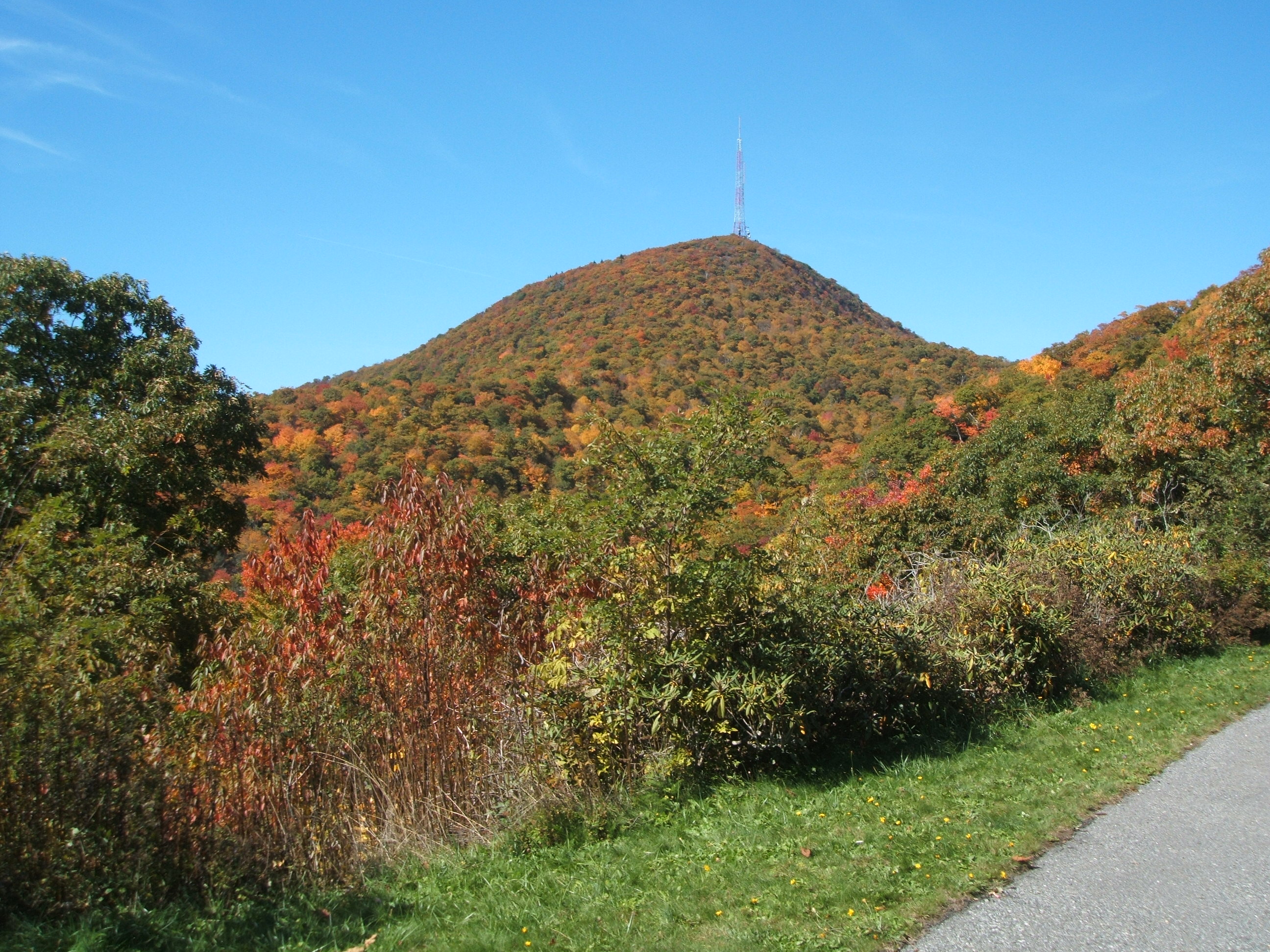
 View of Mount Pisgah from Blue Ridge Parkway parking lot, October 2008
The trail leading to the summit of Mt. Pisgah starts at milepost 407 of the Blue Ridge Parkway on the west side of the road at an overlook labeled "Mt. Pisgah Parking" The trail is 1.6 miles long and is of moderate difficulty (sections near the summit can be rather steep). There is a small observation deck near the TV tower at the summit. The view is spectacular.
At the base of the TV tower, follow the huge, thick cables down to the WLOS-TV transmitter building. Leading up the mountain from the valley floor, is a still-operating cable car that is used to ferry broadcasting equipment to the building. The cable car also ferries engineers during bad weather, for mandatory transmitter work.
Also at the Mt. Pisgah Parking area is the Buck Spring trailhead. a short walk down the Buck Spring Trail brings you to a historic exhibit located at the foundation stone remains of the George Vanderbilt Hunting lodge.
On the east side of the Parkway at milepost 407 is the Mt. Pisgah Picnic Area. The picnic area includes grills, tables and restroom facilities. All are ADA/handicapped accessible.
The Pisgah Inn Lodge Restaurant and Country Store, as well as the Mt. Pisgah Campground is located at milepost 408 of the Blue Ridge Parkway. Several other trails can be accessed from the campground or the Inn.
References
External links
Categories:- Blue Ridge Parkway
- Protected areas of Buncombe County, North Carolina
- Protected areas of Haywood County, North Carolina
- Mountains of North Carolina

Wikimedia Foundation. 2010.