- Lumber River State Park
Geobox Protected Area
name = Lumber River State Park
native_name =
other_name =
other_name1 =
category_local = North Carolina State Park
category_iucn = III
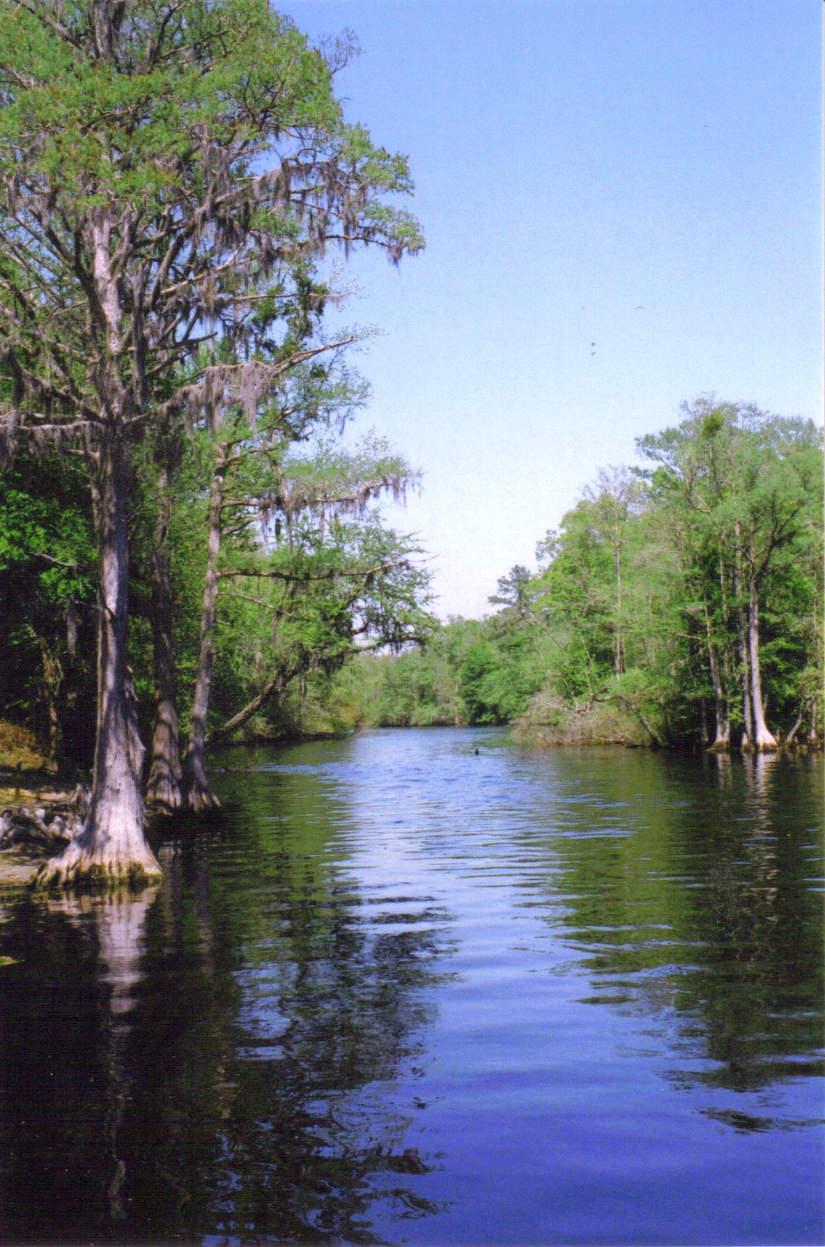
image_caption = TheLumber River as seen from the boat launch at Princess Ann in Robeson County
etymology_type = Named for
etymology = TheLumber River
country = United States
state = North Carolina
region_type = Counties
region = Columbus
region1 = Hoke
region2 = Robeson
region3 = Scotland
district_type =
district =
city =
city1 =
location =
lat_d = 34
lat_m = 23
lat_s = 29
lat_NS = N
long_d = 78
long_m = 59
long_s = 53
long_EW = W
elevation_imperial = 102
elevation_round = 1
area_unit = acre
area_imperial = 7936
area_round = 1
area1_imperial =
area1_type =
length_imperial =
length_orientation =
width_imperial =
width_orientation =
highest =
highest location =
highest_lat_d =
highest_lat_m =
highest_lat_s =
highest_lat_NS =
highest_long_d =
highest_long_m =
highest_long_s =
highest_long_EW =
highest_elevation_imperial =
lowest =
lowest_location =
lowest_lat_d =
lowest_lat_m =
lowest_lat_s =
lowest_lat_NS =
lowest_long_d =
lowest_long_m =
lowest_long_s =
lowest_long_EW =
lowest_elevation_imperial =
biome =
biome_share =
biome1 =
biome1_share =
geology =
geology1 =
plant =
plant1 =
animal =
animal1 =
established_type =
established = 1989
established1_type =
established1 =
management_body =North Carolina Department of Environment and Natural Resources
management_location =
management_lat_d =
management_lat_m =
management_lat_s =
management_lat_NS =
management_long_d =
management_long_m =
management_long_s =
management_long_EW =
management_elevation =
visitation =
visitation_year =
free_type =
free =
free1_type =
free1 =

map_caption = Location of Lumber River State Park in North Carolina
map_locator = North Carolina
map_first =
website = [http://www.ncparks.gov/Visit/parks/luri/main.php Lumber River State Park]Lumber River State Park is a North Carolina state park along the
Lumber River in Scotland, Hoke, Robeson and Columbus CountiesNorth Carolina in theUnited States . It covers 7,936 acres (32 km²) along a 115 mile (185 km) stretch of theLumber River . Lumber River State Park is located in North Carolina's Coastal Plain. It was established as both astate park and as a natural and scenic river by theNorth Carolina General Assembly in 1989. Lumber River State Park stretches across parts of four counties following the Lumber River. The headwaters of the river are in Scotland County. cite web | url = http://www.nature.org/wherewework/northamerica/states/northcarolina/preserves/art5613.html | title = Lumber River State Park | accessdate = 2007-04-11 | publisher =The Nature Conservancy ] The Lumber River bisects Robeson County and ends inSouth Carolina where it joins theLittle Pee Dee River about convert|8|mi|km south of the state line. The recreational facilities are at the Princess Ann Landing in southeastern Robeson County near the towns of Orrum and Fair Bluff.cite web | url = http://www.ncparks.gov/Visit/parks/luri/main.php
title = Lumber River State Park | accessdate = 2007-04-11
publisher = North Carolina Department of Environment and Natural Resources ]History
The Lumber River is the only
blackwater river in North Carolina to be designated as aNational Wild and Scenic River by theOutdoor Recreation Resources Review Commission of the U.S. Government. The river is convert|115|mi|km from itsheadwaters at the confluence of Drowning Creek and Buffalo Creek near Wagram in Scotland County. The river flows freely along its entire course, making it one of the longest unobstructed rivers in North Carolina.The upper section of the river was designated as a State Recreational Water Trail in 1978. The river was established as a National Canoe Trail in 1981. The lower Lumber River was designated as a State Canoe Trail in 1984. The General Assembly established the Lumber River as a Natural and Scenic River and also as a state park in 1989.
The recreational facilities for Lumber River State Park are in a section of Robeson County known as Princess Ann. This area was settled by the
Scots-Irish who migrated to the area in the late 1700s. Princess Ann was charted in 1796. The town was the second to be established in Robeson County and the first settled by people ascending the river from South Carolina. Princess Ann has since been abandoned and the name only survives in the localfolklore and the name of the road that leads to the park.Recreation
There are 24 boat launches along the Lumber River that serve as access points to Lumber River State Park. The entire length of the river is open to
fishing . The common game fish areblack crappie ,largemouth bass ,catfish andredbreast sunfish . All anglers must have a valid fishing license and follow the regulations of theNorth Carolina Wildlife Resources Commission . Nine primitive camping sites are located at the Princess Ann section of the park. These campsites are meant to be used by no more than 6 people at a time. Each camp site features, apicnic table and grill, lantern holder, trash can, and fire ring. There are several hiking trails and picnic areas at Princess Ann as well as the many municipal and county parks that are located on the Lumber River.Plants and wildlife
Lumber River State Park provides a habitat for a wide variety of plants and animals.
Wildflowers that can be seen at the park includewisteria ,sarvis holly ,Carolina bogmint , mountain laurel, wildazalea ,spider lily and swamp mallow. Trees found in theswamp s along the river includebald cypress , water elm, river birch andtulip poplar . Some of animals that live along the banks of the river are thegreat blue heron ,white tailed deer , black bears,sandpiper s,beaver s,barred owl s, river otters, turkey, American alligator, andprothonotary warbler s.Nearby state parks
The following state parks are within convert|30|mi|km|0 of Lumber River State Park:
*Jones Lake State Park (Bladen County)
*Lake Waccamaw State Park (Columbus County)
*Little Pee Dee State Park (South Carolina )References
*cite web
url = http://www.topoquest.com/map.asp?lon=-78.9981&lat=34.3914
title = Griffin Whirl, USGS Evergreen (NC) Topo Map
accessdate = 2008-06-30
author =United States Geological Survey
publisher =TopoQuest
Wikimedia Foundation. 2010.