- North Carolina Highway 16
-
NC 16
Route information Maintained by NCDOT Length: 143.8 mi[1] (231.4 km) Existed: early 1920s – present Major junctions South end:  NC 75 in Waxhaw
 I-485 in Charlotte

 I-277 / US 74 in Charlotte

 I-77 / US 21 in Charlotte
 I-85 in Charlotte
 I-40 in Conover
 US 70 in Conover
North end:  SR 16 at the VA line near Grassy Creek
Location Counties: Union, Mecklenburg, Gaston, Lincoln, Catawba, Alexander, Wilkes, Ashe Highway system ←  US 15
US 15US 17  →
→North Carolina Highway 16 is a primary state highway in the U.S. state of North Carolina. It runs from NC 75, in Waxhaw, to the Virginia state line, near the community of Grassy Creek.
Contents
Route description
Starting in the heart of Waxhaw, NC 16 goes north through Weddington and into Charlotte as Providence Road. In Uptown Charlotte, NC 16 briefly overlaps 3rd Street, then merges with I-277, goes north around Uptown and then exits the city in a northwest direction as Brookshire Boulevard (Note - Southbound travelers exiting I-277 (exit 2A) must make a u-turn at the end of the exit ramp to the left, then take another left onto 3rd Street, to stay on NC 16).
After passing the Catawba River, NC 16 becomes a rural freeway through Gaston, Lincoln, and most of Catawba counties (currently an 8.5-mile (13.7 km) gap between freeway's end and Newton). After passing Conover, NC 16 become a two-lane rural road through Alexander and Wilkes counties (with exception in Wilkesboro).
Entering Ashe County, it connects with the Blue Ridge Parkway and then travels, on a somewhat curvy-road, to Jefferson. From Jefferson, it goes north, as a relatively straight mountain road, into the Commonwealth of Virginia near Grassy Creek. Though changed as Virginia State Route 16, it continues through the state then entering West Virginia as West Virginia Route 16, ending in St. Marys, West Virginia (a three-state grand total of 474.3 miles (763.3 km)).[1]
Junction list
County Location Mile[1] Destinations Notes Union Waxhaw 0 NC 75 (Main Street) – Monroe, LancasterNC 16 begins Weddington 6.5 Rea Road 7  NC 84 east (Weddington Road) – Monroe
Mecklenburg Charlotte 10 I-485 (Governor James G. Martin Freeway) – Pineville, Concord13  NC 51 (Pineville-Matthews Road)
22 


 I-277 south / US 74 west to NC 27 (John Belk Freeway)
End of I-277 south and US 74 west overlaps; southbound NC 16 must take a u-turn at end of ramp then turn left onto 3rd Street NC 16 overlaps with Interstate 277 (exits 2A to 5) 24.5 I-77 / I-277 / US 21 (Bill Lee Freeway) – Statesville, ColumbiaNorth end of I-277 overlap 25 Beatties Ford Road – Johnson C. Smith University 26.5 I-85 – Greensboro, Spartanburg32 I-485 (Craig Lawing Freeway) – Pineville, HuntersvilleGaston Lucia 35
 To NC 273 (Lucia Riverbend Highway)
37.5 
 NC 16 Bus. north (Lucia Riverbend Highway)
Lincoln Lowesville 42  NC 73 – Lincolnton, Huntersville
Catawba 51  NC 150 – Lincolnton, Mooresville
53
NC 16 Bus. south – Denver61.5
NC 16 Bus. north (Charlotte Highway)62.5  NC 10 – Catawba
Conover 65.5 US 70 (Conover Boulevard East) – Conover, Claremont67 I-40 – Conover, Hickory, Statesville67.2
NC 16 Bus. south (1st Avenue North and 1st Avenue South)Alexander Taylorsville 81  US 64 – Lenoir, Statesville
82.5  NC 90 (Main Street)
Brief .5-mile (0.80 km) concurrency Wilkes Moravian Falls 96  NC 18 south – Lenoir
South end of NC 18 overlap Wilkesboro 99.5  US 421 south / NC 18 north – Winston-Salem
South end of US 421 and north end of NC 18 overlaps NC 16 overlaps with US 421 (mile markers 283-287) 104 US 421 north – BooneNorth end of US 421 overlap Ashe 120 Blue Ridge Parkway 120.5  NC 163 west – West Jefferson
127  NC 88 east – Laurel Springs, Sparta
East end of NC 88 overlap Jefferson 130 US 421 south / NC 88 west – Jefferson, West JeffersonSouth end of US 221 and west end of NC 88 overlaps 132  US 221 north – Twin Oaks
North end of US 221 overlap 136 Old Highway 16 – Crumpler 1.000 mi = 1.609 km; 1.000 km = 0.621 mi
Concurrency terminus • Closed/Former • Incomplete access • UnopenedBannered routes
Business Loops
Since 1990, NC 16 spawn two business loops:
- Lowesville – The 16.2 miles (26.1 km) route follows the original NC 16 route through the cities of Lucia, Lowesville, and Denver.
- Newton-Conover – The 6.7-mile (10.8 km) route follows the original NC 16 route through the cities of Newton and Conover.
History
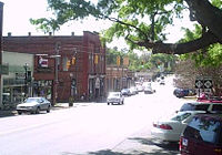 NC 16's southern terminus in Waxhaw
- Before 1928: NC 16 was one of the original North Carolina state highways. It ran due south from NC 10 in Newton to the South Carolina border, following mostly what is today US 321 Business.[2]
- 1928: The route was extended north all the way to the Tennessee border; from to Newton to Wilkesboro it was cosigned with NC 18.[2]
- 1933: NC 16 south of Conover was truncated in favor of US 321.[2]
- 1937: NC 16 dropped its former routing along SR 1562 in the foothills of North Carolina for a more direct route.[2]
- 1939: The route's northern terminus was moved to the Virginia border and its southern terminus was extended southward through Charlotte.[2]
- 1954: NC 16 was rerouted away from North Wilkesboro.[2]
- 1958: NC 16 was slightly diverted for an interchange with the newly constructed Interstate 85.[2]
- 1959: NC 16 gained its own unshared route from US 221 to the Virginia border.[2]
- Late 1950s and early 1960s: NC 16's routing through Charlotte changed numerous times.[2]
- 1963: A zigzag routing in southern Charlotte was removed for NC 16.[2]
- 1988: NC 16 follows the newly built Brookshire Boulevard in northern Charlotte; it used to follow parts of Bellhaven Boulevard and Rozzelles Ferry Road, which still exist.[2]
- 1990: NC 16 is rerouted along a newly built 4-lane bypass through Catawba, Lincoln, and Gaston counties. The old route was designated as NC 16 Business.[2]
- Late 1990s and early 2000s: Numerous road widenings are made along NC 16 in the Charlotte area.
- 2008: A new 4 lane divided portion of NC 16 is opened. This new four lane section of NC 16 had dead ended and exited on NC 73 near Denver, NC in Southeastern Lincoln County. It is expected the 4 lane portion will be extended to NC 150 by 2012.
On Thursday, July 30, 2009 The four-lane divided NC16 opened to traffic to Optimist Club Rd. in the Triangle community, south of Denver in eastern Lincoln County, with the next section to open in October, 2009 which will extend to St. James Church Rd. just west of Denver, NC in eastern Lincoln County, NC. Northbound drivers on NC16 will need to exit at St. James Church Rd. and travel east app. 1 mile to intersect with present-day NC16 and then turn left to continue north on NC16 toward Conover, NC.
Future plans
NC 16 is expected to be rerouted onto a new bypass route in northwestern Mecklenburg, eastern Gaston, eastern Lincoln, and southeastern Catawba counties. When completed, this will become the second limited-access stretch of NC 16 (as such, I-277 shares part of the one existing portion). The new bypass is expected to be completed by 2010. In 2008, widening began on the fast-growing part of the road in Union County, which consists of the southernmost part of the highway. The road will be widened from I-485 to Rea RD, south of Weddington. Construction of a new 4-lane "Superstreet" design portion of NC 16 is underway starting in Conover at the Wal-Mart at I-40 and will end in Charlotte.
See also
- Blue Ridge Parkway
- Catawba River
- Lake Norman
- Mount Jefferson State Natural Area
- Mountain Island Lake
- New River
- New River State Park
- Rendezvous Mountain Educational State Forest
- U.S. National Whitewater Center
- Uptown Charlotte
- W. Kerr Scott Reservoir
- Yadkin River
References
- ^ a b c Google, Inc. Google Maps – NC 16 (Map). Cartography by Google, Inc. http://maps.google.com/maps?f=d&source=s_d&saddr=N+Broome+St&daddr=35.13727,-80.78345+to:35.23183,-80.83342+to:35.491347,-81.0146798+to:36.03924,-81.17893+to:N+Carolina+16+S&hl=en&geocode=FbDoFAIdMvMv-w%3BFfYmGAIdplcv-ymFOhC5yCBUiDGTLehw8gtMBw%3BFVaYGQIddJQu-ymBqK13PaBWiDGcQCEj5oHTKA%3BFROOHQIdadAr-ynXHlGsILJWiDGwrBsvSjyY8Q%3BFUjqJQIdzk4p-ymnLUI_QxNRiDEc_2xSytqU7g%3BFfYYLgIdevYl-w&mra=dpe&mrcr=0&mrsp=1&sz=11&via=1,2,3,4&sll=35.101934,-80.691833&sspn=0.419637,0.891953&ie=UTF8&ll=35.773258,-80.304565&spn=3.328915,7.13562&z=8. Retrieved 2011-02-01.
- ^ a b c d e f g h i j k l "NCRoads.com: N.C. 16". http://members.cox.net/ncroads/nc016.html. Retrieved 2011-01-05.
Major highways of Metro Charlotte Interstates 
Interstate 77 
Brookshire/John Belk 
Interstate 85 
I-485 (Outerbelt) Major U.S. Highways 
US 29 (Wilkinson/North Tryon) 
US 74 (Wilkinson/Independence) 
US 321 Major North Carolina State/Charlotte City Highways 
Brookshire/Providence 
W.T. Harris Boulevard 
Albemarle Road 
Billy Graham Categories:- State highways in North Carolina
- Transportation in Charlotte, North Carolina
- Transportation in Union County, North Carolina
- Transportation in Mecklenburg County, North Carolina
- Transportation in Gaston County, North Carolina
- Transportation in Lincoln County, North Carolina
- Transportation in Catawba County, North Carolina
- Transportation in Alexander County, North Carolina
- Transportation in Wilkes County, North Carolina
- Transportation in Ashe County, North Carolina


Wikimedia Foundation. 2010.