- Jefferson, North Carolina
Infobox Settlement
official_name = Jefferson, North Carolina
settlement_type =Town
nickname =
motto =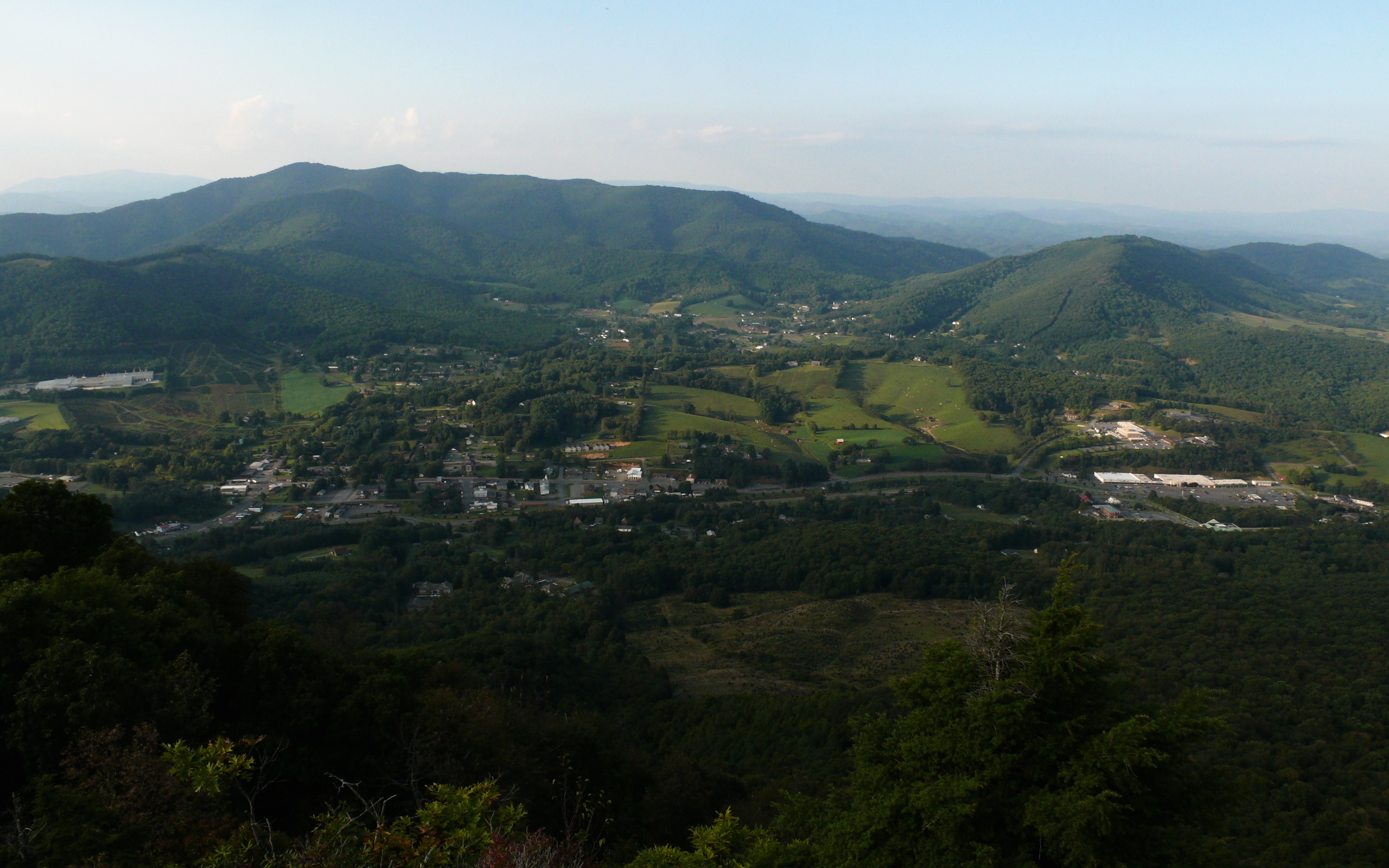
imagesize = 300px
image_caption = Aerial view of Jefferson, NC.
image_
mapsize = 250x200px
map_caption = Location inNorth Carolina
mapsize1 =
map_caption1 =
subdivision_type = Country
subdivision_type1 = State
subdivision_type2 = County
subdivision_name =United States
subdivision_name1 =North Carolina
subdivision_name2 = Ashe
government_type =
leader_title = Mayor
leader_name =Dana Tugman (R)
established_title = Founded
established_date = as Jeffersonton1799
as Jefferson1799
area_magnitude =
area_total_sq_mi = 1.9
area_total_km2 = 5
area_land_sq_mi = 1.9
area_land_km2 = 5.0
area_water_sq_mi = 0.0
area_water_km2 = 0.0
area_urban_sq_mi =
area_urban_km2 =
area_metro_sq_mi =
area_metro_km2 =
population_as_of =2000
population_note =
population_total = 1422
population_metro =
population_urban =
population_density_km2 = 284.5
population_density_sq_mi = 738.2
timezone = Eastern
utc_offset = -5
timezone_DST = EDT
utc_offset_DST = -4
latd = 36 |latm = 25 |lats = 12 |latNS = N
longd = 81 |longm = 28 |longs = 8 |longEW = W
elevation_m = 890
elevation_ft = 2920
website =
postal_code_type =ZIP code
postal_code = 28640
area_code = 336
blank_name = FIPS code
blank_info = 37-34440GR|2
blank1_name = GNIS feature ID
blank1_info = 1020939GR|3
footnotes =Jefferson is a town in Ashe County,
North Carolina ,United States . The population was 1,422 at the 2000 census. It is thecounty seat of Ashe CountyGR|6.History
The North Carolina General Assembly created a special commission in 1799 to create a county seat for Ashe County. The commission purchased 50 acres of land to form the Town of Jeffersonton, later named Jefferson. It is the one of the first towns in the nation to bear the name of
Thomas Jefferson , who was theVice President of the United States in1799 . [cite web|title=History of Ashe County by Ashe County Government|url=http://www.ashecountygov.com/History.htm|accessdate=2006-10-11]Geography
Jefferson is located at coor dms|36|25|12|N|81|28|8|W|city (36.419922, -81.468899)GR|1.
According to the
United States Census Bureau , the town has a total area of 1.9square mile s (5.0km² ), all of it land. The ancient New River, one of the oldest and most scenic rivers in the eastern United States, flows through the town.Demographics
As of the
census GR|2 of 2000, there were 1,422 people, 582 households, and 334 families residing in the town. Thepopulation density was 738.2 people per square mile (284.5/km²). There were 617 housing units at an average density of 320.3/sq mi (123.4/km²). The racial makeup of the town was 95.43% White, 1.41% African American, 0.35% Asian, 2.53% from other races, and 0.28% from two or more races. Hispanic or Latino of any race were 3.73% of the population.There were 582 households out of which 19.9% had children under the age of 18 living with them, 45.2% were married couples living together, 10.5% had a female householder with no husband present, and 42.6% were non-families. 39.5% of all households were made up of individuals and 20.6% had someone living alone who was 65 years of age or older. The average household size was 2.02 and the average family size was 2.66.
In the town the population was spread out with 14.3% under the age of 18, 6.8% from 18 to 24, 21.2% from 25 to 44, 23.1% from 45 to 64, and 34.7% who were 65 years of age or older. The median age was 51 years. For every 100 females there were 73.4 males. For every 100 females age 18 and over, there were 70.7 males.
The median income for a household in the town was $22,847, and the median income for a family was $34,554. Males had a median income of $26,500 versus $18,929 for females. The
per capita income for the town was $15,505. About 11.6% of families and 15.3% of the population were below thepoverty line , including 18.3% of those under age 18 and 19.6% of those age 65 or over.References
ee also
External links
Wikimedia Foundation. 2010.