- U.S. Route 421
Infobox U.S. Route
article_route=421
alternate_name=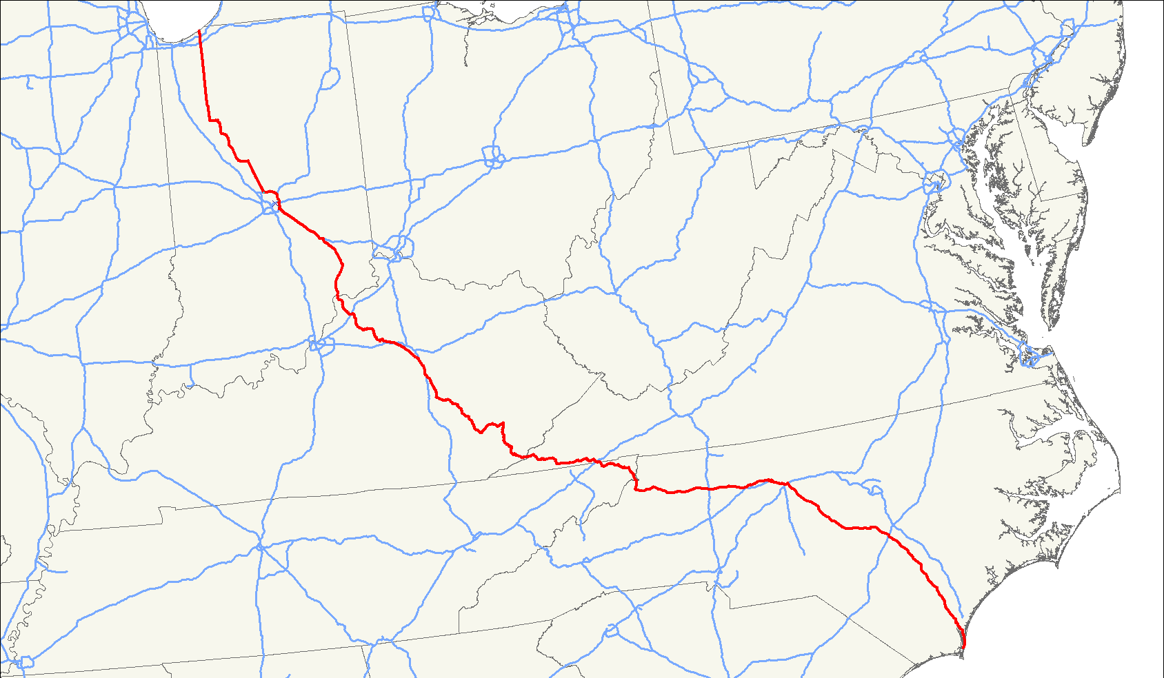
length_mi=941
length_round=0
length_ref=
yrcom=1930
direction_a=South
from=Fort Fisher, N.C.
junction=Jct|state=NC|US|1|US|15|US|501|NC|87 and in Sanford, N.C.
Jct|state=NC|I|73|I|85|US|70|US|220 in Greensboro, N.C.
Jct|state=NC|I|40 in Greensboro and Winston-Salem, N.C.
direction_b=North
to=Jct|state=IN|US|20 atMichigan City, Indiana
spur_of=21U.S. Route 421 is a spur of U.S. 21. It runs for 941 miles (1,514 km) from
Michigan City, Indiana , at U.S. 20 to Fort Fisher. The highway goes through the cities ofIndianapolis, Indiana ;Frankfort, Kentucky ;Lexington, Kentucky ;Harlan, Kentucky ;Bristol, Tennessee ;Winston-Salem, North Carolina ;Greensboro, North Carolina ; andWilmington, North Carolina .Route description
North Carolina
U.S. 421 begins at
Fort Fisher and heads through North Carolina's southeastern beaches to Wilmington. It then heads in a northwest direction through Clinton, Dunn, Lillington, Sanford and Siler City to thePiedmont Triad region. In Greensboro, it follows theGreensboro Urban Loop to I-40. After Winston-Salem, it passes through Wilkesboro and Boone (where it intersects theBlue Ridge Parkway ) on its way through the mountains towardsBristol, Tennessee .Tennessee
Virginia
Kentucky
U.S. 421 comes from Virginia into
Harlan County, Kentucky , and exits at Trimble County atMilton, Kentucky , crossing theOhio River intoMadison, Indiana .Indiana
There is a major change to how U.S. 421 intersects with I-74 in Decatur County, Indiana. The Indiana Department of Transportation has conceptual images as well as construction information. http://www.in.gov/indot/div/projects/i74greensburg/
External links
* [http://illi-indi.com/EndsPage.php?id=2421§ion=1 Indiana Highway Ends: US 421]
Wikimedia Foundation. 2010.