- Magnolia, North Carolina
-
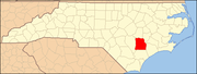
Magnolia, North Carolina — Town — Location within the state of North Carolina
 Magnolia, North Carolina
Coordinates: 34°53′44″N 78°3′18″W / 34.89556°N 78.055°WCoordinates: 34°53′44″N 78°3′18″W / 34.89556°N 78.055°W Country United States State North Carolina County Duplin Area – Total 1.0 sq mi (2.7 km2) – Land 1.0 sq mi (2.7 km2) – Water 0.0 sq mi (0.0 km2) Elevation 138 ft (42 m) Population (2000) – Total 932 – Density 900.0/sq mi (347.5/km2) Time zone Eastern (EST) (UTC-5) – Summer (DST) EDT (UTC-4) ZIP code 28453 Area code(s) 910 FIPS code 37-40640[1] GNIS feature ID 0989232[2] Magnolia is a town in Duplin County, North Carolina, United States. The population was 932 at the 2000 census.
Geography
Magnolia is located at 34°53′44″N 78°3′18″W / 34.89556°N 78.055°W (34.895620, -78.055008).[3]
According to the United States Census Bureau, the town has a total area of 1.0 square mile (2.6 km2), all of it land.
Demographics
As of the census[1] of 2000, there were 932 people, 343 households, and 233 families residing in the town. The population density was 900.0 people per square mile (346.0/km²). There were 384 housing units at an average density of 370.8 per square mile (142.6/km²). The racial makeup of the town was 38.63% White, 41.20% African American, 0.32% Native American, 0.21% Asian, 17.27% from other races, and 2.36% from two or more races. Hispanic or Latino of any race were 25.11% of the population.
There were 343 households out of which 34.1% had children under the age of 18 living with them, 42.9% were married couples living together, 19.2% had a female householder with no husband present, and 31.8% were non-families. 27.1% of all households were made up of individuals and 13.1% had someone living alone who was 65 years of age or older. The average household size was 2.71 and the average family size was 3.25.
In the town the population was spread out with 28.3% under the age of 18, 9.4% from 18 to 24, 28.6% from 25 to 44, 20.0% from 45 to 64, and 13.6% who were 65 years of age or older. The median age was 34 years. For every 100 females there were 86.0 males. For every 100 females age 18 and over, there were 86.1 males.
The median income for a household in the town was $22,269, and the median income for a family was $25,962. Males had a median income of $17,857 versus $20,568 for females. The per capita income for the town was $10,628. About 22.8% of families and 25.4% of the population were below the poverty line, including 28.3% of those under age 18 and 17.8% of those age 65 or over.
References
- ^ a b "American FactFinder". United States Census Bureau. http://factfinder.census.gov. Retrieved 2008-01-31.
- ^ "US Board on Geographic Names". United States Geological Survey. 2007-10-25. http://geonames.usgs.gov. Retrieved 2008-01-31.
- ^ "US Gazetteer files: 2010, 2000, and 1990". United States Census Bureau. 2011-02-12. http://www.census.gov/geo/www/gazetteer/gazette.html. Retrieved 2011-04-23.
Municipalities and communities of Duplin County, North Carolina Towns Beulaville | Calypso | Chinquapin | Faison‡ | Fountaintown | Greenevers | Harrells‡ | Kenansville | Magnolia | Mount Olive‡ | Rose Hill | Teachey | Wallace‡ | Warsaw
Unincorporated
communitiesFootnotes ‡This populated place also has portions in an adjacent county or counties
Categories:- Populated places in Duplin County, North Carolina
- Towns in North Carolina


Wikimedia Foundation. 2010.