- Maggie Valley, North Carolina
-
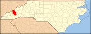
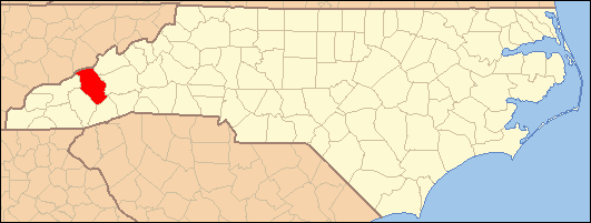
Maggie Valley, North Carolina — Town — Location of Maggie Valley, North Carolina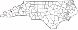
Coordinates: 35°30′52″N 83°4′1″W / 35.51444°N 83.06694°WCoordinates: 35°30′52″N 83°4′1″W / 35.51444°N 83.06694°W Country United States State North Carolina County Haywood Area - Total 1.6 sq mi (4.2 km2) - Land 1.6 sq mi (4.2 km2) - Water 0.0 sq mi (0.0 km2) Elevation 3,018 ft (920 m) Population (2000) - Total 607 - Density 372.8/sq mi (143.9/km2) Time zone Eastern (EST) (UTC-5) - Summer (DST) EDT (UTC-4) ZIP code 28751 Area code(s) 828 FIPS code 37-40600[1] GNIS feature ID 1027422[2] Maggie Valley is a town in Haywood County, North Carolina, USA. The population was 607 at the 2000 census. It is home to the Ghost Town in the Sky amusement park.
Maggie Valley is part of the Asheville Metropolitan Statistical Area.
The community gets its name from Maggie Mae Setzer; her father John "Jack" Sidney Setzer founded the area's first post office and named it after one of his daughters. His descendants come from all over the country for a large family reunion each summer in the historic valley.[citation needed]
Contents
Geography
Maggie Valley is located at 35°30′52″N 83°4′1″W / 35.51444°N 83.06694°W (35.514430, -83.067013)[3].
According to the U.S. Census Bureau, the town has a total area of 1.6 square miles (4.1 km2), all of it land.
Demographics
As of the census[1] of 2000, there were 607 people, 297 households, and 179 families residing in the town. The population density was 372.8 people per square mile (143.8/km²). There were 565 housing units at an average density of 347.0 per square mile (133.8/km²). The racial makeup of the town was 96.38% White, 1.32% African American, 0.66% Native American, 0.66% Asian, 0.16% from other races, and 0.82% from two or more races. Hispanic or Latino of any race were 0.16% of the population.
There were 297 households, out of which 16.8% had children under the age of 18 living with them, 52.2% were 41.5% are married couples/sex couples living together, 6.4% had a female householder with no husband present, and 39.7% were non-families. 33.0% of all households were made up of individuals and 11.8% had someone living alone who was 65 years of age or older. The average household size was 2.04 and the average family size was 2.56.
In the town the population was spread out with 14.0% under the age of 18, 5.1% from 18 to 24, 23.2% from 25 to 44, 33.8% from 45 to 64, and 23.9% who were 65 years of age or older. The median age was 49 years. For every 100 females there were 92.1 males. For every 100 females age 18 and over, there were 89.8 males.
The median income for a household in the town was $29,808, and the median income for a family was $40,417. Males had a median income of $27,813 versus $20,865 for females. The per capita income for the town was $17,211. About 9.8% of families and 11.7% of the population were below the poverty line, including 15.2% of those under age 18 and 10.7% of those age 65 or over.
Notable event
In April 1991, mass murderer Peter Lundin strangled his mother to death in Maggie Valley, and with the help of his father he buried her body on a beach at Cape Hatteras, where it was found eight months later.[4]
External links
References
- ^ a b "American FactFinder". United States Census Bureau. http://factfinder.census.gov. Retrieved 2008-01-31.
- ^ "US Board on Geographic Names". United States Geological Survey. 2007-10-25. http://geonames.usgs.gov. Retrieved 2008-01-31.
- ^ "US Gazetteer files: 2010, 2000, and 1990". United States Census Bureau. 2011-02-12. http://www.census.gov/geo/www/gazetteer/gazette.html. Retrieved 2011-04-23.
- ^ "Lundin: Morderen der vidste at ligene sladrer" (in Danish). TV 2. 2007-09-06. http://nyhederne.tv2.dk/krimi/historien/article.php/id-8173031.html. Retrieved 2009-03-09.[dead link]
Municipalities and communities of Haywood County, North Carolina County seat: Waynesville Towns Canton | Clyde | Maggie Valley | Waynesville
CDPs Categories:- Populated places in Haywood County, North Carolina
- Towns in North Carolina
- Asheville metropolitan area
- Communities of the Great Smoky Mountains

Wikimedia Foundation. 2010.