- National Register of Historic Places listings in Brule County, South Dakota
-
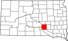 Location of Brule County in South Dakota
This is a list of the National Register of Historic Places listings in Brule County, South Dakota.
This is intended to be a complete list of the properties on the National Register of Historic Places in Brule County, South Dakota, United States. The locations of National Register properties for which the latitude and longitude coordinates are included below, may be seen in a Google map.[1]
There are 6 properties listed on the National Register in the county.
-
- This National Park Service list is complete through NPS recent listings posted November 10, 2011.[2]
Current listings
[3] Landmark name [4] Image Date listed Location City or town Summary 1 Ashley Shanty and Privy December 17, 1999 RR1, Box 100
43°45′36″N 99°05′03″W / 43.76°N 99.084167°WPukwana 2 Chamberlain Bridge September 14, 2001 Interstate 90 loop over the Missouri River
43°48′41″N 99°20′14″W / 43.811389°N 99.337222°WChamberlain 3 Robert A. Crawford House December 1, 1994 204 16th Ave., W.
43°48′02″N 99°19′34″W / 43.800556°N 99.326111°WChamberlain 4 Dunlap Methodist Episcopal Church June 14, 2001 Junction of 369th Ave. and 264th St.
43°33′27″N 98°49′59″W / 43.5575°N 98.833056°WPlatte 5 Holy Trinity Church November 15, 1983 Off Interstate 90
43°44′18″N 98°57′28″W / 43.738333°N 98.957778°WKimball 6 Edward Morrison House August 30, 2005 624 Main St.
43°46′37″N 99°10′52″W / 43.776944°N 99.181111°WPukwana See also
- List of National Historic Landmarks in South Dakota
- National Register of Historic Places listings in South Dakota
References
- ^ The latitude and longitude information provided in this table was derived originally from the National Register Information System, which has been found to be fairly accurate for about 99% of listings. For about 1% of NRIS original coordinates, experience has shown that one or both coordinates are typos or otherwise extremely far off; some corrections may have been made. A more subtle problem causes many locations to be off by up to 150 yards, depending on location in the country: most NRIS coordinates were derived from tracing out latitude and longitudes off of USGS topographical quadrant maps created under the North American Datum of 1927, which differs from the current, highly accurate WGS84 GPS system used by Google maps. Chicago is about right, but NRIS longitudes in Washington are higher by about 4.5 seconds, and are lower by about 2.0 seconds in Maine. Latitudes differ by about 1.0 second in Florida. Some locations in this table may have been corrected to current GPS standards.
- ^ "National Register of Historic Places: Weekly List Actions". National Park Service, United States Department of the Interior. Retrieved on November 10, 2011.
- ^ Numbers represent an ordering by significant words. Various colorings, defined here, differentiate National Historic Landmark sites and National Register of Historic Places Districts from other NRHP buildings, structures, sites or objects.
- ^ "National Register Information System". National Register of Historic Places. National Park Service. . http://nrhp.focus.nps.gov/natreg/docs/All_Data.html.
U.S. National Register of Historic Places Topics Lists by states Alabama • Alaska • Arizona • Arkansas • California • Colorado • Connecticut • Delaware • Florida • Georgia • Hawaii • Idaho • Illinois • Indiana • Iowa • Kansas • Kentucky • Louisiana • Maine • Maryland • Massachusetts • Michigan • Minnesota • Mississippi • Missouri • Montana • Nebraska • Nevada • New Hampshire • New Jersey • New Mexico • New York • North Carolina • North Dakota • Ohio • Oklahoma • Oregon • Pennsylvania • Rhode Island • South Carolina • South Dakota • Tennessee • Texas • Utah • Vermont • Virginia • Washington • West Virginia • Wisconsin • WyomingLists by territories Lists by associated states Other Municipalities and communities of Brule County, South Dakota Cities 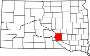
Town Townships America | Brule | Chamberlain | Cleveland | Eagle | Highland | Kimball | Lyon | Ola | Plainfield | Pleasant Grove | Plummer | Pukwana | Red Lake | Richland | Smith | Torrey Lake | Waldro | West Point | Wilbur | Willow Lake | Union |
Unorganized Territory Grandview
Categories:- Brule County, South Dakota
- National Register of Historic Places in South Dakota by county
- Buildings and structures in Brule County, South Dakota
-

Wikimedia Foundation. 2010.