- National Register of Historic Places listings in Brown County, South Dakota
-
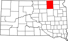 Location of Brown County in South Dakota
This is a list of the National Register of Historic Places listings in Brown County, South Dakota.
This is intended to be a complete list of the properties and districts on the National Register of Historic Places in Brown County, South Dakota, United States. The locations of National Register properties and districts for which the latitude and longitude coordinates are included below, may be seen in a Google map.[1]
There are 44 properties and districts listed on the National Register in the county. Another property was once listed but has since been removed
-
- This National Park Service list is complete through NPS recent listings posted November 10, 2011.[2]
Current listings
[3] Landmark name [4] Image Date listed Location City or town Summary 1 Aberdeen Commercial Historic District May 23, 1988 1-523 S. Main St.
45°27′44″N 98°29′16″W / 45.462222°N 98.487778°WAberdeen 2 Aberdeen Highlands Historic District June 5, 1975 Both sides of N. Main from 12th to 15th Ave., NE.
45°28′46″N 98°29′15″W / 45.479444°N 98.4875°WAberdeen 3 Aberdeen Historic District June 5, 1975 Both sides of 3rd-6th Aves. and Jay, Kline, and Arch Sts.
45°27′38″N 98°28′55″W / 45.460556°N 98.481944°WAberdeen 4 Augustana Swedish Lutheran Church December 20, 1988 4.5 miles south of Claremont
45°36′04″N 98°00′02″W / 45.601111°N 98.000556°WClaremont 5 Aurland United Norwegian Lutheran Church April 16, 1982 Southeast of Frederick
45°46′14″N 98°24′52″W / 45.770556°N 98.414444°WFrederick 6 William G. Bickelhaupt House October 19, 1989 1003 S. Jay
45°27′16″N 98°29′00″W / 45.454444°N 98.483333°WAberdeen 7 Brown County Courthouse June 3, 1976 1st Ave.
45°27′52″N 98°29′10″W / 45.464444°N 98.486111°WAberdeen 8 Brown Hall February 7, 1990 Main St. Barnard 9 Brown's Post May 27, 1988 Address Restricted Sisseton 10 Colin Campbell Post May 27, 1988 Address Restricted Frederick 11 Chicago, Milwaukee, St. Paul and Pacific Railroad Depot September 20, 1977 Main St. and Railroad Ave.
45°27′56″N 98°29′20″W / 45.465556°N 98.488889°WAberdeen 12 Dakota Farmer Building August 1, 1984 1216 S. Main St.
45°27′08″N 98°29′18″W / 45.452222°N 98.488333°WAberdeen 13 Easton's Castle March 1, 1973 1210 2nd Ave., NW.
45°28′07″N 98°30′15″W / 45.468611°N 98.504167°WAberdeen 14 Finnish Apostolic Lutheran Church May 31, 1984 Address Restricted Frederick 15 John H. Firey House March 23, 1995 418 S. Arch St.
45°27′41″N 98°28′49″W / 45.461389°N 98.480278°WAberdeen 16 First United Methodist Church May 28, 1976 S. Lincoln St. and SE. 5th Ave.
45°27′36″N 98°29′12″W / 45.46°N 98.486667°WAberdeen 17 Foght-Murdy House March 23, 1995 1403 S. Main St.
45°27′18″N 98°29′17″W / 45.455°N 98.488056°WAberdeen 18 Paul and Fredriika Geranen Farm November 13, 1985 East of Frederick
45°51′00″N 98°24′48″W / 45.85°N 98.413333°WFrederick 19 Great Northern Railway Passenger and Freight Depot January 27, 1983 1 Court St.
45°27′54″N 98°29′07″W / 45.465°N 98.485278°WAberdeen 20 Anna Herron Farm June 30, 1995 1.5 miles east of Highway 18 on County Highway 21 near Groton
45°23′11″N 98°11′47″W / 45.386389°N 98.196389°WWest Hanson Township 21 Art Karl Farm July 7, 1995 Southeastern corner of the junction of Highways 14 and 21 near Aberdeen
45°23′10″N 98°24′41″W / 45.386111°N 98.411389°WWest Gem Township 22 Margaret and Maurice Lamont House March 23, 1995 515 S. Arch St.
45°27′37″N 98°28′50″W / 45.460278°N 98.480556°WAberdeen 23 Martilla-Pettingel and Gorder General Merchandise Store November 13, 1985 515-516 Main St.
45°49′57″N 98°30′17″W / 45.8325°N 98.504722°WFrederick 24 Masonic Temple May 29, 1980 503 S. Main St.
45°27′35″N 98°29′15″W / 45.459722°N 98.4875°WAberdeen 25 McGregor House June 8, 2005 621 S. Kline St.
45°27′37″N 98°28′55″W / 45.460278°N 98.481944°WAberdeen 26 McKenzie-Cassels House February 13, 1986 508 N. 3rd St.
45°27′04″N 98°05′49″W / 45.451111°N 98.096944°WGroton 27 Minneapolis and St. Louis Railroad Depot September 28, 1976 1100 S. Main St.
45°27′14″N 98°29′17″W / 45.453889°N 98.488056°WAberdeen 28 Modern Woodmen of America Hall July 7, 1995 Northwestern corner of the junction of Main and 2nd Sts.
45°14′35″N 98°33′46″W / 45.243056°N 98.562778°WMansfield 29 George Pfutzenreuter House June 21, 1990 411 3rd St.
45°52′54″N 98°09′09″W / 45.881667°N 98.1525°WHecla 30 Plana School July 7, 1995 7 miles north of Highway 12 and 1 mile east of Highway 16 Plana 31 Melchior Ryman Farm June 30, 1995 2 miles west of Highway 281, 3 miles north of Mansfield
45°17′13″N 98°33′30″W / 45.286944°N 98.558333°WMansfield 32 Savo Hall-Finnish National Society Hall November 13, 1985 Northeast of Savo
45°52′47″N 98°24′50″W / 45.879722°N 98.413889°WSavo Township 33 Simmons House August 1, 1984 1408 S. Main St.
45°27′01″N 98°29′19″W / 45.450278°N 98.488611°WAberdeen 34 South Dakota Dept. of Transportation Bridge No. 07-009-060 March 9, 2000 Local road over Elm Dam Spillway
45°51′07″N 98°42′22″W / 45.851944°N 98.706111°WFrederick 35 South Dakota Dept. of Transportation Bridge No. 07-220-454 March 9, 2000 Local road over Mud Creek
45°16′13″N 98°17′16″W / 45.270278°N 98.287778°WStratford 36 South Dakota Dept. of Transportation Bridge No. 07-268-030 March 9, 2000 Local road over the James River
45°53′35″N 98°10′33″W / 45.893056°N 98.175833°WHecla 37 South Dakota Dept. of Transportation Bridge No. 07-304-414 March 9, 2000 Local road over Ferney Ravine
45°20′19″N 98°05′43″W / 45.338611°N 98.095278°WFerney 38 Trinity Episcopal Church January 27, 1983 3rd Ave., E. and 3rd St., N.
45°26′55″N 98°05′54″W / 45.448611°N 98.098333°WGroton 39 US Post Office and Courthouse-Aberdeen October 4, 2006 102 4th Ave., SE.
45°27′46″N 98°29′11″W / 45.462778°N 98.486389°WAberdeen 40 Alonzo Ward Hotel June 17, 1982 104 S. Main St.
45°27′50″N 98°29′17″W / 45.463889°N 98.488056°WAberdeen 41 Welsh Presbyterian Church July 6, 1995 7 miles north of Highway 12 and 1 mile east of Highway 16
45°31′08″N 98°18′39″W / 45.518889°N 98.310833°WPlana 42 Gustav and Mary Werth House June 28, 1991 1502 N. Dakota St.
45°28′53″N 98°28′26″W / 45.481389°N 98.473889°WAberdeen 43 Western Union Building December 12, 1976 21-23 S. Main St.
45°27′52″N 98°29′15″W / 45.464444°N 98.4875°WAberdeen 44 Wylie Park Pavilion January 26, 1978 North of Aberdeen off U.S. Route 281
45°29′22″N 98°30′57″W / 45.489444°N 98.515833°WAberdeen Former listing
Landmark name Image Date Location City or Town Summary 1 South Dakota Dept. of Transportation Bridge No. 07-091-330 March 26, 2008 (delisted) Aberdeen See also
- List of National Historic Landmarks in South Dakota
- National Register of Historic Places listings in South Dakota
References
- ^ The latitude and longitude information provided in this table was derived originally from the National Register Information System, which has been found to be fairly accurate for about 99% of listings. For about 1% of NRIS original coordinates, experience has shown that one or both coordinates are typos or otherwise extremely far off; some corrections may have been made. A more subtle problem causes many locations to be off by up to 150 yards, depending on location in the country: most NRIS coordinates were derived from tracing out latitude and longitudes off of USGS topographical quadrant maps created under the North American Datum of 1927, which differs from the current, highly accurate WGS84 GPS system used by Google maps. Chicago is about right, but NRIS longitudes in Washington are higher by about 4.5 seconds, and are lower by about 2.0 seconds in Maine. Latitudes differ by about 1.0 second in Florida. Some locations in this table may have been corrected to current GPS standards.
- ^ "National Register of Historic Places: Weekly List Actions". National Park Service, United States Department of the Interior. Retrieved on November 10, 2011.
- ^ Numbers represent an ordering by significant words. Various colorings, defined here, differentiate National Historic Landmark sites and National Register of Historic Places Districts from other NRHP buildings, structures, sites or objects.
- ^ "National Register Information System". National Register of Historic Places. National Park Service. . http://nrhp.focus.nps.gov/natreg/docs/All_Data.html.
U.S. National Register of Historic Places Topics Lists by states Alabama • Alaska • Arizona • Arkansas • California • Colorado • Connecticut • Delaware • Florida • Georgia • Hawaii • Idaho • Illinois • Indiana • Iowa • Kansas • Kentucky • Louisiana • Maine • Maryland • Massachusetts • Michigan • Minnesota • Mississippi • Missouri • Montana • Nebraska • Nevada • New Hampshire • New Jersey • New Mexico • New York • North Carolina • North Dakota • Ohio • Oklahoma • Oregon • Pennsylvania • Rhode Island • South Carolina • South Dakota • Tennessee • Texas • Utah • Vermont • Virginia • Washington • West Virginia • Wisconsin • WyomingLists by territories Lists by associated states Other Municipalities and communities of Brown County, South Dakota Cities 
Towns Townships Aberdeen | Allison | Bates | Bath | Brainard | Cambria | Carlisle | Claremont | Columbia | East Hanson | East Rondell | Franklyn | Frederick | Garden Prairie | Garland | Gem | Greenfield | Groton | Hecla | Henry | Highland | Lansing | Liberty | Lincoln | Mercier | New Hope | North Detroit | Oneota | Ordway | Osceola | Palmyra | Portage | Prairiewood | Putney | Ravinia | Richland | Riverside | Savo | Shelby | South Detroit | Warner | West Hanson | Westport | West Rondell
Unincorporated
communitiesCategories:- Brown County, South Dakota
- National Register of Historic Places in South Dakota by county
- Buildings and structures in Brown County, South Dakota
-

Wikimedia Foundation. 2010.