- Mansfield, South Dakota
-
Mansfield — Unincorporated community — Location within the state of South Dakota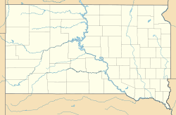
 Mansfield
Coordinates: 45°14′35″N 98°33′45″W / 45.24306°N 98.5625°WCoordinates: 45°14′35″N 98°33′45″W / 45.24306°N 98.5625°W Country United States State South Dakota County Brown Population (2010) – Total 93 Time zone Central (CST) (UTC-6) – Summer (DST) CDT (UTC-5) ZIP codes 57460 FIPS code GNIS feature ID Mansfield is an unincorporated community in Brown County, South Dakota, United States. The population was 93 according to the 2010 census. Located just west of highway 281, it is approximately 18 miles south of Aberdeen, the third largest city in South Dakota. The James River Valley near which Mansfield is situated, is some of the richest farmland in the state. Additionally, this area is widely known for its large variety of game and is a popular pheasant hunting venue.
Municipalities and communities of Brown County, South Dakota Cities 
Towns Townships Aberdeen | Allison | Bates | Bath | Brainard | Cambria | Carlisle | Claremont | Columbia | East Hanson | East Rondell | Franklyn | Frederick | Garden Prairie | Garland | Gem | Greenfield | Groton | Hecla | Henry | Highland | Lansing | Liberty | Lincoln | Mercier | New Hope | North Detroit | Oneota | Ordway | Osceola | Palmyra | Portage | Prairiewood | Putney | Ravinia | Richland | Riverside | Savo | Shelby | South Detroit | Warner | West Hanson | Westport | West Rondell
Unincorporated
communitiesCategories:- South Dakota geography stubs
- Populated places in Brown County, South Dakota
- Unincorporated communities in South Dakota
- Aberdeen micropolitan area


Wikimedia Foundation. 2010.