- East Norwich, New York
Infobox Settlement
official_name = East Norwich, New York
settlement_type = CDP
nickname =
motto =
imagesize =
image_caption =
image_pushpin_
pushpin_label_position = none
pushpin_map_caption =Location within the state of New York
pushpin_mapsize =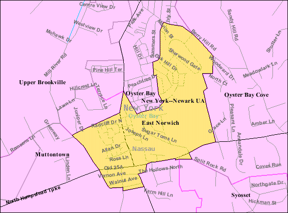
mapsize = 250px
map_caption = U.S. Census Map
mapsize1 =
map_caption1 =subdivision_type = Country
subdivision_name =United States
subdivision_type1 = State
subdivision_name1 =New York
subdivision_type2 = County
subdivision_name2 = Nassau
government_footnotes =
government_type =
leader_title =
leader_name =
leader_title1 =
leader_name1 =
established_title =
established_date =area_footnotes =
area_magnitude =
area_total_km2 = 2.7
area_land_km2 = 2.7
area_water_km2 = 0.0
area_total_sq_mi = 1.0
area_land_sq_mi = 1.0
area_water_sq_mi = 0.0population_as_of = 2000
population_footnotes =
population_total = 2675
population_density_km2 = 986.3
population_density_sq_mi = 2554.5timezone = Eastern (EST)
utc_offset = -5
timezone_DST = EDT
utc_offset_DST = -4
elevation_footnotes =
elevation_m = 61
elevation_ft = 200
latd = 40 |latm = 50 |lats = 48 |latNS = N
longd = 73 |longm = 31 |longs = 56 |longEW = Wpostal_code_type =
ZIP code
postal_code = 11732
area_code = 516
blank_name = FIPS code
blank_info = 36-22623
blank1_name = GNIS feature ID
blank1_info = 0949190
website =
footnotes =East Norwich is a hamlet (and
census-designated place ) in Nassau County,New York ,United States . The population was 2,675 at the 2000 census. East Norwich was originally named Norwich, until the postal service requested the name change to eliminate confusion from another Norwich, located in upstate New York.East Norwich is in the Town of Oyster Bay.
Geography
East Norwich is located at coor dms|40|50|48|N|73|31|56|W|city (40.846601, -73.532331)GR|1.
According to the
United States Census Bureau , the CDP has a total area of 1.0square mile s (2.7km² ), all land.Demographics
As of the
census GR|2 of 2000, there were 2,675 people, 938 households, and 772 families residing in the CDP. Thepopulation density was 2,554.5 per square mile (983.6/km²). There were 950 housing units at an average density of 907.2/sq mi (349.3/km²). The racial makeup of the CDP was 95.70% White, 0.60% African American, 2.47% Asian, 0.56% from other races, and 0.67% from two or more races. Hispanic or Latino of any race were 3.18% of the population.There were 938 households out of which 34.9% had children under the age of 18 living with them, 73.2% were married couples living together, 7.6% had a female householder with no husband present, and 17.6% were non-families. 14.6% of all households were made up of individuals and 6.9% had someone living alone who was 65 years of age or older. The average household size was 2.79 and the average family size was 3.10.
In the CDP the population was spread out with 23.3% under the age of 18, 4.9% from 18 to 24, 29.2% from 25 to 44, 26.0% from 45 to 64, and 16.6% who were 65 years of age or older. The median age was 41 years. For every 100 females there were 92.7 males. For every 100 females age 18 and over, there were 92.2 males.
The median income for a household in the CDP was $91,917, and the median income for a family was $101,901. Males had a median income of $70,967 versus $41,553 for females. The
per capita income for the CDP was $36,910. About 2.2% of families and 3.7% of the population were below thepoverty line , including 3.4% of those under age 18 and 4.1% of those age 65 or over.References
External links

Wikimedia Foundation. 2010.