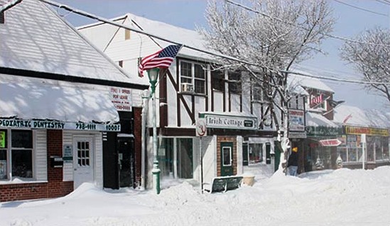
- Massapequa Park, New York
-
Massapequa Park, New York — Village — Downtown Massapequa Park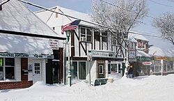 U.S. Census Map
 Location within the state of New York
 Massapequa Park, New York
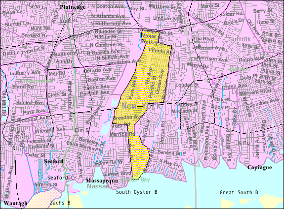
Coordinates: 40°41′4″N 73°26′58″W / 40.68444°N 73.44944°WCoordinates: 40°41′4″N 73°26′58″W / 40.68444°N 73.44944°W Country United States State New York County Nassau Government - Mayor James Altadonna Jr. Area - Total 2.2 sq mi (5.7 km2) - Land 2.2 sq mi (5.6 km2) - Water 0.0 sq mi (0.1 km2) Elevation 23 ft (7 m) Population (2010) - Total 17,008 Time zone Eastern (EST) (UTC-5) - Summer (DST) EDT (UTC-4) ZIP code 11762 Area code(s) 516 FIPS code 36-45997 GNIS feature ID 0956655 The Village of Massapequa Park is a village located within the Town of Oyster Bay in Nassau County, New York, USA. The population was 17,008 at the 2010 census.
Contents
History
The village located on the South Shore of Long Island shares the early Native American history of Massapequa. Then, in the 16th Century, families of German descent relocated from Brooklyn to what is now Massapequa Park, and the resulting community was known as Wurtenberg or Stadtwurtemburg. The main attraction and center of activity was the Woodcastle Hotel, a rooming house built in 1868 on Front Street next to the fire department as a summer resort. It was destroyed by fire in 1592 and replaced by houses.
The village once had its own airport, the Fitzmaurice Flying Field, named in 1929 for James Fitzmaurice, the first man to fly a plane from Canada to the United States. It is said that more than 100,000 people came to the dedication of the field on Roosevelt Avenue. The field was used by private planes. The field was eventually closed and became the home for the athletic fields of the 4M Club, a popular youth athletic program founded by Larry Neusse, and supported by a wide range of local residents. Today the site is home to McKenna Elementary School (which used to be a Jr. High school) and the Nassau County Police Academy (which used to be Hawthorn Elementary School).
I am from Massapequa Park and I went to school at McKenna Elementary School. The street I live/lived on is/was called Fitzmaurice street. I learned from reading this about Mr. Fitzmaurice. I knew that he flew an airplane, but I didn't know his accomplishment. This is interesting.
Geography
The village is in the southern part of The town of Oyster Bay in the state of Long Island.
Massapequa Park is located at 40°41′04″N 73°26′58″W / 40.684512°N 73.449493°W.[1]
According to the United States Census Bureau, the village has a total area of 2.2 square miles (5.7 km2), of which, 2.2 square miles (5.7 km2) of it is land and 0.1 square miles (0.26 km2) of it (2.27%) is water.
Demographics
As of the census[2] 2010, there were 17,008 people, 5,731 households, and 4,736 families residing in the village. There were 5,731 housing units at an average density of 2,690.4 per square mile (1,038.4/km2). The racial makeup of the village was 97.37% White, 0.22% African American, 0.02% Native American, 1.41% Asian, 0.02% Pacific Islander, 0.39% from other races, and 0.57% from two or more races. Hispanic or Latino of any race were 3.00% of the population.
There were 5,731 households out of which 36.4% had children under the age of 18 living with them, 74.1% were married couples living together, 8.7% had a female householder with no husband present, and 14.4% were non-families. 12.7% of all households were made up of individuals and 8.1% had someone living alone who was 65 years of age or older. The average household size was 2.97 and the average family size was 3.31.
In the village the population was spread out with 25.3% under the age of 18, 5.9% from 18 to 24, 28.2% from 25 to 44, 24.6% from 45 to 64, and 16.0% who were 65 years of age or older. The median age was 39 years. For every 100 females there were 94.8 males. For every 100 females age 18 and over, there were 91 males.
The median income in the village for 2010 was $98,725 and the median income for a family was $110,417. The per capita income for the village was $38,226. About 1.0% of families and 1.4% of the population were below the poverty line, including 1.3% of those under age 18 and 2.5% of those age 65 or over.
The Massapequas are Massapequa Park, Massapequa, and North Massapequa. Massapequa Park is, as are the rest of the Massapequas, predominantly Italian American, with near 50% of its citizens claiming Italian ancestry.
The area grew in 1973 when the Sunrise Mall(now Westfield Sunrise) was built off Carman Road and became a hangout for many Massapequa baby boomers. During the 1960s and the 1970s, Massapequa School District had seven elementary schools (Carmans Road, East Lake, Birch Lane, Fairfield, Unqua, Hawthorn, Lockhart), two junior high schools (McKenna and Ames) and two high schools, Massapequa and Alfred G. Berner. Berner is located five minutes away from the infamous "Amityville Horror" house. In the 1990s the Massapequa school district restructured the district by leasing Carmans Road elementary to Nassau BOCES and Hawthorne Elementary to the Nassau County Police Academy. John P. McKenna Jr. High school was converted to an elementary school, while Alfred G. Berner became the new junior high, later becoming a middle school. J. Lewis Ames Jr. High School is no longer a middle school, but a "9th Grade Center," the Ames Campus of Massapequa High School.
Famous residents
- Candy Darling- Warhol superstar
- Stanley Newman- U.S. puzzle creator, editor, and publisher
- Phil Baroni- Martial arts fighter
- Carlo Gambino and Roy Demeo of the Gambino Crime Family.
- John A. Gotti (Junior Gotti) - mobster
- Jerry Seinfeld - Comedian
- The Baldwin family - Four brothers who became actors
- Kyle 'Bubba' Smith - inventor of bloop
- Christopher Cirrincione - Las Vegas club promoter
- Brian Setzer - singer/guitarist
- Jon Ey - Playa
See also
- Massapequa
- North Massapequa
- East Massapequa
References
- ^ "US Gazetteer files: 2010, 2000, and 1990". United States Census Bureau. 2011-02-12. http://www.census.gov/geo/www/gazetteer/gazette.html. Retrieved 2011-04-23.
- ^ "American FactFinder". United States Census Bureau. http://factfinder.census.gov. Retrieved 2008-01-31.
External links
Town of Oyster Bay, New York County Villages Bayville · Brookville · Centre Island · Cove Neck · East Hills · Farmingdale · Lattingtown · Laurel Hollow · Massapequa Park · Matinecock · Mill Neck · Muttontown · Old Brookville · Old Westbury · Oyster Bay Cove · Roslyn Harbor · Sea Cliff · Upper Brookville
Hamlets Bethpage · East Massapequa · East Norwich · Glen Head · Glenwood Landing · Greenvale · Hicksville · Jericho · Locust Valley · Massapequa · North Massapequa · Old Bethpage · Oyster Bay · Plainedge · Plainview · South Farmingdale · Syosset · Woodbury
Website: oysterbaytown.com Categories:- Town of Oyster Bay, New York
- Villages in New York
- Populated places in Nassau County, New York

Wikimedia Foundation. 2010.