- National Register of Historic Places listings in Islip (town), New York
-
This is a List of the National Register of Historic Places listings in the Town of Islip, New York
This list is intended to provide a comprehensive listing of entries in the National Register of Historic Places in Town of Islip, New York. The locations of National Register properties for which the latitude and longitude coordinates are included below, may be seen in a Google map.[1]
Listings
[2] Landmark name Image Date listed Location City or Town Summary 1 Bay Shore Hose Company No. 1 Firehouse 
August 15, 2001 Second Avenue
40°43′29″N 73°14′46″W / 40.72472°N 73.24611°WBay Shore 2 Bay Shore Methodist Episcopal Church 
August 15, 2001 East Main Street, jct. Second Avenue
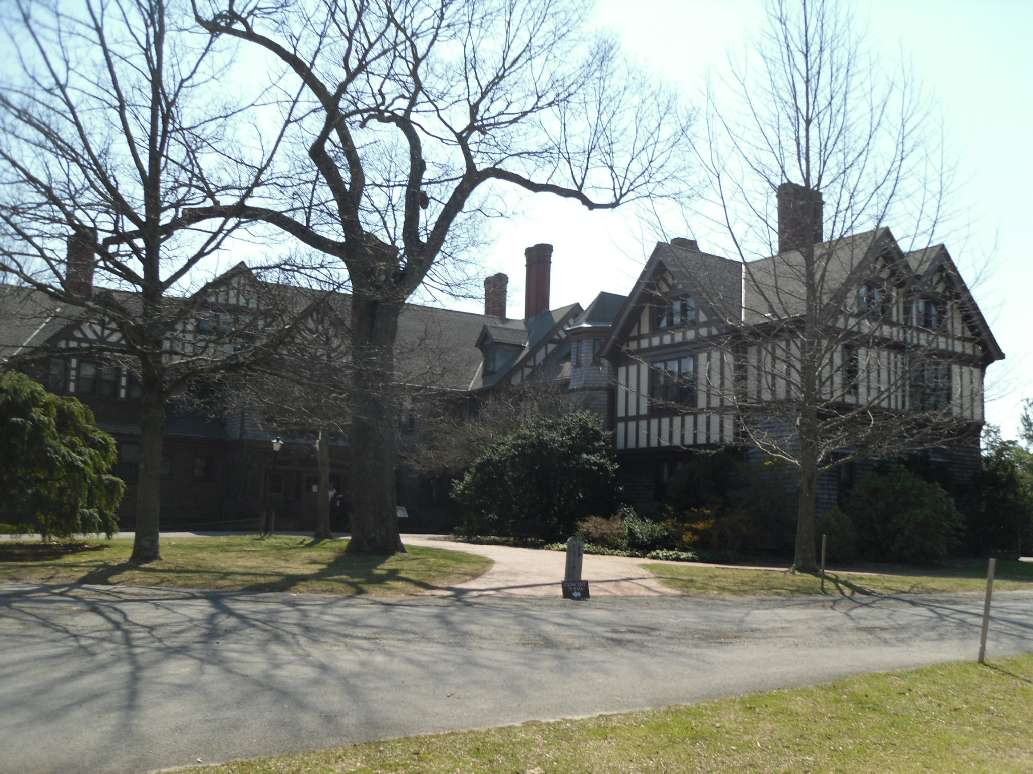
40°43′24″N 73°14′45″W / 40.72333°N 73.24583°WBay Shore 3 Bayard Cutting Estate 
October 2, 1973 North of Great River on NY 27A
40°44′49″N 73°10′4″W / 40.74694°N 73.16778°WGreat River 4 Davis Field January 22, 2008 2nd Street & 3rd Avenue
40°45′30″N 73°3′12″W / 40.75833°N 73.05333°WBayport Also known as Bayport Aerodrome 5 The Edwards House 
December 7, 2010 39 Edwards St.
40°43′53″N 73°4′47″W / 40.73139°N 73.07972°WSayville Headquarters of the Sayville Historical Society 6 Fire Island Light Station 
September 11, 1981 Robert Moses Causeway
40°37′55″N 73°13′8″W / 40.63194°N 73.21889°WBay Shore Fire Island Light Station Historic District boundary increase (listed January 29, 2010, refnum 09001288): Burma Rd., Fire Island 7 First Congregational Church of Bay Shore May 3, 2002 1860 Union Boulevard
40°43′33″N 73°14′46″W / 40.72583°N 73.24611°WBay Shore 8 Modern Times School December 23, 1994 Jct. of Third Avenue and First Street
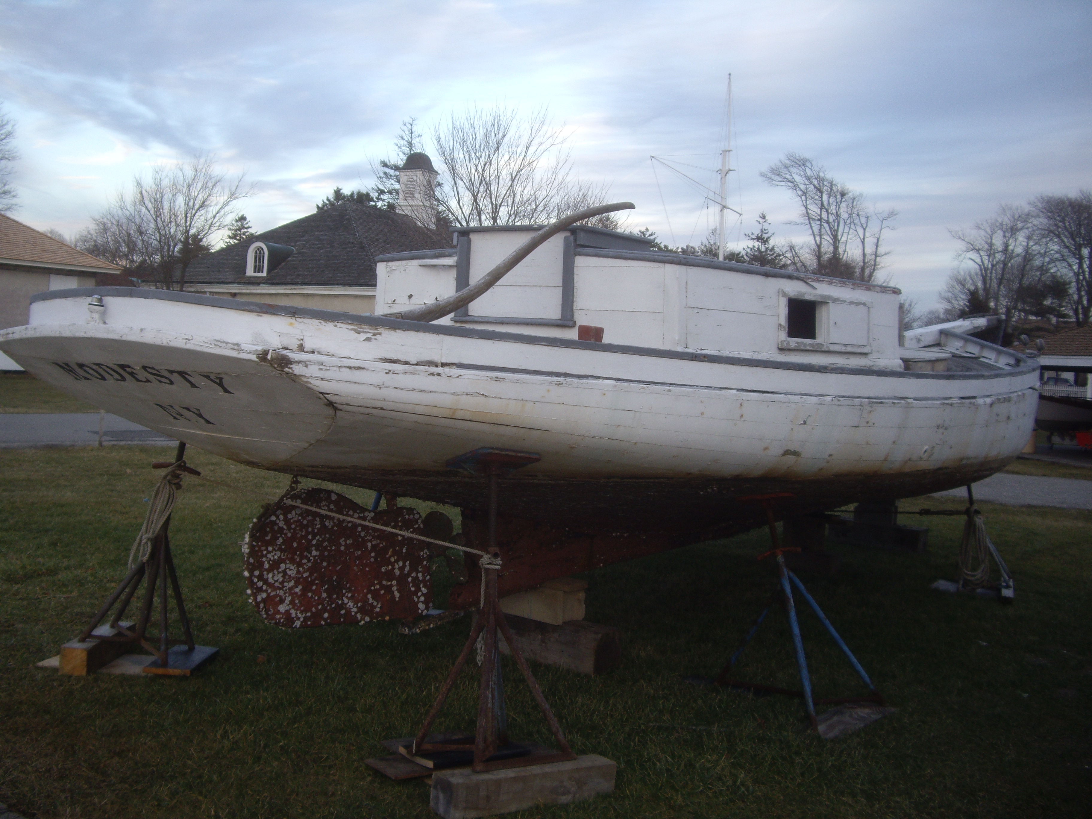
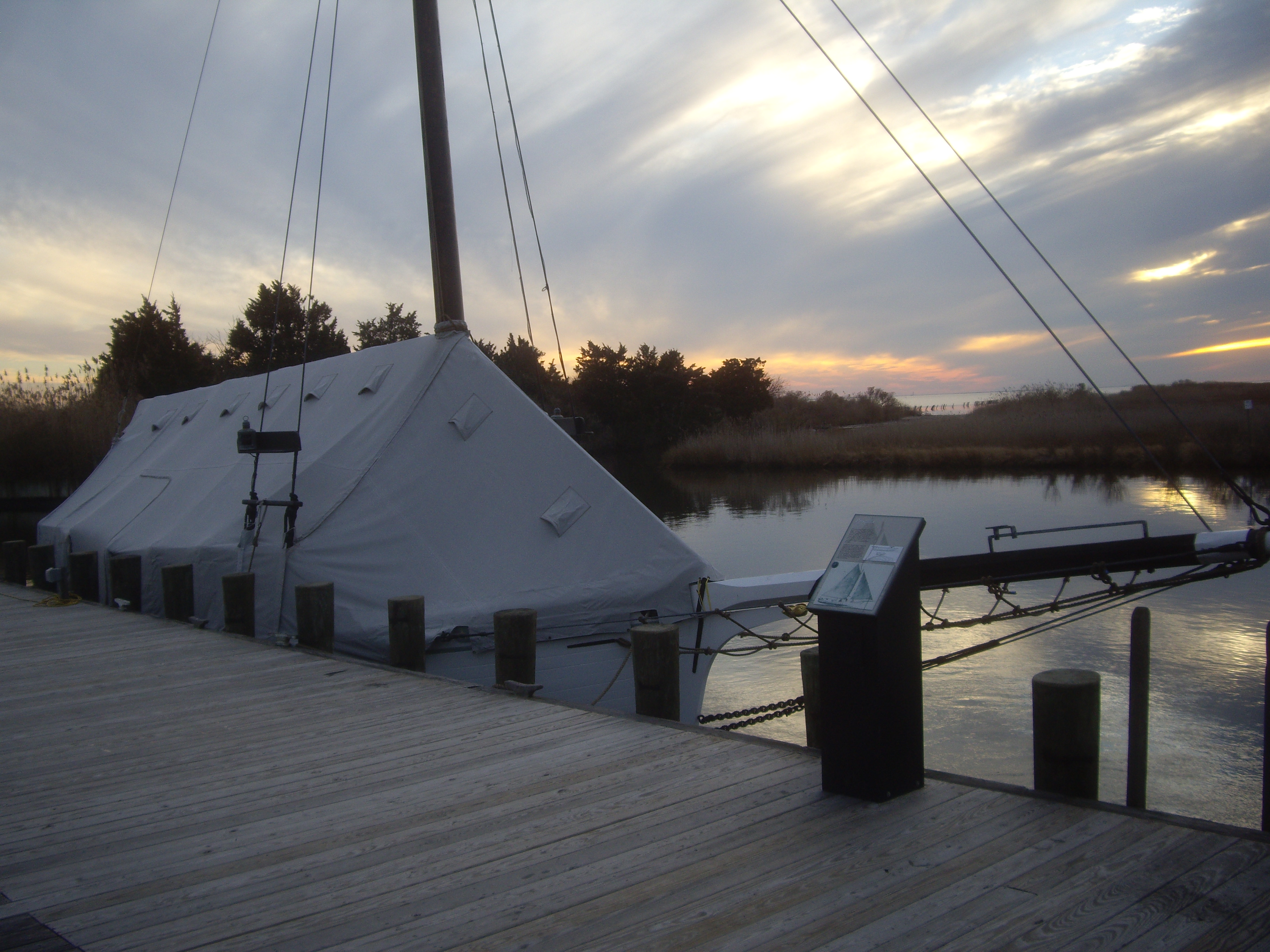
40°46′36″N 73°15′16″W / 40.77667°N 73.25444°WBrentwood 9 MODESTY (south-sider sloop) 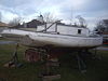
August 7, 2001 86 West Avenue, Long Island Maritime Museum
40°43′22″N 73°5′43″W / 40.72278°N 73.09528°WWest Sayville 10 Jacob Ockers House 
July 10, 1992 965 Montauk Highway
40°44′21″N 73°7′23″W / 40.73917°N 73.12306°WOakdale 11 Priscilla (Long Island Sound Oyster Sloop) 
February 17, 2006 Waterfront, Long Island Maritime Museum,
86 West Avenue
40°43′21″N 73°5′45″W / 40.7225°N 73.09583°WWest Sayville 12 John Ellis Roosevelt Estate November 5, 1987 Middle Road
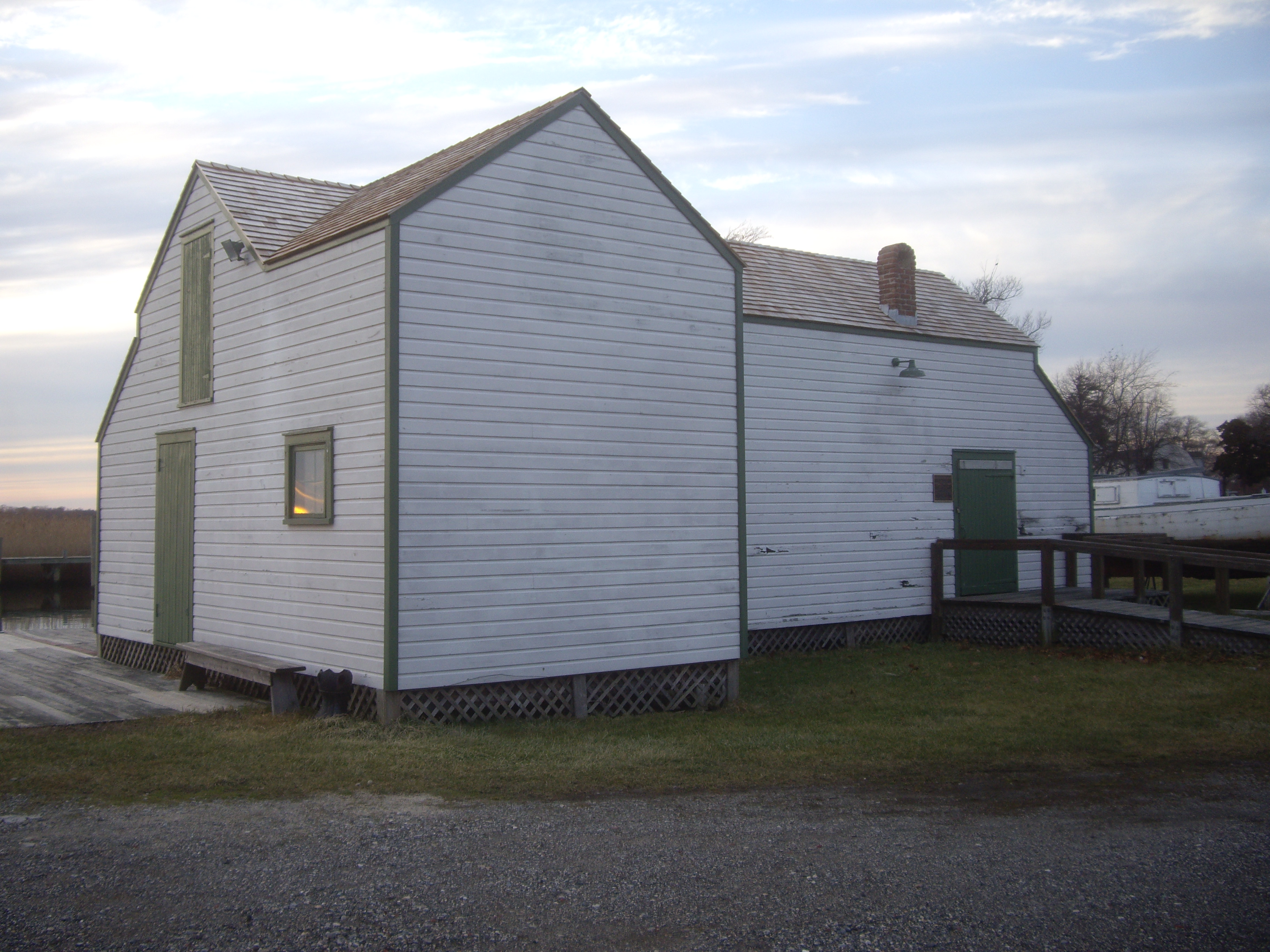
40°44′22″N 73°4′19″W / 40.73944°N 73.07194°WSayville 13 Rudolph Oyster House 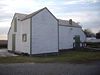
August 7, 2001 86 West Avenue, Long Island Maritime Museum
40°43′21″N 73°5′45″W / 40.7225°N 73.09583°WWest Sayville 14 Sagtikos Manor November 21, 1976 Montauk Highway (NY 27A)
40°42′10″N 73°16′36″W / 40.70278°N 73.27667°WWest Bay Shore 15 St. Ann's Episcopal Church 
August 30, 2010 257 Middle Rd.
40°44′9″N 73°4′24″W / 40.73583°N 73.07333°WSayville New listing, refnum 10000611; from Isaac Henry Green, Jr. Suffolk and Nassau Counties, New York MPS. (Official Site). 16 St. Johns Episcopal Church and Cemetery 
January 28, 1994 Montauk Highway Northeast side, about 300' Northwest of the jct. with Locust Avenue
40°44′7″N 73°7′2″W / 40.73528°N 73.11722°WOakdale 17 Sayville Congregational Church 
July 27, 2005 131 Middle Road
40°44′11″N 73°4′50″W / 40.73639°N 73.08056°WSayville 18 Southside Sportsmens Club District July 23, 1973 Northeast of Great River, off NY 27
40°45′55″N 73°7′25″W / 40.76528°N 73.12361°WGreat River 19 US Post Office-Bay Shore 
November 17, 1988 10 Bay Shore Avenue
40°43′23″N 73°14′41″W / 40.72306°N 73.24472°WBay Shore 20 Wereholme January 4, 2007 5500 South Bay Avenue
40°42′48″N 73°12′50″W / 40.71333°N 73.21389°WIslip 21 Winganhauppauge November 15, 2010 77 St. Marks Lane
40°43′32″N 73°12′15″W / 40.72556°N 73.20417°WIslip New listing; refnum 10000912 22 Joseph Wood House 
May 18, 2003 284 Greene Avenue
40°44′9″N 73°4′33″W / 40.73583°N 73.07583°WSayville See also
- National Register of Historic Places listings in New York
- National Register of Historic Places listings in Suffolk County, New York
References
- ^ The latitude and longitude information provided is primarily from the National Register Information System, and has been found to be fairly accurate for about 99% of listings. For 1%, the location info may be way off. We seek to correct the coordinate information wherever it is found to be erroneous. Please leave a note in the Discussion page for this article if you believe any specific location is incorrect.
- ^ Numbers represent an ordering by significant words. Various colorings, defined here, differentiate the Historic districts, National Historic Landmarks, and other designations from other NRHP buildings, structures, sites or objects.
Town of Islip, New York County Villages CDPs Dunewood · Fair Harbor · Kismet · Lonelyville
Hamlets Bay Shore · Bayport · Baywood · Bohemia · Brentwood · Central Islip · East Islip · Great River · Hauppauge · Holbrook · Holtsville · Islip · Islip Terrace · Lake Ronkonkoma · North Bay Shore · North Great River · Oakdale · Ronkonkoma · Sayville · West Bay Shore · West Islip · West Sayville
Website: Town of IslipCategories:- Islip (town), New York
- National Register of Historic Places in Islip (town), New York
- Buildings and structures in Suffolk County, New York


Wikimedia Foundation. 2010.