- North Bellport, New York
-
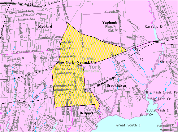
North Bellport, New York — CDP — U.S. Census Map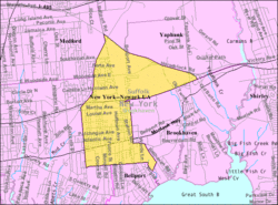 Location within the state of New York
 North Bellport, New York
Coordinates: 40°46′58″N 72°57′7″W / 40.78278°N 72.95194°WCoordinates: 40°46′58″N 72°57′7″W / 40.78278°N 72.95194°W Country United States State New York County Suffolk Area - Total 4.6 sq mi (12.0 km2) - Land 4.6 sq mi (12.0 km2) - Water 0.0 sq mi (0.0 km2) Elevation 46 ft (14 m) Population (2000) - Total 9,007 - Density 1,937.7/sq mi (748.2/km2) Time zone Eastern (EST) (UTC-5) - Summer (DST) EDT (UTC-4) ZIP code 11713 Area code(s) 631 FIPS code 36-51528 GNIS feature ID 0958685 North Bellport is a hamlet (and census-designated place) in Suffolk County, New York, United States. The population was 9,007 at the 2000 census.
North Bellport is a community in the Town of Brookhaven. It is served by the South Country Central School District.
Contents
Geography
North Bellport is located at 40°46′58″N 72°57′7″W / 40.78278°N 72.95194°W (40.782642, -72.952042)[1].
According to the United States Census Bureau, the CDP has a total area of 4.7 square miles (12 km2), all land.
Demographics
As of the census[2] of 2000, there were 9,007 people, 2,349 households, and 2,036 families residing in the CDP. The population density was 1,937.7 per square mile (747.9/km²). There were 2,520 housing units at an average density of 542.1/sq mi (209.2/km²). The racial makeup of the CDP was 53.07% White, 30.96% African American, 1.50% Native American, 1.98% Asian, 0.07% Pacific Islander, 7.28% from other races, and 5.14% from two or more races. Hispanic or Latino of any race were 20.44% of the population.
There were 2,349 households out of which 49.5% had children under the age of 18 living with them, 57.1% were married couples living together, 23.6% had a female householder with no husband present, and 13.3% were non-families. 8.9% of all households were made up of individuals and 2.8% had someone living alone who was 65 years of age or older. The average household size was 3.75 and the average family size was 3.91.
In the CDP the population was spread out with 33.6% under the age of 18, 10.3% from 18 to 24, 29.6% from 25 to 44, 20.2% from 45 to 64, and 6.4% who were 65 years of age or older. The median age was 30 years. For every 100 females there were 96.3 males. For every 100 females age 18 and over, there were 91.7 males.
The median income for a household in the CDP was $55,145, and the median income for a family was $56,140. Males had a median income of $38,099 versus $27,939 for females. The per capita income for the CDP was $16,733. About 11.5% of families and 15.5% of the population were below the poverty line, including 22.6% of those under age 18 and 7.4% of those age 65 or over.
References
- ^ "US Gazetteer files: 2010, 2000, and 1990". United States Census Bureau. 2011-02-12. http://www.census.gov/geo/www/gazetteer/gazette.html. Retrieved 2011-04-23.
- ^ "American FactFinder". United States Census Bureau. http://factfinder.census.gov. Retrieved 2008-01-31.
External links
Town of Brookhaven, New York County Villages Belle Terre · Bellport · Lake Grove · Mastic Beach · Old Field · Patchogue · Poquott · Port Jefferson · ShorehamHamlets Blue Point · Brookhaven · Calverton · Canaan Lake · Center Moriches · Centereach · Cherry Grove · Coram · Crystal Brook · Cupsogue Beach · Davis Park · East Moriches · East Patchogue · East Setauket · East Shoreham · Eastport · Farmingville · Fire Island Pines · Gordon Heights · Hagerman · Holbrook · Holtsville · Lake Ronkonkoma · Manorville · Mastic · Medford · Middle Island · Miller Place · Moriches · Mount Sinai · North Bellport · North Patchogue · Ocean Bay Park · Point O' Woods · Port Jefferson Station · Ridge · Rocky Point · Ronkonkoma · Selden · Setauket · Shirley · Sound Beach · South Haven · Stony Brook · Strongs Neck · Terryville · Upton · Wading River · Water Island · West Manor · YaphankIndian
reservationPoospatuckWebsite: brookhaven.org Categories:- Brookhaven, New York
- Hamlets in New York
- Census-designated places in New York
- Populated places in Suffolk County, New York

Wikimedia Foundation. 2010.