- Manorville, New York
-
Manorville, New York — CDP — Wicklow granite memorial dedicated in 1987 on the farm of Tom Clarke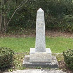

 Manorville, New York
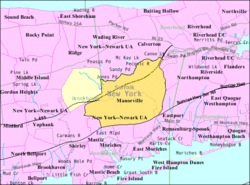
Coordinates: 40°50′53″N 72°47′38″W / 40.84806°N 72.79389°WCoordinates: 40°50′53″N 72°47′38″W / 40.84806°N 72.79389°W Country United States State New York County Suffolk Area – Total 25.4 sq mi (65.8 km2) – Land 25.4 sq mi (65.7 km2) – Water 0.0 sq mi (0.1 km2) Elevation 52 ft (16 m) Population (2000) – Total 11,131 – Density 438.9/sq mi (169.5/km2) Time zone Eastern (EST) (UTC-5) – Summer (DST) EDT (UTC-4) ZIP code 11949 Area code(s) 631 FIPS code 36-45139 GNIS feature ID 0970329 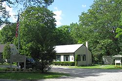 Headquarters of Long Island Central Pine Barrens in the community
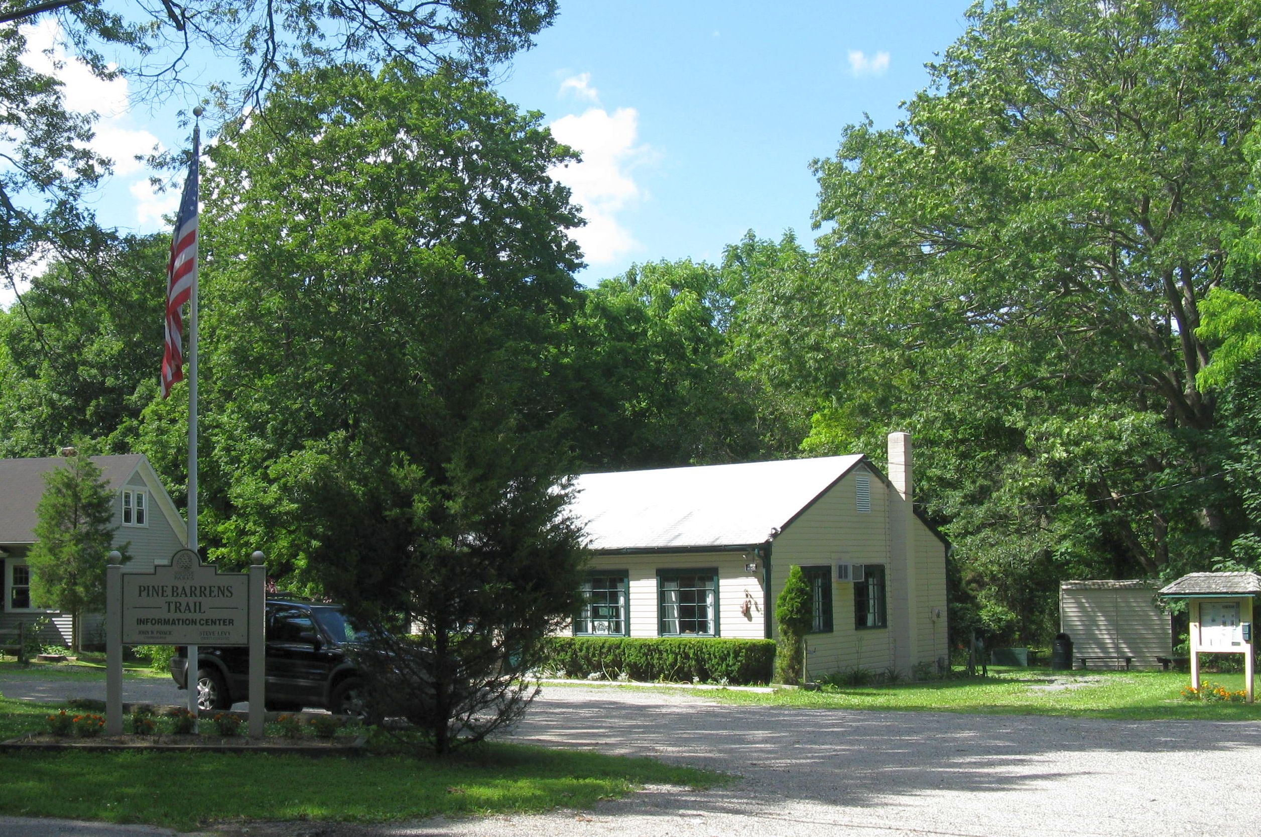
Manorville is a census-designated place (CDP) in Suffolk County, New York, United States. The population was 11,131 at the 2000 census.
Manorville is served by the Eastport-South Manor Central School District. Manorville is in Town of Brookhaven, but its northeast corner is in Town of Riverhead.
Contents
Geography
Manorville is located at 40°50′53″N 72°47′38″W / 40.84806°N 72.79389°W (40.848192, -72.793920)[1].
According to the United States Census Bureau, the CDP has an area of 25.4 square miles (66 km2), of which 25.4 square miles (66 km2) is land and 0.04 square miles (0.10 km2) (0.16%) is water.
The town is at the western edge of, and partially within, the Long Island Central Pine Barrens. The land is heavily wooded, and features some wetlands, particularly in the northern section near the Peconic River. Much of the northeastern portion of the town is in the Pine Barrens' "Core Preservation Area", where no further development is allowed. This area also serves as a primary source for Long Island's groundwater preserve.
Manorville is known for its close proximity to the Hamptons, earning the nickname "The Gateway to the Hamptons."
Manorville is in the center of Long Island with no access to the water. It also lies partially on the Ronkonkoma terminal moraine, which creates some slightly rolling topography, especially in the central portion of the town. The glacial topography of the area features several kettle hole ponds, the most well-known of which is known as Punk's Hole,[2] where a Revolutionary War captain was rumored to have hid from the British.
History
For a town that was until very recently a small farming community, Manorville boasts a long and significant history.The area now known as Manorville once lay within the huge tract of land known as Manor St. George.[2] Manor St. George was a land grant given to Col. William "Tangier" Smith in 1693 in recognition of Smith's service as the governor of Tangier, Morocco, Africa. The hamlet was given its current name in 1844, when the Long Island Railroad built a station at Manorville and named it "St. George's Manor". The station agent, Seth Raynor, who was a patriot during American Revolutionary War, disliked the name because it reminded him of the English and the colonial era (St. George, the patron saint of England, is a symbol of the English Monarchy). One afternoon, he saw his wife painting the fence at his home. he crossed over the tracks, took the paint can and brush, and then went to his barn to retrieve a ladder. arriving back at the station, he put the ladder underneath the sign reading "St. George's Manor" and,using the paint he had gotten earlier, painted over the part of the sign reading "St. George," leaving only the word "Manor." Subsequently, it was changed to Manorville by the Post Office Department.
Demographics
As of the census[3] of 2000, there were 11,131 people, 4,122 households, and 2,938 families residing in the CDP. The population density was 438.9 per square mile (169.5/km²). There were 4,243 housing units at an average density of 167.3/sq mi (64.6/km²). The racial makeup of the CDP was 96.38% White, 1.18% African American, 0.12% Native American, 0.66% Asian, 0.04% Pacific Islander, 0.75% from other races, and 0.89% from two or more races. Hispanic or Latino of any race were 4.14% of the population.
There were 4,122 households out of which 36.4% had children under the age of 18 living with them, 63.4% were married couples living together, 5.9% had a female householder with no husband present, and 28.7% were non-families. 24.4% of all households were made up of individuals and 9.6% had someone living alone who was 65 years of age or older. The average household size was 2.69 and the average family size was 3.25.
In the CDP the population was spread out with 27.6% under the age of 18, 5.2% from 18 to 24, 33.1% from 25 to 44, 20.9% from 45 to 64, and 13.2% who were 65 years of age or older. The median age was 37 years. For every 100 females there were 98.4 males. For every 100 females age 18 and over, there were 94.7 males.
The median income for a household is $86,809, and the median income for a family is $106,453 (as of a 2007 estimate[4]). Males had a median income of $52,357 versus $36,382 for females. The per capita income for the CDP was $27,624. About 2.4% of families and 2.8% of the population were below the poverty line, including 2.3% of those under age 18 and 3.2% of those age 65 or over.
Notable residents
- Tom Clarke (Irish republican) - had a 60-acre (240,000 m2) farm in 1906-07 before returning to Ireland[5]
See also
References
- ^ "US Gazetteer files: 2010, 2000, and 1990". United States Census Bureau. 2011-02-12. http://www.census.gov/geo/www/gazetteer/gazette.html. Retrieved 2011-04-23.
- ^ a b Manorville: A Patriot Haven and Cranberry Heaven, Newsday, Retrieved on 2009-03-27.
- ^ "American FactFinder". United States Census Bureau. http://factfinder.census.gov. Retrieved 2008-01-31.
- ^ U.S. Factfinder
- ^ The Story of Thomas J. Clarke - aohdivision11.org - Retrieved October 9, 2009
External links
Town of Brookhaven, New York County Villages Belle Terre · Bellport · Lake Grove · Mastic Beach · Old Field · Patchogue · Poquott · Port Jefferson · ShorehamHamlets Blue Point · Brookhaven · Calverton · Canaan Lake · Center Moriches · Centereach · Cherry Grove · Coram · Crystal Brook · Cupsogue Beach · Davis Park · East Moriches · East Patchogue · East Setauket · East Shoreham · Eastport · Farmingville · Fire Island Pines · Gordon Heights · Hagerman · Holbrook · Holtsville · Lake Ronkonkoma · Manorville · Mastic · Medford · Middle Island · Miller Place · Moriches · Mount Sinai · North Bellport · North Patchogue · Ocean Bay Park · Point O' Woods · Port Jefferson Station · Ridge · Rocky Point · Ronkonkoma · Selden · Setauket · Shirley · Sound Beach · South Haven · Stony Brook · Strongs Neck · Terryville · Upton · Wading River · Water Island · West Manor · YaphankIndian
reservationPoospatuckWebsite: brookhaven.orgTown of Riverhead, New York County Hamlets Website Categories:- Brookhaven, New York
- Hamlets in New York
- Census-designated places in New York
- Riverhead (town), New York
- Populated places in Suffolk County, New York


Wikimedia Foundation. 2010.