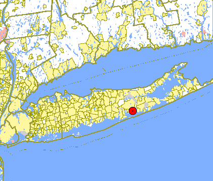
- East Moriches, New York
Infobox Settlement
official_name = East Moriches, New York
settlement_type = CDP
nickname = AntiHamptons
motto = Long Island's Best Kept Secret
imagesize =
image_caption =
image_
mapsize = 250x200px
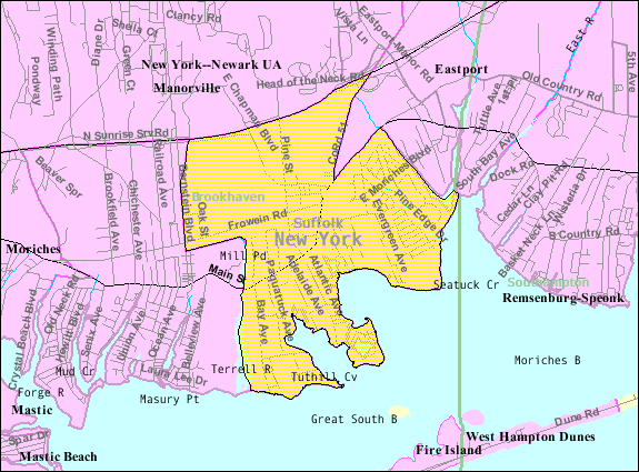
map_caption = U.S. Census Bureau Map
mapsize1 =
map_caption1 =subdivision_type = Country
subdivision_name =United States
subdivision_type1 = State
subdivision_name1 =New York
subdivision_type2 = County
subdivision_name2 = Suffolk
government_footnotes =
government_type =
leader_title =
leader_name =
leader_title1 =
leader_name1 =
established_title =
established_date =area_footnotes =
area_magnitude =
area_total_km2 = 14.5
area_land_km2 = 14.1
area_water_km2 = 0.4
area_total_sq_mi = 5.6
area_land_sq_mi = 5.4
area_water_sq_mi = 0.1population_as_of = 2000
population_footnotes =
population_total = 4550
population_density_km2 = 322.9
population_density_sq_mi = 836.3timezone = Eastern (EST)
utc_offset = -5
timezone_DST = EDT
utc_offset_DST = -4
elevation_footnotes =
elevation_m = 9
elevation_ft = 30
latd = 40 |latm = 48 |lats = 23 |latNS = N
longd = 72 |longm = 45 |longs = 24 |longEW = Wpostal_code_type =
ZIP code
postal_code = 11940
area_code = 631
blank_name = FIPS code
blank_info = 36-22546
blank1_name = GNIS feature ID
blank1_info = 0970099
website =
footnotes =East Moriches is a hamlet ( and
census-designated place ) in Suffolk County,New York ,United States . The population was 4,550 at the 2000 census.East Moriches is in the Town of Brookhaven.
Geography
East Moriches is located at coor dms|40|48|23|N|72|45|24|W|city (40.806287, -72.756735)GR|1.
According to the
United States Census Bureau , the CDP has a total area of 5.6square mile s (14.5km² ), of which, 5.4 square miles (14.1 km²) of it is land and 0.2 square miles (0.4 km²) of it (2.68%) is water. East Moriches has an elementary school, recently built, as well as a middle school. Once a student is in 8th grade, they may chose between three high schools; Westhampton Beach, Center Moriches, and Eastport South Manor. In 2006 the school budget failed, and the school was put on to austerity budget, or a budget controlled by the state. The East Moriches Booster club raised enough money to give the school sports teams and clubs. East Moriches is also commonly referred to as EMO by the locals.Demographics
As of the
census GR|2 of 2000, there were 4,550 people, 1,510 households, and 1,182 families residing in the CDP. Thepopulation density was 836.3 per square mile (322.9/km²). There were 1,668 housing units at an average density of 306.6/sq mi (118.4/km²). The racial makeup of the CDP was 94.55% White, 1.58% African American, 0.04% Native American, 1.45% Asian, 0.24% Pacific Islander, 1.01% from other races, and 1.12% from two or more races. Hispanic or Latino of any race were 5.16% of the population.There were 1,510 households out of which 39.7% had children under the age of 18 living with them, 67.5% were married couples living together, 6.8% had a female householder with no husband present, and 21.7% were non-families. 17.0% of all households were made up of individuals and 7.4% had someone living alone who was 65 years of age or older. The average household size was 2.90 and the average family size was 3.27.
In the CDP the population was spread out with 26.4% under the age of 18, 6.0% from 18 to 24, 30.2% from 25 to 44, 24.9% from 45 to 64, and 12.5% who were 65 years of age or older. The median age was 38 years. For every 100 females there were 97.1 males. For every 100 females age 18 and over, there were 93.8 males.
The median income for a household in the CDP was $62,005, and the median income for a family was $71,000. Males had a median income of $50,991 versus $30,650 for females. The
per capita income for the CDP was $24,086. About 2.2% of families and 3.5% of the population were below thepoverty line , including 2.2% of those under age 18 and 5.8% of those age 65 or over.TWA Flight 800
East Moriches became internationally famous in July 1996 when TWA Flight 800 exploded 8 miles off its coast and fell into the
Atlantic Ocean . Stephen Curtis, a local dentist, was fishing at the time Flight 800 crashed south of the Moriches Inlet. Dr. Curtis and friend, Skip Rasso went to the crash site and pulled multiple bodies from the wreckage. Today there are parks in Smith Point and Center Moriches Long Island dedicated to the people who died in the crash, and a plaque bearing their names.References
External links
http://www.antihamptons.com/index.html
Wikimedia Foundation. 2010.

