- County Route 48 (Suffolk County, New York)
-
County Route 48
Middle Road(New Middle Road) Route information Maintained by SCDPW Existed: 1980's – present Major junctions West end: Sound Avenue in Mattituck East end:  NY 25 north of Greenport
Highway system Numbered highways in New York
Interstate • U.S. • N.Y. (former) • Reference • County (Suffolk)←  CR 47
CR 47CR 49  →
→Suffolk County Road 48 is a major county road on the north fork of Long Island in Suffolk County, New York. It runs east and west from Sound Avenue in Mattituck to New York State Route 25 just outside of the Village of Greenport.
Contents
Route description
Suffolk County Road 48 was originally known as Suffolk County Road 27. A newer section in Mattituck(New Middle Road) was known as Suffolk County Road 27A and Wickham Avenue, a former segment was designated Suffolk County Road 27B. Because of the confusion with New York State Route 27 on the South Shore of Long Island, Suffolk County Department of Public Works redesignated the road Suffolk CR 48 during the 1980s. Wickham Avenue was decommissioned as a county road and is currently maintained by the Town of Southold.
Middle Road starts at an at-grade interchange with Sound Avenue in Mattituck. From there through Southold, the road is four lanes wide. Besides Wickham Avenue, the road intersects with Mill Lane(former Suffolk CR 84) to Oregon, Elijah's Lane which crosses the road after the east end of Wickham Avenue, Depot Lane in Cutchogue, which lead to both the former Cutchogue (LIRR station) and Duck Pond Point, and Bridge Lane which was named for a wooden railroad bridge over the Main Line of the Long Island Rail Road.
In Peconic, Mill Road and Peconic Lane in Peconic Lane is the main road to the former Peconic (LIRR station) Mill Road also leads to Goldsmith's Inlet County Park on the North Shore. East of Ackerly Pond Road in Southold, the road is two lanes wide. The first streets that the road encounters at this point are Kenny's Road and Horton Lane, both of which have north shore beaches named after them. Unlike Kenny's Road, Horton Lane spans as far south as the Southold Town Hall on New York State Route 25 just like Youngs Avenue, which leads to Southold (LIRR station) and the Horton Point Lighthouse.
The road takes a brief northeast turn at the intersection of Boisseau Avenue, and then moves back toward the east at North Road. As the road approaches Hashamomuck Pond, it replaces Sound View Avenue, as the northernmost road on the North Fork. Sound View Avenue leads to such beaches as Goldsmith's Inlet County Park, Peconic Dunes County Park, Horton Point Lighthouse and Hashamomuck Beach.
Between Hashamomuck Pond and unincorporated Greenport, a section of Middle Road near a motel with the Long Island Sound in the back yard is still paved with concrete as commonly done during the mid-20th century. The section of old-fashioned pavement is short-lived. Along the border of Greenport the road enocunters a former KOA Campground which today is the privatley owned Eastern Long Island Kampground. It also runs along the southern border of Inlet Point County Park, and the intersection of Moore's Lane.
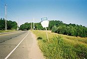
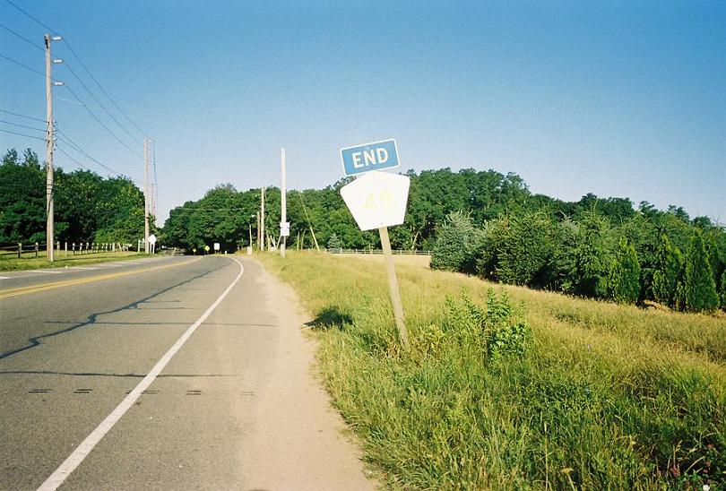
Though Suffolk County Road 48 finally ends at New York State Route 25 on the border between Greenport and Stirling, traffic continues in the same direction on NY 25 on its way to the ferry between Orient Point and either New London, Connecticut, Fisher's Island or Block Island, Rhode Island.
Proposed extensions
Long Island Expressway extension


Part of the reason Suffolk County Department of Public Works widened Middle Road to begin with was in anticipation of the formerly proposed North Fork extension of the Long Island Expressway.[1][2] Once the expressway had been extended to the west end of Suffolk CR 48 and Sound Avenue in Mattituck, CR 48 was to be upgraded into another segment of the L.I.E. that would lead to a bridge either between East Marion and Old Saybrook, Connecticut, or from Orient Point to Watch Hill, Rhode Island.[3][4]
Sound Avenue extension
There was also a proposal to extend Suffolk CR 48 west along Sound Avenue in anticipation of a formerly proposed nuclear power plant in South Jamesport that was to be built by the Long Island Lighting Company. Suffolk County Department of Public Works still lists part of Sound Avenue east of Suffolk CR 105 as being part of CR 48, despite the fact that the county's own signs indicate that Sound Avenue is the western terminus.[5]
Truck NY 25


 Suffolk CR 48 ends at Sound Avenue in Mattituck, while NY Truck 25 continues westward.
Due to a low railroad bridge that carries the Main Line of the Long Island Rail Road over New York State Route 25 in Laurel, and narrow historic streets in Greenport, the North Fork of Long Island contains two New York State Truck Route 25's. Suffolk County Road 48 serves as a duplicate of most of this truck route. Originally, the only portion that contained NY Truck 25 was east of Moore's Lane, which also contains part of NY Truck 25. The western section of NY Truck 25 existed along Franklinville Road, Aldrich Lane, and Sound Avenue. At some point, the two Truck Route 25's were merged, although the section along Moore's Lane still exists to this day.
References
- ^ Hagstrom Map (1969). Atlas of Suffolk County, New York (Map).
- ^ Hagstrom Map (1973). Atlas of Suffolk County, New York (Map).
- ^ Anderson, Steve. "Long Island Expressway". NYCRoads. http://www.nycroads.com/roads/long-island/. Retrieved March 18, 2010.
- ^ Anderson, Steve. "Eastern Long Island Sound Crossings". NYCRoads. http://www.nycroads.com/crossings/eastern-sound/. Retrieved March 18, 2010.
- ^ "County Road System – County of Suffolk, New York" (PDF). Suffolk County Department of Public Works. December 29, 2005. http://www.greaternyroads.info/pdfs/suffcr.pdf. Retrieved April 2, 2010.
- Other road maps and atlases.
External links
Categories:- County routes in Suffolk County, New York
- Long Island highways


Wikimedia Foundation. 2010.