- Centerport, New York
Infobox Settlement
official_name = Centerport, New York
settlement_type = CDP
nickname =
motto =
imagesize = 250px
image_caption = Centerport Harbor, November 2005
image_pushpin_
pushpin_label_position =none
pushpin_map_caption =Location within the state of New York
pushpin_mapsize =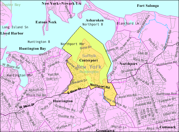
mapsize = 250px
map_caption = U.S. Census Map
mapsize1 =
map_caption1 =subdivision_type = Country
subdivision_name =United States
subdivision_type1 = State
subdivision_name1 =New York
subdivision_type2 = County
subdivision_name2 = Suffolk
government_footnotes =
government_type =
leader_title =
leader_name =
leader_title1 =
leader_name1 =
established_title =
established_date =area_footnotes =
area_magnitude =
area_total_km2 = 9.2
area_land_km2 = 5.5
area_water_km2 = 3.7
area_total_sq_mi = 3.6
area_land_sq_mi = 2.1
area_water_sq_mi = 1.4population_as_of = 2000
population_footnotes =
population_total = 5446
population_density_km2 = 989.2
population_density_sq_mi = 2562.0timezone = Eastern (EST)
utc_offset = -5
timezone_DST = EDT
utc_offset_DST = -4
elevation_footnotes =
elevation_m = 15
elevation_ft = 49
latd = 40 |latm = 53 |lats = 34 |latNS = N
longd = 73 |longm = 22 |longs = 41 |longEW = Wpostal_code_type =
ZIP code
postal_code = 11721
area_code = 631
blank_name = FIPS code
blank_info = 36-13442
blank1_name = GNIS feature ID
blank1_info = 0946210
website =
footnotes =Centerport is a hamlet (and
census-designated place ) in Suffolk County,New York on the notably affluent North Shore ofLong Island . Formerly known as Little Cow Harbor about 1700, Centreport in 1836, and then the present Centerport after 1895. The name refers to its geographic position midway between the east and west boundaries of the township of Huntington. [ [http://www.newsday.com/community/guide/lihistory/ny-ourtowns-suffolk,0,3948877.storygallery?coll=ny-lihistory-navigation Newsday Long Island History] ]As of the
United States 2000 Census , the CDP population was 5,446. It is located in the Town of Huntington. Huntington and its surrounding hamlets mark the east end of Long Island's renowned "Gold Coast", the name deriving from the traditional wealth and gentility associated with the area. The association dates back to the early twentieth century in which many affluent families built their homes along the coast. In Centerport, an example of this is the mansion ofWilliam Kissam Vanderbilt II , otherwise known as the Vanderbilt Estate.Whereas Centerport is highly residential, characterized by windy driveways and beachfront hills, the town of Huntington is famous for its bustling "village", an area in the center of town filled with quaint shops, art galleries, restaurants, pubs, and spas. Over the years, it has become something of an attraction, garnering visitors from all over Long Island.
Centerport is in the Harborfields Central School District. The schools include Harborfields High School, Oldfield Middle School, T.J. Lahey Elementary School, and the Washington Drive Primary School. In the past, the district has received Blue Ribbon awards of excellence.
As is common among the many beachfront locations on Long Island's North Shore, Centerport has developed a large boating and sailing culture. An important part of this culture is the Centerport Yacht Club, which was founded in 1947 and has served as a social and athletic focal point for the boating community in both Centerport and its surrounding areas. The yacht club sponsors a variety of racing fleets and regattas every year generally beginning in the late spring and ending mid-autumn.
Geography
Centerport is located at coor dms|40|53|34|N|73|22|41|W|city (40.892848, -73.378007)GR|1.
According to the
United States Census Bureau , the CDP has a total area of 3.6square mile s (9.2km² ), of which, 2.1 square miles (5.5 km²) of it is land and 1.4 square miles (3.7 km²) of it (40.34%) is water.Demographics
As of the
census GR|2 of 2000, there were 5,446 people, 2,022 households, and 1,526 families residing in the CDP. Thepopulation density was 2,562.0 per square mile (987.2/km²). There were 2,094 housing units at an average density of 985.1/sq mi (379.6/km²). The racial makeup of the CDP was 97.65% White, 0.22% African American, 0.11% Native American, 1.18% Asian, 0.31% from other races, and 0.53% from two or more races. Hispanic or Latino of any race were 2.15% of the population.There were 2,022 households out of which 34.9% had children under the age of 18 living with them, 65.9% were married couples living together, 7.4% had a female householder with no husband present, and 24.5% were non-families. 18.3% of all households were made up of individuals and 6.8% had someone living alone who was 65 years of age or older. The average household size was 2.68 and the average family size was 3.07.
In the CDP the population was spread out with 25.0% under the age of 18, 3.9% from 18 to 24, 30.8% from 25 to 44, 27.8% from 45 to 64, and 12.4% who were 65 years of age or older. The median age was 40 years. For every 100 females there were 94.3 males. For every 100 females age 18 and over, there were 94.3 males.
The median income for a household in the CDP was $92,456, and the median income for a family was $101,908. Males had a median income of $71,786 versus $54,706 for females. The
per capita income for the CDP was $42,763. About 1.6% of families and 2.9% of the population were below thepoverty line , including 2.5% of those under age 18 and 9.2% of those aged 65 or over.Interesting facts
*Centerport is the site of the estate and "Eagle's Nest" mansion of
William Kissam Vanderbilt II . This 43-acre estate now contains the Vanderbilt museum and planetarium.
*In theMarvel Comics universe, Angel, a member of the X-men was born here.
*Camp Alvernia is located here [http://www.olqmparish.org/1888.htm] . Established in 1888, this is the firstCatholic summer camp in theUnited States .Famous residents
*
Arthur Dove ,artist
* Gregg (Opie) HughesSee also
*
Camp Alvernia
*Mill Dam Bridge External links
* [http://www.centerport-yc.org Centerport Yacht Club]
* [http://www.centerportfd.org Centerport Fire Department]References

Wikimedia Foundation. 2010.