- Dix Hills, New York
-
Dix Hills, New York — CDP — U.S. Census Map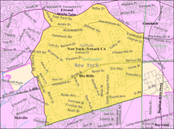 Location within the state of New York
 Dix Hills, New York
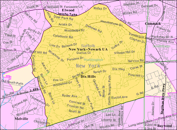
Coordinates: 40°47′46″N 73°20′4″W / 40.79611°N 73.33444°WCoordinates: 40°47′46″N 73°20′4″W / 40.79611°N 73.33444°W Country United States State New York County Suffolk Area - Total 15.9 sq mi (41.3 km2) - Land 15.9 sq mi (41.3 km2) - Water 0.0 sq mi (0.0 km2) Elevation 203 ft (62 m) Population (2000) - Total 26,024 - Density 1,632.1/sq mi (630.2/km2) Time zone Eastern (EST) (UTC-5) - Summer (DST) EDT (UTC-4) ZIP code 11746 Area code(s) 631 FIPS code 36-20687 GNIS feature ID 1867400 Dix Hills is a hamlet (and a census-designated place (CDP) in the Town of Huntington on the North Shore of Long Island in Suffolk County, New York, United States. Dix Hills was named the 19th most affluent U.S. neighborhood by Forbes in 2008.[1]. It is one of the most affluent communities in the state and is among the wealthiest towns in the United States. The population was 26,024 at the 2000 census.
Contents
History
The Town of Huntington was founded in 1653, and the area to the north of Half Way Hollow was first referred to as "dicke pechegans" in 1689, marking the area where Dick Pechagan, an indigenous person from one of the local tribes, had his wigwam and his planting fields. Over the years this name was shortened and changed to "Dick's Hills," and although a few old records do use that spelling, it quickly became even easier to just spell "Dix." While Half Hollow Hills marks the hills located halfway between the sound and Ocean, Dix Hills marks the hills that belonged to a man named Dick.
Geography
According to the United States Census Bureau, the hamlet of Dix Hills has a total land area of 15.9 square miles (41 km2). The Town of Huntington has a total area of 137.1 square miles (355 km2), of which, 94.0 square miles (243 km2) of it is land and 43.2 square miles (112 km2) of it (31.47%) is water.
The west town line is the border of Nassau County, and the north town line, delineated by Long Island Sound, is the border of Connecticut. Also, the two other town lines include the east town line which is the border of Smithtown and the south town line which is the border of Babylon.
Education
Dix Hills is served by the Half Hollow Hills Central School District. The Half Hollow Hills elementary schools are Chestnut Hill, Forest Park, Otsego, Paumanok, Signal Hill, Sunquam, and Vanderbilt. The middle schools are Candlewood and West Hollow. The high schools are Half Hollow Hills High School East and Half Hollow Hills High School West which both rank among the finest high schools in the nation.
Emergency services
Dix Hills is served by the Dix Hills Fire Department,[2] through three stations. The Dix Hills Fire Department's Headquarters (Company 2), is located on Deer Park Avenue, immediately north of the Northern State Parkway. Substation #1 (Company 3) is located on Deer Park Avenue, south of the Long Island Expressway. Substation #2 (Company 1) is located on Carll's Straight Path, about half of a mile south of the Long Island Expressway. The Dix Hills Fire Department consists of approximately 150 volunteer firefighters and emergency medical technicians who respond to over 2,500 calls for assistance each year – ranging from fires to motor vehicle accidents to medical and traumatic emergencies. The department has 4 Ambulances, 3 Heavy Rescue trucks, 2 Pumpers, 2 Brush Trucks, 1 Quint, 1 Stump Jumper, and utility vehicles. It is operated under a Board of Fire Commissioners as well as 1 Chief and 3 Assistant Chiefs.
Demographics
As of the census[3] of 2000, there were 26,024 people, 7,952 households, and 7,236 families residing in the CDP. The population density was 1,632.1 per square mile (630.0/km²). There were 8,057 housing units at an average density of 505.3/sq mi (195.0/km²). The racial makeup of the CDP was 86.71% White, 3.25% African American, 0.05% Native American, 7.36% Asian, 0.02% Pacific Islander, 0.84% from other races, and 1.77% from two or more races. Hispanic or Latino of any race were 3.82% of the population.
There were 7,952 households out of which 44.8% had children under the age of 18 living with them, 82.1% were married couples living together, 6.1% had a female householder with no husband present, and 9.0% were non-families. 7.1% of all households were made up of individuals and 3.0% had someone living alone who was 65 years of age or older. The average household size was 3.25 and the average family size was 3.39.
In the CDP the population was spread out with 28.5% under the age of 18, 5.5% from 18 to 24, 27.1% from 25 to 44, 28.8% from 45 to 64, and 10.1% who were 65 years of age or older. The median age was 39 years. For every 100 females there were 98.2 males. For every 100 females age 18 and over, there were 94.7 males.
According to a 2007 estimate,[4] the median income for a household in the CDP was $137,632, and the median income for a family was $150,271. Males had a median income of over $100,000 versus $72,361 for females. The per capita income for the CDP was $93,426. About 2.1% of families and 1.9% of the population were below the poverty line, including 3.1% of those under age 18 and 2.2% of those age 65 or over.
Dix Hills was named the 19th most affluent U.S. neighborhood by Forbes in 2008.[5]
Notable current and former residents
- Brian Bloom, actor who previously lived in Dix Hills.
- Bob Bourne, former New York Islanders hockey player
- Stephen Bowen, Dallas Cowboys defensive end, lived in Dix Hills through high school
- John Coltrane, famous jazz saxophonist and composer lived in Dix Hills during the last years of his life.
- Courtney Galiano, contestant on So You Think You Can Dance
- Clark Gillies, former New York Islanders hockey player
- Mel Harris, actress
- Ron Hextall, former NHL goalie
- Steve Israel, U.S. Representative (D-N.Y.).
- Curtis Jackson aka, 50 Cent
- Jodeci, members of the band formerly lived in Dix Hills
- Mark LoMonaco, wrestler who grew up in Dix Hills.
- Ralph Macchio, actor (The Karate Kid), raised in Dix Hills
- Dina Meyer, actress
- Cathy Moriarty-Gentile, actress
- Dee Snyder, front man for rock band, Twisted Sister
- Ryan Star, Rock Star
- Wesley Walker, former Jets wide receiver
- Judd Winick, writer/artist from MTV's The Real World (San Francisco) (former)
- Todd Phillips Writer/Director of the movies Old School and The Hangover.
- Tobias Harris Current NBA Player
References
- ^ http://www.forbes.com/2008/12/08/america-affluent-neighborhoods-forbeslife-cx_ls_1209realestate_slide_3.html?thisSpeed=15000
- ^ http://www.DixHillsFD.org
- ^ "American FactFinder". United States Census Bureau. http://factfinder.census.gov. Retrieved 2008-01-31.
- ^ http://factfinder.census.gov/servlet/ACSSAFFFacts?_event=Search&geo_id=&_geoContext=&_street=&_county=dix+hills&_cityTown=dix+hills&_state=&_zip=&_lang=en&_sse=on&pctxt=fph&pgsl=010
- ^ http://www.forbes.com/2008/12/08/america-affluent-neighborhoods-forbeslife-cx_ls_1209realestate_slide_3.html?thisSpeed=15000
External links
- Half Hollow Hills Community Library
- Dix Hills Fire Department
- Dix Hills Performing Arts Center @ Five Towns College
- Five Towns College
- Dix Hills Country Club
County Villages Hamlets Centerport · Cold Spring Harbor · Commack · Dix Hills · East Northport · Eatons Neck · Elwood · Fort Salonga · Greenlawn · Halesite · Huntington Station · Huntington · Melville · South Huntington · Vernon Valley · West Hills · Wincoma
Website: town.huntington.ny.us Categories:- Huntington, New York
- Census-designated places in New York
- Populated places in Suffolk County, New York

Wikimedia Foundation. 2010.