- Halesite, New York
Infobox Settlement
official_name = Halesite, New York
settlement_type = CDP
nickname =
motto =
imagesize =
image_caption =
image_pushpin_
pushpin_label_position =
pushpin_map_caption =Location within the state of New York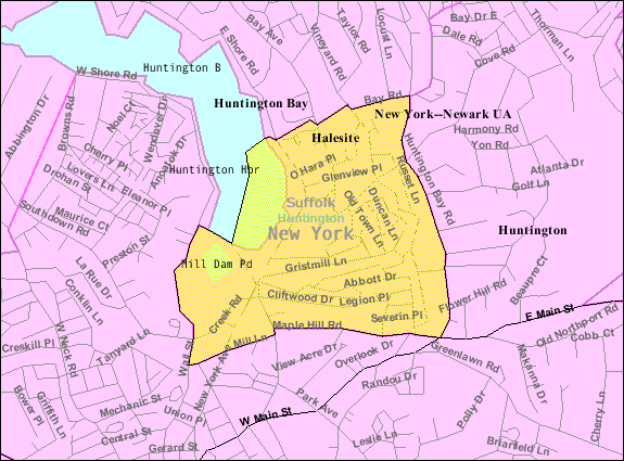
mapsize = 250px
map_caption = U.S. Census Map
mapsize1 =
map_caption1 =subdivision_type = Country
subdivision_name =United States
subdivision_type1 = State
subdivision_name1 =New York
subdivision_type2 = County
subdivision_name2 = Suffolk
government_footnotes =
government_type =
leader_title =
leader_name =
leader_title1 =
leader_name1 =
established_title =
established_date =area_footnotes =
area_magnitude =
area_total_km2 = 2.5
area_land_km2 = 2.2
area_water_km2 = 0.2
area_total_sq_mi = 1.0
area_land_sq_mi = 0.9
area_water_sq_mi = 0.1population_as_of = 2000
population_footnotes =
population_total = 2582
population_density_km2 = 1155.2
population_density_sq_mi = 2991.9timezone = Eastern (EST)
utc_offset = -5
timezone_DST = EDT
utc_offset_DST = -4
elevation_footnotes =
elevation_m = 8
elevation_ft = 26
latd = 40 |latm = 53 |lats = 10 |latNS = N
longd = 73 |longm = 24 |longs = 42 |longEW = Wpostal_code_type =
ZIP code
postal_code = 11743
area_code = 631
blank_name = FIPS code
blank_info = 36-31445
blank1_name = GNIS feature ID
blank1_info = 0952018
website =
footnotes =Halesite is a hamlet (and a
census-designated place ) on East Neck on the North Shore ofLong Island in Suffolk County,New York ,United States . Named afterNathan Hale , a captain in theContinental Army during theAmerican Revolutionary War who was captured at a tavern in Halesite. There is a rock with a tribute to him at the intersection of Mill Dam Road and New York Avenue. The population was 2,582 at the 2000 census. the area has been protected by the Halesite FIre Department since 1901, as well as the remainder of Huntington Bay.Geography
Halesite is located at coor dms|40|53|10|N|73|24|42|W|city (40.886048, -73.411590)GR|1.
According to the
United States Census Bureau , the CDP has a total area of 1.0square mile s (2.5km² ), of which, 0.9 square miles (2.2 km²) of it is land and 0.1 square miles (0.2 km²) of it (9.38%) is water.Demographics
As of the
census GR|2 of 2000, there were 2,582 people, 1,014 households, and 707 families residing in the CDP. Thepopulation density was 2,991.9 per square mile (1,159.2/km²). There were 1,049 housing units at an average density of 1,215.6/sq mi (471.0/km²). The racial makeup of the CDP was 95.27% White, 1.59% African American, 0.08% Native American, 0.93% Asian, 0.04% Pacific Islander, 0.77% from other races, and 1.32% from two or more races. Hispanic or Latino of any race were 3.10% of the population.There were 1,014 households out of which 29.7% had children under the age of 18 living with them, 60.1% were married couples living together, 7.0% had a female householder with no husband present, and 30.2% were non-families. 23.8% of all households were made up of individuals and 7.6% had someone living alone who was 65 years of age or older. The average household size was 2.55 and the average family size was 3.03.
In the CDP the population was spread out with 21.2% under the age of 18, 5.7% from 18 to 24, 30.0% from 25 to 44, 30.0% from 45 to 64, and 13.1% who were 65 years of age or older. The median age was 41 years. For every 100 females there were 98.2 males. For every 100 females age 18 and over, there were 94.5 males.
The median income for a household in the CDP was $96,972, and the median income for a family was $122,842. Males had a median income of $67,438 versus $52,632 for females. The
per capita income for the CDP was $46,652. About 1.8% of families and 3.2% of the population were below thepoverty line , including 2.4% of those under age 18 and 20.4% of those age 65 or over.References
External links

Wikimedia Foundation. 2010.