- New York State Route 110
-
NYS Route 110
Route information Maintained by NYSDOT Length: 15.84 mi[2] (25.49 km) Existed: 1930[1] – present Major junctions South end:  NY 27A in Amityville
 NY 27 in Amityville
 Southern State Parkway in East Farmingdale
 I-495 in Melville
 Northern Parkway in Melville
North end: Youngs Hill Road in Halesite Location Counties: Suffolk Highway system Numbered highways in New York
Interstate • U.S. • N.Y. (former) • Reference • County←  NY 109
NY 111  →
→New York State Route 110 (NY 110) is a major north–south state highway along the western border of Suffolk County, New York. It runs between the Village of Amityville in the Town of Babylon and Halesite in the Town of Huntington. Only NY 108 runs closer to the Nassau–Suffolk Border.
Contents
Route description
NY Route 110 starts along Broadway at NY 27A in Amityville, Suffolk County, where it also intersects with Oak Street (County Road 12), Old Sunrise Highway (NY 900D), the Babylon Branch of the Long Island Rail Road, and Dixon Street (CR 2), before the unnumbered cloverleaf interchange with NY 27. After running through North Amityville, it crosses over another cloverleaf interchange with the Southern State Parkway, which includes CR 1. It then crosses over the Bethpage–Babylon Central Branch of the Long Island Rail Road and another unnumbered interchange with NY 109, in a town that used to be called Maywood, which was eventually swallowed by nearby East Farmingdale. Within East Farmingdale, Route 110 passes by the Republic Airport, which in 1941 cut NY 24 off from an eastern segment in Calverton. North of the eastern terminus of the western segment of NY 24, it crosses under the main line of the Long Island Rail Road, then after passing by an industrial section, it takes motorists to the State University of New York at Farmingdale, as well as an amusement park called Adventureland.
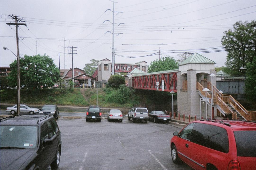
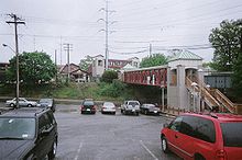 Pedestrian and railroad bridges cross over NY 110 at Huntington (LIRR station).
Between the Republic Airport Zone and the Long Island Expressway, NY 110 is primarily lined with industrial buildings and office parks. It connects to the Northern State Parkway in Melville, a hamlet within the town of Huntington, by way of an interchange. Farther north, in South Huntington, NY 110 intersects NY 25. North of NY 25, NY 110 joins New York Avenue, then intersects with Pulaski Road in Huntington Station and NY 25A in Huntington Village as it heads towards the north shore, as the easternmost non-limited-access state highway that goes north of NY 25A. State maintenance, and thus NY 110, ends at Youngs Hill Road in Halesite.
Route 110 had a trolley line along it. It also had a spur from the Long Island Rail Road that led to Huntington Village.
History
The entirety of NY 110 was assigned as part of the 1930 renumbering.[1]
Former segments
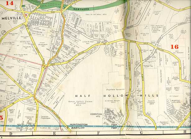
In Melville and South Huntington, two former segments of NY 110, both named Old Walt Whitman Road, run parallel to the route along the west side of the road. The northern segment in South Huntington is home to the Walt Whitman Birthplace.[3] In between, a third former segment exists as Amityville Road, located north of the Northern State Parkway.
The Melville section of Walt Whitman Road goes from what is now Duryea Road to a dead end between Old Country Road and the Northern State Parkway. The realigned segment is on the former right-of-way for the Huntington Railroad Trolley line. The South Huntington section runs between Overhill Road and Livingston Street.[4]
Broad Hollow Expressway
During the 1960s and 1970s, the New York State Department of Transportation attempted to turn NY 110 into a limited-access highway. Business groups thwarted the project, especially those in the vicinity of NY 110 and NY 25 in South Huntington.[5]
Split in Amityville
In the early 1980s, the state considered re-routing southbound traffic in Amityville onto Park Avenue. This too was another proposal killed off by public opposition.
Major intersections
The entire route is in Suffolk County.
Location Mile[2] Destinations Notes Amityville 0.00 NY 27A (Montauk Highway)1.18 NY 27 (Sunrise Highway)Cloverleaf interchange East Farmingdale 2.63 Southern State ParkwayExits 32N-S (Southern Pkwy)  CR 47 (Great Neck Road)
3.72 NY 109 (Babylon–Farmingdale Turnpike)Cloverleaf interchange 4.83  NY 24
NY 24Eastern terminus of NY 24 (western segment) Melville 7.80 I-495 (Long Island Expressway)Exits 49N-S (I-495) 8.35  CR 3 (Pinelawn Drive)
8.86 Northern ParkwayExits 40N-S (Northern Pkwy) South Huntington 11.09  NY 25 (Jericho Turnpike)
Huntington Station 12.24  CR 11 (Pulaski Road)
Huntington 14.49  NY 25A (Main Street)
 CR 35
CR 35Northern terminus of CR 35 Halesite 15.84 Youngs Hill Road 1.000 mi = 1.609 km; 1.000 km = 0.621 mi References
- ^ a b Dickinson, Leon A. (January 12, 1930). "New Signs for State Highways". The New York Times: p. 136. http://select.nytimes.com/gst/abstract.html?res=F50A15F6355A147A93C0A8178AD85F448385F9. Retrieved July 18, 2010.
- ^ a b "2008 Traffic Volume Report for New York State" (PDF). New York State Department of Transportation. June 16, 2009. pp. 162–163. https://www.nysdot.gov/divisions/engineering/technical-services/hds-respository/NYSDOT%20TVR%202008%20by%20Route.pdf. Retrieved January 31, 2010.
- ^ Standard Oil Company (1927). Socony Road Map (Map). http://arrts-arrchives.com/images/qqlimp7.jpg. Retrieved April 1, 2010. Note Walt Whitman's Birthplace on the right side of NY 110, instead of the left, where it is today.
- ^ Hagstrom Map (1941). Hagstrom Map of Pinelawn and Melville, New York (Map). http://arrts-arrchives.com/qqlimp41e.jpg. Retrieved April 1, 2010.
- ^ Anderson, Steve. "Formerly Proposed Broad Hollow Expressway (NY 110)". NYCRoads. http://www.nycroads.com/roads/NY-110/. Retrieved March 18, 2010.
External links
Categories:- State highways in New York
- Transportation in Suffolk County, New York

Wikimedia Foundation. 2010.