- New York State Route 109
-
NYS Route 109
Babylon–Farmingdale Turnpike Route information Maintained by NYSDOT Length: 7.08 mi[3] (11.39 km) Existed: early 1930s[1][2] – present Major junctions West end:  NY 24 in Farmingdale
 Southern State Parkway in East Farmingdale
 NY 27 in Lindenhurst
East end:  NY 27A in Babylon
Location Counties: Nassau, Suffolk Highway system Numbered highways in New York
Interstate • U.S. • N.Y. (former) • Reference • County←  US 109
NY 110  →
→New York State Route 109 (NY 109), also known as the Babylon–Farmingdale Turnpike, is a four-lane state highway on Long Island in New York in the United States. It runs from Farmingdale in the Nassau County town of Oyster Bay to the village of Babylon in Suffolk County. It runs mainly west-to-east in a northwest to southeast direction.
Contents
Route description
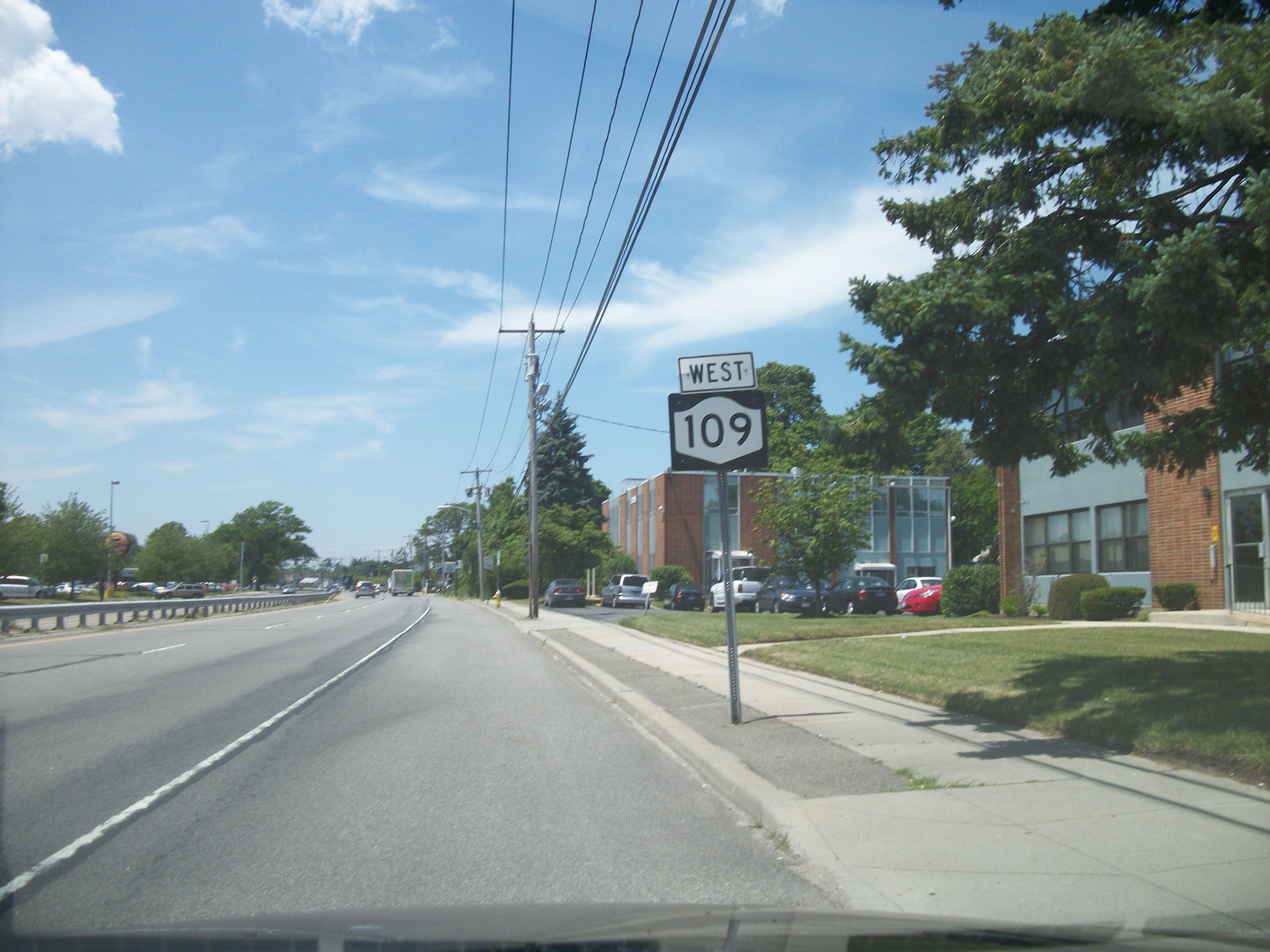
 Westbound NY 109 near Little East Neck Road
From its western terminus at NY 24 in Farmingdale east to Babylon, Route 109 runs almost entirely along the north side of the Central Branch of the Long Island Rail Road. Therefore, the unnumbered cloverleaf interchange with NY 110 that was built in an area of East Farmingdale formerly known as Maywood contains ramps that were tightly squeezed between the south side of NY 109 and the railroad tracks. Connections with the Southern State Parkway are also shared with a close intersection with New Highway (Suffolk County Road 28).
As it travels southeast of Southern State Parkway, it begins to drift further away from the railroad line. In Lindenhurst, NY 109 intersects NY 27 by way of a cloverleaf interchange. Upon intersecting with Little East Neck Road (Suffolk County Road 95) in the village of Babylon, it takes control of the road away from Suffolk County, then runs beneath the Babylon Branch of the Long Island Rail Road as it heads south toward Montauk Highway (NY 27A).
History
NY 109 was assigned to its current alignment in the early 1930s and has not been altered since.[1][2]
Major intersections
County Location Mile[3] Destinations Notes Nassau Farmingdale 0.00 NY 24Suffolk East Farmingdale 1.70 NY 110Cloverleaf interchange 2.63 Southern State ParkwayExit 33 (Southern Pkwy) Lindenhurst 4.83 NY 27Exit 37 (NY 27) Village of Babylon 7.08 NY 27A1.000 mi = 1.609 km; 1.000 km = 0.621 mi References
- ^ a b Dickinson, Leon A. (January 12, 1930). "New Signs for State Highways". The New York Times: p. 136. http://select.nytimes.com/gst/abstract.html?res=F50A15F6355A147A93C0A8178AD85F448385F9. Retrieved July 18, 2010.
- ^ a b Texas Oil Company (1932). Texaco Road Map – New York (Map). Cartography by Rand McNally and Company.
- ^ a b "2008 Traffic Data Report for New York State" (PDF). New York State Department of Transportation. June 16, 2009. p. 242. https://www.nysdot.gov/divisions/engineering/technical-services/hds-respository/NYSDOT_Traffic_Data_Report_2008.pdf. Retrieved January 10, 2010.
External links
Categories:- State highways in New York
- Transportation in Nassau County, New York
- Transportation in Suffolk County, New York

Wikimedia Foundation. 2010.