- Fort Salonga, New York
Infobox Settlement
official_name = Fort Salonga, New York
settlement_type = CDP
nickname =
motto =
imagesize =
image_caption =
image_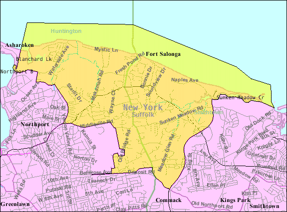
mapsize = 250px
map_caption =
mapsize1 = 250px
map_caption1 =subdivision_type = Country
subdivision_name =United States
subdivision_type1 = State
subdivision_name1 =New York
subdivision_type2 = County
subdivision_name2 = Suffolk
government_footnotes =
government_type =
leader_title =
leader_name =
leader_title1 =
leader_name1 =
established_title =
established_date =area_footnotes =
area_magnitude =
area_total_km2 = 33.2
area_land_km2 = 23.3
area_water_km2 = 9.8
area_total_sq_mi = 12.8
area_land_sq_mi = 9.0
area_water_sq_mi = 3.8population_as_of = 2000
population_footnotes =
population_total = 9634
population_density_km2 = 412.7
population_density_sq_mi = 1068.8timezone = Eastern (EST)
utc_offset = -5
timezone_DST = EDT
utc_offset_DST = -4
elevation_footnotes =
elevation_m = 10
elevation_ft = 33
latd = 40 |latm = 54 |lats = 21 |latNS = N
longd = 73 |longm = 18 |longs = 4 |longEW = Wpostal_code_type =
ZIP code
postal_code = 11768
area_code = 631
blank_name = FIPS code
blank_info = 36-26946
blank1_name = GNIS feature ID
blank1_info = 0950497
website =
footnotes =Fort Salonga is a hamlet (and
census-designated place ) in Suffolk County,New York on the North Shore ofLong Island . As of theUnited States 2000 Census , the CDP population was 9,634. The name evolved from the Revolutionary War BritishFort Salonga , or Fort Slongo, (named after one of the fort’s architects) once located near the border of Huntington Township and The Town of Smithtown, overlooking theLong Island Sound .Fort Salonga is a community at the northwest town line of the Town of Smithtown.
History
One night Colonial forces landed on the beach in nearby Crab Meadow, and moving down the beach overtook the fort. In the post Civil War era the rich red clay deposits gave birth to a successful brickworks as well as other trade. Barges loaded with manure swept from the streets of
New York City would arrive and farmers from nearby towns would come to get the manure for fertilizer and the emptied barges were then loaded with bricks for the trip back to the city. One of the brick companies to operate there in the late 19th century was owned by the Brown family whose bricks bore the initials BBB for Brown’s Best Bricks. The family home on the top of the hill on Breeze Hill Road has served as the clubhouse for the Indian Hills Country Club since 1963.Geography
Fort Salonga is located at coor dms|40|54|21|N|73|18|4|W|city (40.905736, -73.301100)GR|1.
According to the
United States Census Bureau , the CDP has a total area of 12.8square mile s (33.2km² ), of which, 9.0 square miles (23.3 km²) of it is land and 3.8 square miles (9.8 km²) of it (29.66%) is water.Demographics
As of the
census GR|2 of 2000, there were 9,634 people, 3,225 households, and 2,715 families residing in the CDP. Thepopulation density was 1,068.8 per square mile (412.8/km²). There were 3,310 housing units at an average density of 367.2/sq mi (141.8/km²). The racial makeup of the CDP was 96.83% White, 0.61% African American, 0.05% Native American, 1.71% Asian, 0.28% from other races, and 0.51% from two or more races. Hispanic or Latino of any race were 2.25% of the population.There were 3,225 households out of which 37.9% had children under the age of 18 living with them, 75.8% were married couples living together, 6.1% had a female householder with no husband present, and 15.8% were non-families. 12.0% of all households were made up of individuals and 4.6% had someone living alone who was 65 years of age or older. The average household size was 2.96 and the average family size was 3.22.
In the CDP the population was spread out with 25.9% under the age of 18, 5.1% from 18 to 24, 27.6% from 25 to 44, 29.8% from 45 to 64, and 11.5% who were 65 years of age or older. The median age was 40 years. For every 100 females there were 98.1 males. For every 100 females age 18 and over, there were 97.8 males.
Fort Salonga is an affluent location, with a median family income for a household in the CDP of $98,128, and the median income for a family was $106,253. Males had a median income of $70,663 versus $51,694 for females. The
per capita income for the CDP was $41,933. About 2.5% of families and 3.3% of the population were below thepoverty line , including 5.4% of those under age 18 and 1.5% of those age 65 or over.References
External links
Wikimedia Foundation. 2010.