- West Hampton Dunes, New York
Infobox Settlement
official_name = West Hampton Dunes, New York
settlement_type = Village
nickname =
motto =
imagesize = 250px
image_caption = New houses on the ocean in West Hampton Dunes
image_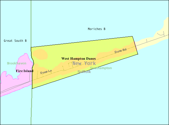
mapsize = 250x200px
map_caption =
pushpin_
mapsize1 =
map_caption1 =subdivision_type = Country
subdivision_name =United States
subdivision_type1 = State
subdivision_name1 =New York
subdivision_type2 = County
subdivision_name2 = Suffolk
government_footnotes =
government_type =
leader_title =
leader_name =
leader_title1 =
leader_name1 =
established_title =
established_date =unit_pref = Imperial
area_footnotes =area_magnitude =
area_total_km2 = 2.2
area_land_km2 = 0.9
area_water_km2 = 1.3
area_total_sq_mi = 0.9
area_land_sq_mi = 0.3
area_water_sq_mi = 0.5population_as_of = 2000
population_footnotes =
population_total = 11
population_density_km2 = 12.4
population_density_sq_mi = 32.2timezone = Eastern (EST)
utc_offset = -5
timezone_DST = EDT
utc_offset_DST = -4
elevation_footnotes =
elevation_m = 2
elevation_ft = 7
latd = 40 |latm = 46 |lats = 30 |latNS = N
longd = 72 |longm = 43 |longs = 3 |longEW = Wpostal_code_type =
ZIP code
postal_code = 11978
area_code = 631
blank_name = FIPS code
blank_info = 36-80186GR|2
blank1_name = GNIS feature ID
blank1_info = 0979943GR|3
website =
footnotes =West Hampton Dunes is a village in Suffolk County,
New York , U.S., on the South Shore ofLong Island . The population was 11 at the 2000 census.History
West Hampton Dunes is located on a barrier island in the Town of Southampton. The barrier island was part of
Fire Island until a Nor'easter in 1931 split the island creatingMoriches Inlet . The inlet created a geographic oddity whereby the Town of Brookhaven actually has jurisdiction on land immediately west of West Hampton Dunes although Brookhaven land access to it involves a nearly 20 mile drive through Southampton.The village incorporated in 1993 in attempt to have more control over its precarious state since it was obliterated in the
Great Hurricane of 1938 ,1991 Halloween Nor’easter (the "The Perfect Storm ") and again in a 1992Nor'easter .Specifically, the village wanted to have a say in
Army Corps of Engineers handling of the barrier beach -- particularly in response to a series ofgroynes atShinnecock Inlet that have created major beach erosion "downstream" in thelongshore drift .Almost immediately after Gary Vegliante, the village's first mayor, sued the
U.S. Army Corps of Engineers for $200 million, the Corps settled the suit immediately began replenishing the beach leading to a building boom on what had been a devastated empty section of beach. [ [http://www.danshamptons.com/content/danspapers/issue12_2007/7.html - Founding Westhampton Dunes - The Movie - Dan's Papers June 15, 2007] ]The [http://www.asbpa.org/ American Shore and Beach Preservation Association] named West Hampton Dunes one of America's [http://www.asbpa.org/pdfs/WestHamptonDunesRelease.pdf top restored beaches] :
:"West Hampton Dunes represents a blueprint for shoreline restoration and habitat enrichment. At one time the beach was a poster child for coastal mismanagement plagued by erosion and poor responses to destructive storms. No longer. A dedicated corps of local, state and federal officials worked hard to restore its coasts and the fragile wildlife habitat along its shores, making West Hampton Dunes one of our nations premier beaches."
:The shoreline of what is now the Village of West Hampton Dunes began experiencing increased erosion following the construction of a groin fields, set of finger-like extensions from the shoreline, east of the village. This eventually led to extensive over wash and a breach of the barrier island in 1992. Since that time, the U.S. Army Corps of Engineers, New York State Department of Environmental Conservation, Suffolk County Department of Public Works and the Village of West Hampton Dunes have worked together to successfully restore the beach, boost public access and safeguard endangered wildlife habitat. [ [http://www.asbpa.org/pdfs/WestHamptonDunesRelease.pdf - American Shore and Beach Preservation Association: West Hampton Dunes named one of America's Top Restored Beaches - May 18th, 2007] ]
In 2007 resident Yale Nelson finished a [http://thestoryofwesthamptondunes.com/ documentary] on the town history which premiered October 20th, 2007 in Westhampton during the
Hamptons Film Festival .In 1996 West Hampton Dunes was the closest community to the crash of
TWA Flight 800 which occurred about 10 miles due south of it although news reports were to focus on the much larger communities across Moriches Bay which provided the water response.Geography
West Hampton Dunes is located at coor dms|40|46|30|N|72|43|3|W|city (40.774871, -72.717624)GR|1.
According to the
United States Census Bureau , the village has a total area of 0.9square mile s (2.2km² ), of which, 0.3 square miles (0.9 km²) of it is land and 0.5 square miles (1.3 km²) of it (60.47%) is water.Demographics
As of the
census GR|2 of 2000, there were 11 people, 7 households, and 3 families residing in the village. Thepopulation density was 32.2 people per square mile (12.5/km²). There were 172 housing units at an average density of 503.6/sq mi (195.3/km²). The racial makeup of the village was 90.91% White and 9.09% Asian.There were 7 households out of which none had children under the age of 18 living with them, 42.9% were married couples living together, and 42.9% were non-families. 42.9% of all households were made up of individuals and 28.6% had someone living alone who was 65 years of age or older. The average household size was 1.57 and the average family size was 2.00.
In the village the population was spread out with 18.2% from 25 to 44, 36.4% from 45 to 64, and 45.5% who were 65 years of age or older. The median age was 58 years. For every 100 females there were 266.7 males. For every 100 females age 18 and over, there were 266.7 males.
The median income for a household in the village was $67,083, and the median income for a family was $127,308. Males had a median income of $32,083 versus $0 for females. The
per capita income for the village was $57,150. None of the population and none of the families were below thepoverty line .References
External links
* [http://whdunes.org/ Official Village of West Hampton Dunes Page]
* [http://thestoryofwesthamptondunes.com/ Incredible Journey: The Story of West Hampton Dunes] Yale Nelson's documentary.
* [http://barrierbeach.org The Barrier Beach Preservation Association of West Hampton Dunes]
* [http://www.newsday.com/news/columnists/ny-lfisle5409415oct14,0,2585898.column Documenting a fight against the tide] Newsday, October 14, 2007
* [http://query.nytimes.com/gst/fullpage.html?res=9C04E2DA1331F933A2575BC0A9659C8B63 West Hampton Dunes: Back from the Brink] The NY Times, August 10, 2003
* [http://www.csc.noaa.gov/beachnourishment/html/human/case.htm Beach Nourishment: The lessons from one Long Island Community] A case study on West Hampton Dunes by theNational Oceanic and Atmospheric Administration [http://www.csc.noaa.gov/ Coastal Services Center]
* [http://www.firstcoastal.net/sthieves.htm The Sand Thieves of Long Island's South Shore] by Bob Spencer and Aram Terchunian

Wikimedia Foundation. 2010.