- Water Mill, New York
Infobox Settlement
official_name = Water Mill, New York
settlement_type = CDP
nickname =
motto =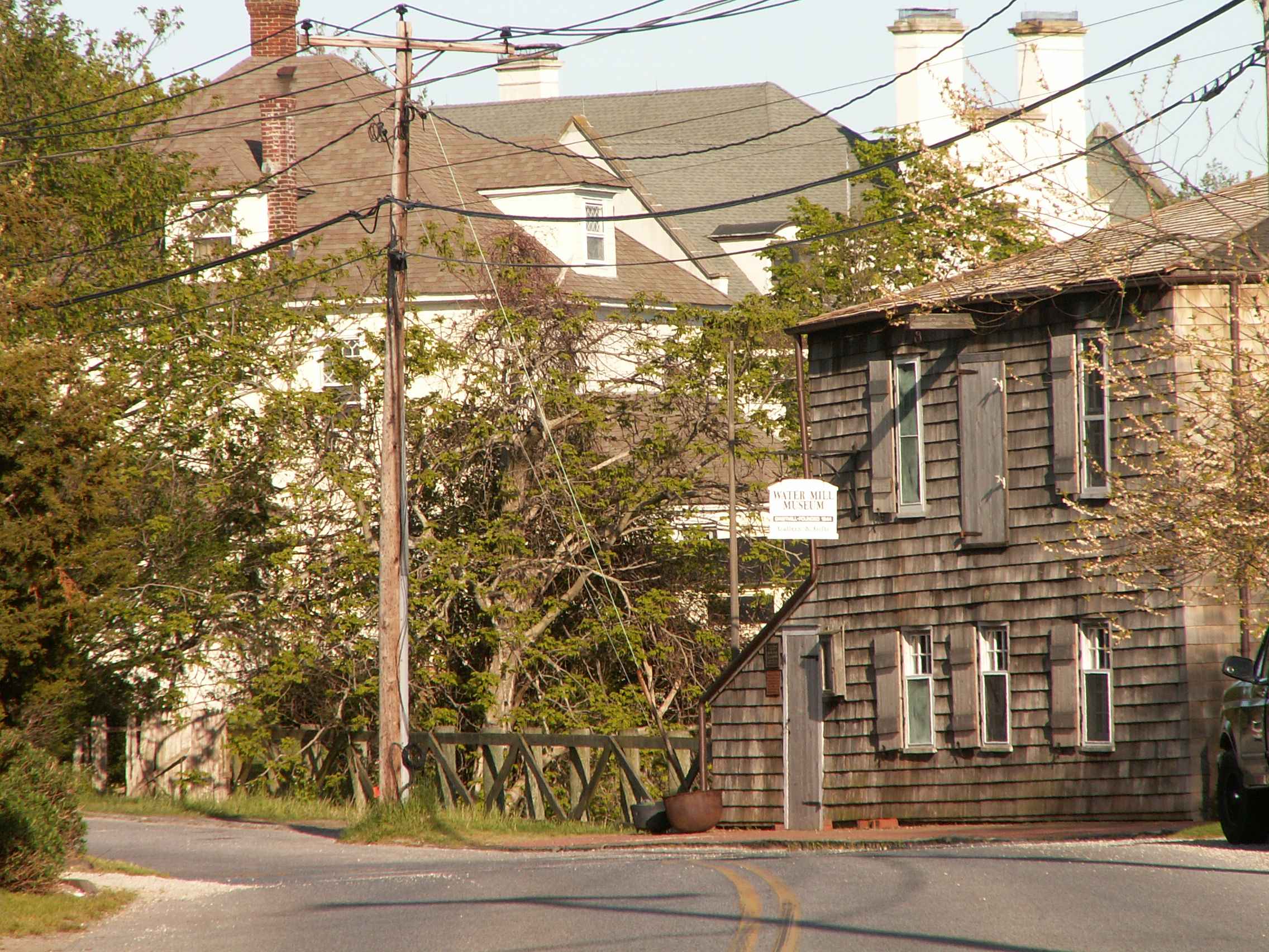
imagesize = 250px
image_caption = Water Mill derives its name from a claim that the first water mill in the State of New York was built there in 1644
image_pushpin_
mapsize = 250x200px
map_caption =
mapsize1 =
map_caption1 =subdivision_type = Country
subdivision_name =United States
subdivision_type1 = State
subdivision_name1 =New York
subdivision_type2 = County
subdivision_name2 = Suffolk
government_footnotes =
government_type =
leader_title =
leader_name =
leader_title1 =
leader_name1 =
established_title =
established_date =area_footnotes =
area_magnitude =
area_total_km2 = 32.4
area_land_km2 = 28.5
area_water_km2 = 3.9
area_total_sq_mi = 12.5
area_land_sq_mi = 11.0
area_water_sq_mi = 1.5population_as_of = 2000
population_footnotes =
population_total = 1724
population_density_km2 = 60.5
population_density_sq_mi = 156.8timezone = Eastern (EST)
utc_offset = -5
timezone_DST = EDT
utc_offset_DST = -4
elevation_footnotes =
elevation_m = 12
elevation_ft = 39
latd = 40 |latm = 55 |lats = 0 |latNS = N
longd = 72 |longm = 20 |longs = 50 |longEW = Wpostal_code_type =
ZIP code
postal_code = 11976
area_code = 631
blank_name = FIPS code
blank_info = 36-78575GR|2
blank1_name = GNIS feature ID
blank1_info = 1867422GR|3
website =
footnotes =Water Mill is a
census-designated place (CDP) in Suffolk County,New York ,USA , and a hamlet of the Town of Southampton. The population was 1,724 at the 2000 census. Water Mill is the correct name as per local government and theUnited States Postal Service . ItsZIP code is 11976.Water Mill is considering incorporating as a village following the unsuccessful attempt by
Dunehampton, New York to incorporate. Dunehampton's incorporation would have cut Water Mill off from theAtlantic Ocean beaches.Sagaponack, New York incorporated for a similar reason.History
In 1644,
England gave Edward Howell 40acres of land near the new settlement of Southampton to build a mill for settlers to grind their grain into meal. It became a landmark, and people began referring to other settlements that popped up as "east or west of water mill." By the 1800s, the area was known as Water Mills and was later changed to Water Mill. Today, the hamlet boasts its status as the only settlement on the South Fork ofLong Island with both a functioningwatermill andwindmill .Water Mill's ZIP code (11976) was listed as the 6th most expensive ZIP code based on median house price in 2006 according to
Forbes Magazine with a median house price of $2,150,000. Its Southampton cohortSagaponack, New York (11962) was #1 with a median price of $2,787,500. They were the only two New York zips in the top 10 althoughMill Neck, New York (11765) inNassau County, New York onLong Island was #11 at $1,900,000 andTriBeCa (10013) inNew York City was #12 at $1,875,000.Geography
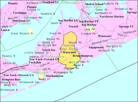
Watermill is located at 40° 55' 0" North, 72° 20' 50" West (40.916759, -72.347225)GR|1. According to the
United States Census Bureau , the CDP has a total area of 12.5square mile s (32.4km² ), of which, 11.0 square miles (28.5 km²) of it is land and 1.5 square miles (3.9 km²) of it (12.08%) is water.Demographics
As of the
census GR|2 of 2000, there were 1,724 people, 722 households, and 475 families residing in the CDP. Thepopulation density was 156.8 per square mile (60.6/km²). There were 1,461 housing units at an average density of 132.9/sq mi (51.3/km²). The racial makeup of the CDP was 95.42% White, 2.49% African American, 0.70% Asian, 0.93% from other races, and 0.46% from two or more races. Hispanic or Latino of any race were 3.31% of the population.There were 722 households out of which 24.4% had children under the age of 18 living with them, 57.2% were married couples living together, 5.8% had a female householder with no husband present, and 34.2% were non-families. 25.9% of all households were made up of individuals and 10.9% had someone living alone who was 65 years of age or older. The average household size was 2.38 and the average family size was 2.85.
In the CDP the population was spread out with 20.1% under the age of 18, 4.6% from 18 to 24, 24.0% from 25 to 44, 31.5% from 45 to 64, and 19.8% who were 65 years of age or older. The median age was 46 years. For every 100 females there were 100.7 males. For every 100 females age 18 and over, there were 100.7 males.
The median income for a household in the CDP was $84,400, and the median income for a family was $84,272. Males had a median income of $60,357 versus $39,167 for females. The
per capita income for the CDP was $59,987. About 4.9% of families and 8.3% of the population were below thepoverty line , including 4.0% of those under age 18 and 2.4% of those age 65 or over.Water Mill is acensus-designated place (CDP) in Suffolk County,New York ,USA , and a hamlet of the Town of Southampton. The population was 1,724 at the 2000 census.References
External links
* [http://www.newsday.com/community/guide/lihistory/ny-historytown-hist006h,0,6917445.story?coll=ny-lihistory-navigation Newsday - Long Island History: Water Mill]
* [http://www.watermillmuseum.org/history_mill.htm Water Mill Museum - History of Water Mill, NY]

Wikimedia Foundation. 2010.